Deep in the forest on the Côte Saint-Jean

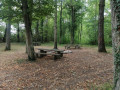
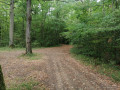
This route is truly ideal in very hot weather. It runs entirely in the shade along wide, lovely paths. The starting point is certainly of interest: it is a picturesque picnic area right in the heart of the woods. There are no significant difficulties, no steep climbs – an ideal outing for the whole family.

Details

n°26331921
Creation:
Last update:
Last review:
  • Walking
    Activity: Walking
  • ↔
    Distance: 3.34 mi
  • ◔
    Average duration: 1h 40 
  • ▲
    Difficulty: Easy

  • ⚐
    Back to start: Yes
  • ↗
    Ascent: + 148 ft
  • ↘
    Descent: - 141 ft

  • ▲
    Highest point: 1,047 ft
  • ▼
    Lowest point: 896 ft

Photos

Description of the walk

The superb picnic area provided by the village of Haraucourt-sur-Seille and signposted from the village. Head towards Côte Saint-Jean.

(S/E) Opposite the picnic area, take the path furthest to the left for about 300 m.

(1) At the Fork in the road, continue along the path, turning left. Walk for about 500 m until you come out onto a wide forest track called Chemin de Trumechère.

(2) Follow this for over two kilometres until you reach a junction of forest roads.

(3) Take the Haute Charrière forest track on the right. After 400 m, at the junction, turn right and continue for about fifty metres.

(4) Immediately take the path on the right leading into the forest (signposted). The entrance is just before the park, which is a few metres away. Continue through the forest until you reach a junction.

(5) Turn left and carry on. At a junction of paths, keep going straight ahead to return to the picnic area (S/E).


Waypoints

  1. S/E : mi 0 - alt. 1,037 ft - Picnic area on the Côte Saint-Jean
  2. 1 : mi 0.23 - alt. 1,017 ft - Fork in the road
  3. 2 : mi 0.51 - alt. 955 ft - Trumechère forest track
  4. 3 : mi 2.04 - alt. 902 ft - Junction of forest tracks
  5. 4 : mi 2.32 - alt. 997 ft - Entrance to the woodland (signposted)
  6. 5 : mi 2.74 - alt. 1,010 ft - Junction, turn left
  7. S/E : mi 3.34 - alt. 1,037 ft - Picnic area on the Côte Saint-Jean

Reviews and comments

4.3 / 5
Based on 2 reviews

Reliability of the description
4.5 / 5
Ease of following the route
4.5 / 5
Route interest
4 / 5
Azimut71
Azimut71

Overall rating : 4.7 / 5

Date of your route : Sep 08, 2024
Reliability of the description : ★★★★★ Very good
Ease of following the route : ★★★★★ Very good
Route interest : ★★★★☆ Good
Very busy route : No

The access path is in rather poor condition. When you arrive, park before entering the woods: the path gets muddy in wet weather.

Machine-translated

logedu
logedu

Thank you for your feedback, and I look forward to seeing you out and about!!

Machine-translated

jpdulot
jpdulot

Overall rating : 4 / 5

Date of your route : Feb 05, 2024
Reliability of the description : ★★★★☆ Good
Ease of following the route : ★★★★☆ Good
Route interest : ★★★★☆ Good
Very busy route : No

A lovely, easy walk, suitable for all ages… It’s a shame that:

  • the weather wasn’t great – a very cold wind outside the forest –
  • Some of the paths were quite muddy.
  • About 1 hour 50 minutes, then on to the Mulcey inn...

Thank you for this route

Machine-translated

Other walks in the area

For more walks, use our search engine .

The GPS track and description are the property of this route's author. Please do not copy them without permission.