The St-Livier circular route via the Salival Stream

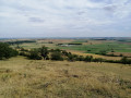
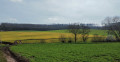
This walk, which presents no particular difficulty, will allow you to enjoy some magnificent panoramic views. The orientation table at the top of Mont St-Jean, the St-Livier Chapel and the former Salival Abbey – now a farm – are points of interest that will enhance your walk. You’ll finish with a long straight stretch along one of the banks of the Salival Stream, which is so idyllic. If, like me, you do the walk in winter, you may be lucky enough to spot the famous sheep affectionately known by the locals as ‘Dédé de St-Livier’. He’s very well known because he stubbornly refuses to return to the sheepfold during the winter. I was lucky enough to photograph him at the end of January (see photo).

Details

44890857
Creation:
Last update:
Last review:
  • Walking
    Activity: Walking
  • ↔
    Distance: 3.66 mi
  • ◔
    Average duration: 2h 00 
  • ▲
    Difficulty: Easy

  • ⚐
    Back to start: Yes
  • ↗
    Ascent: + 341 ft
  • ↘
    Descent: - 341 ft

  • ▲
    Highest point: 1,010 ft
  • ▼
    Lowest point: 692 ft
  • ⚐ Country: France
  • ⚐ City: Moyenvic (57630)
  • ⚑
    Start/End: N 48.792852° / E 6.560689°
  • ❏
    IGN map(s): Ref. 3514O
  • Hour-by-hour weather

Photos

Description of the walk

A stretch of an old road, near the junction of the D155 and the D955, provides an ideal car park for the start of the walk.

(S/E) Cross the D955, taking care with the traffic, which can be heavy at times. Follow theGR®5(signposted) for 300 m.

(1) Cross a rustic bridge. Then continue straight on along theGR®5for 650 m until you reach a crossroads.

(2) Leave theGR®5and turn left. Walk up a fairly steep slope for about 650 m. Continue along the path on the right for 300 m.

(3) Shortly after passing the beehives on your right, carry on straight ahead, ignoring the path that leads downhill to your right. After 30 m, the path turns left. Climb for about 70 m until you reach a park gate.

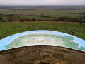
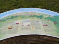
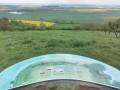
(4) Open the gate and close it carefully behind you. There are sometimes sheep in the park. Follow the steep climb for 95 m, then turn right towards the orientation table, situated about 100 m away.

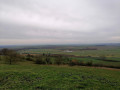
(5) You can enjoy an exceptional panoramic view.
Then retrace your steps and continue to the right for a few metres along the path to leave the park (please ensure you close the gates properly behind you here too).

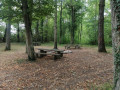
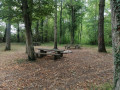
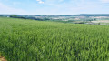
(6) Just past the gate, take the path on the right, running alongside the fence. Walk alongside a vast field for nearly 1.1 km. Along the way: a bench from which to admire the scenery, as well as hedgerows and a few interesting viewpoints. You’ll come to a small copse where a few steps have been laid out on the ground.

(7) Carry on towards St Livier’s Chapel, which has been visible for some time now.
Take the opportunity to explore this remarkable building steeped in history, which is open to visitors. You might even meet the hermit who lives there.
Then carry on for 900 metres until you reach a crossroads near the former Salival Abbey, which has been converted into a farm.

(8) The path on the right is blocked by a large gate. Turn left to follow the Salival Stream for over 1 km. You’ll come to the rustic bridge you crossed at the start of the route.

(1) Turn right onto the path, heading in the opposite direction to your outward journey, to return to the (S/E).

Waypoints

  1. S/E : mi 0 - alt. 728 ft - Car park (old road)
  2. 1 : mi 0.26 - alt. 692 ft - Bridge. Junction marking the end of the circular route
  3. 2 : mi 0.67 - alt. 791 ft - Crossroads. Leave the GR5
  4. 3 : mi 1.08 - alt. 876 ft - Just past the beehives
  5. 4 : mi 1.15 - alt. 938 ft - Gate (entrance to the sheep park)
  6. 5 : mi 1.27 - alt. 1,007 ft - Orientation board
  7. 6 : mi 1.35 - alt. 1,010 ft - Gate (exit from the park)
  8. 7 : mi 2.08 - alt. 902 ft - St Livier Chapel
  9. 8 : mi 2.69 - alt. 722 ft - Crossroads. Former Salival Abbey
  10. S/E : mi 3.66 - alt. 728 ft - Car park (old road)

Always be cautious and plan ahead when you're outdoors. Visorando and the author of this route cannot be held responsible for any accidents occurring on this route.

The GR® and PR® markings are the intellectual property of the Fédération Française de Randonnée Pédestre.

Reviews and comments

4.7 / 5
Based on 2 reviews

Reliability of the description
5 / 5
Ease of following the route
4.5 / 5
Route interest
4.5 / 5
moncam
moncam

Overall rating : 4.7 / 5

Date of your route : Feb 01, 2025
Reliability of the description : ★★★★★ Very good
Ease of following the route : ★★★★★ Very good
Route interest : ★★★★☆ Good
Very busy route : No

The first part of the walk is very pleasant, right up to the information board. From there, the view is magnificent. Information on the history of salt mining helps you to understand the landscape properly. The rest of the route is less interesting (we didn’t spot Dédé), and we found ourselves wading through mud that was more or less frozen on the section that winds around the fields. Best done when the ground is properly dry, or turn back at the orientation table.

Machine-translated

Kerckhove
Kerckhove

Overall rating : 4.7 / 5

Date of your route : Oct 14, 2024
Reliability of the description : ★★★★★ Very good
Ease of following the route : ★★★★☆ Good
Route interest : ★★★★★ Very good
Very busy route : No

A really lovely walk, with stunning views and varied scenery. We really enjoyed it.

Machine-translated

Other walks in the area

For more walks, use our search engine .

The GPS track and description are the property of this route's author. Please do not copy them without permission.