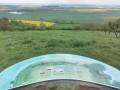
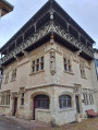
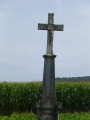
The Côte Saint-Jean as seen from Haraucourt-sur-Seille

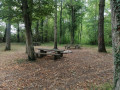
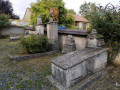
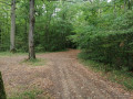
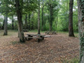
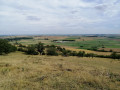
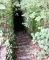
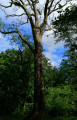
Half of the route takes place through woodland. The paths there are wide and very pleasant. The picnic area in the heart of the woods is quite unique and very welcome on hot days. There is a remarkable view from the Haute Charrière forest road. On the way back, don’t miss the Mennonite cemetery. The site has been restored and is well worth a visit.

Details

n°26264262
Creation:
Last update:
Last review:
  • Walking
    Activity: Walking
  • ↔
    Distance: 5.63 mi
  • ◔
    Average duration: 2h 55 
  • ▲
    Difficulty: Easy

  • ⚐
    Back to start: Yes
  • ↗
    Ascent: + 404 ft
  • ↘
    Descent: - 423 ft

  • ▲
    Highest point: 1,047 ft
  • ▼
    Lowest point: 692 ft

Photos

Description of the walk

There is a car park in front of the Haraucourt-sur-Seille cemetery, situated on Chemin de Hampont, towards Côte Saint-Jean.

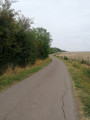
(S/E) With your back to the village, take Chemin de Hampont (a small tarmac road) towards Côte Saint-Jean for 800 metres. Continue along a track until you reach a Fork in the road with signposts.

(1) Turn right. Enter the woodland and discover a superb picnic area.

(2) Take the first path on your right and carry on to a junction (marker 307).

(3) Carry on straight ahead until you reach a Fork in the road. Take the path on the right and continue to the edge of the forest, where you’ll come out onto the Haute Charrière forest road.

(4) Turn right and continue along the forest road for approximately 1.8 km.

(5) Take the path on the right: there are signposts and a sign indicating the direction of Haraucourt-sur-Seille. Walk down into the forest for 300 m until you reach a large meadow.

(6) Carry on straight ahead along the path, which further on becomes a tarmac road called Chemin de la Voitrebolle. Continue to the farm of the same name.

(7) Carry on until you reach the entrance to Haraucourt-sur-Seille. At the Fork in the road, turn right onto Rue du Château and follow it for a few dozen metres.

(8) Turn right to visit the Mennonite cemetery: there is a signpost.

(9) Then turn round to continue along Rue du Château and return to your starting point at the cemetery (S/E).

Waypoints

  1. S/E : mi 0 - alt. 719 ft - Haraucourt-sur-Seille Cemetery
  2. 1 : mi 0.86 - alt. 1,010 ft - Turn off to the right
  3. 2 : mi 1.1 - alt. 1,040 ft - Picnic area
  4. 3 : mi 1.49 - alt. 1,004 ft - Crossroads, elevation 307
  5. 4 : mi 2.07 - alt. 997 ft - Haute Charrière forest road
  6. 5 : mi 3.18 - alt. 1,033 ft - Path on the right
  7. 6 : mi 3.35 - alt. 883 ft - Meadow, straight ahead
  8. 7 : mi 4.57 - alt. 755 ft - La Voitrebolle (farm)
  9. 8 : mi 5.33 - alt. 715 ft - Rue du Château
  10. 9 : mi 5.36 - alt. 728 ft - Mennonite cemetery
  11. S/E : mi 5.63 - alt. 715 ft - Haraucourt-sur-Seille Cemetery

Worth a visit

Mennonite cemetery

The small village of Haraucourt is notable for having a Mennonite cemetery that has existed since 1811. The Mennonites are a branch of the Anabaptist movement that emerged in the 17th century; they were Protestant dissidents from Switzerland. The Anabaptists were driven out of Sainte-Marie-aux-Mines in the 18th century by Louis XIV; they then set off westwards. The Haraucourt cemetery served the entire Anabaptist community of Dieuze.

Reviews and comments

5 / 5
Based on 1 review

Reliability of the description
5 / 5
Ease of following the route
5 / 5
Route interest
5 / 5
nicger
nicger

Overall rating : 5 / 5

Date of your route : Jul 24, 2023
Reliability of the description : ★★★★★ Very good
Ease of following the route : ★★★★★ Very good
Route interest : ★★★★★ Very good
Very busy route : No

A lovely walk, through woods and meadows, with lovely paths! The Mennonite cemetery is a real bonus.

Machine-translated

Other walks in the area

For more walks, use our search engine .

The GPS track and description are the property of this route's author. Please do not copy them without permission.