


Refine your search for walks in Pietraporzio
Pietraporzio walks


 Mont Ténibre via the Alfredo Talarico Refuge
 Visorando Member
 10.51 mi
 +5,673 ft
 -5,676 ft
 9h 50
9h 50
 Very difficult
 Departure from Pietraporzio (Cuneo)
This route takes you on a circular hike up Mont Ténibre on the Italian side, starting from the Alfredo Talarico Refuge. The route passes by the Ervedo Zanotti Refuge and Lake Mongioie. The final 500 metres, between the Pas de Ténibre and the summit, are within the Mercantour National Park.
Bacchi Rossi Refuge - Vens Lakes Refuge
 4.60 mi
+2,359 ft
-807 ft
4h 10
4.60 mi
+2,359 ft
-807 ft
4h 10
 Moderate
Departure from Argentera (Cuneo)
Moderate
Departure from Argentera (Cuneo)
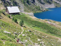
On thissecond day of the Tour of Mount Aiga from the Ferrere Refuge, you will pass through Plan de Belvédère, where there is a tin shelter overlooking the Rio Forneris valley and a fountain. You will also pass below Lake Emma, Monte Peiron at 2,796 m and Pointe Testa di Garbe at 2,749 m, to arrive, after a few hairpin bends, at Col de Fer at 2,584 m. You will then head towards Small Pass of Tortisse and the Vens Refuge, the end of this stage.
Refuge de Vens - Camp des Fourches
 7.34 mi
+2,090 ft
-2,441 ft
5h 10
Moderate
Departure from Saint-Étienne-de-Tinée (Alpes-Maritimes)
7.34 mi
+2,090 ft
-2,441 ft
5h 10
Moderate
Departure from Saint-Étienne-de-Tinée (Alpes-Maritimes)
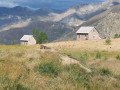
Thisthird and final stage of the Tour du Mont Aiga starts from the Refuge de Vens and crosses a balcony below the slopes of the Aiguilles de Tortisse to the north-east of the Lacs de Vens. After passing the Crête de la Côte and descending to the Maisons Forestières de Tortisse, you will walk along a balcony path beneath the slopes of the Tête des Mourres to reach the Morgon plateau and climb back up to Laussets and finally to the Lacs de Morgon. At the large Morgon lake, you will descend eastwards into Salso Moréno to rejoin the path of thefirst stage and Camp des Fourches. It is possible to see chamois early in the morning and, of course, marmots throughout the day.
Small pass of Tortisse – Cime du Fer – Saint-Étienne-de-Tinée
 9.23 mi
+1,955 ft
-6,621 ft
5h 55
9.23 mi
+1,955 ft
-6,621 ft
5h 55
 Difficult
Departure from Saint-Étienne-de-Tinée (Alpes-Maritimes)
Difficult
Departure from Saint-Étienne-de-Tinée (Alpes-Maritimes)
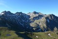
Before descending back to Saint-Etienne-de-Tinée, you climb to the Cime du Fer (2,700 m), which offers a superb 360° view, notably of the Tête de Moïse (3,104 m) and the magnificent Mont Viso (3,841 m).
Then we descend alongside the Tortisse torrent before heading back towards the Lacs de Vens and climbing up to the Lac des Babarottes.
We continue along a section of the Chemin de l’Énergie until we catch sight of Mont Ténibre.
We then finish with a long descent (-1,200 m) down to the village.
Circuit of Monte Bersaio
 10.40 mi
+4,610 ft
-4,583 ft
8h 50
Difficult
Departure from Sambuco (Cuneo)
10.40 mi
+4,610 ft
-4,583 ft
8h 50
Difficult
Departure from Sambuco (Cuneo)
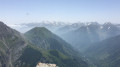
Circular hike from the beautiful village of Sambuco in the Valle Stura, Provence of Cuneo. The high point is Monte Bersaio directly above the village. The majority of the walk is through high alpine meadows. If done in late June or early July there will be a profusion of wildflowers and the final meadows, just below the summit of Monte Bersaio, are full of Edelweiss.
Rabuons Mountain Hut – Saint-Étienne de Tinée
4.93 mi
+164 ft
-4,642 ft
2h 25
Moderate
Departure from Saint-Étienne-de-Tinée (Alpes-Maritimes)
The final day is less demanding than the previous one, consisting entirely of a descent. It’s a chance to walk the ‘Chemin de l’Énergie’ one last time before a long descent to Saint-Étienne-de-Tinée.
Rabuons Refuge – Vens Refuge
 9.54 mi
+3,383 ft
-3,875 ft
7 hrs
Very difficult
Departure from Saint-Étienne-de-Tinée (Alpes-Maritimes)
9.54 mi
+3,383 ft
-3,875 ft
7 hrs
Very difficult
Departure from Saint-Étienne-de-Tinée (Alpes-Maritimes)
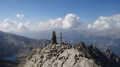
After a night at the Rabuons Mountain Hut, you’ll be ready to climb Mont Ténibre, the main highlight of this second stage. The route is challenging but you’ll be richly rewarded by the panoramic views that await you. To the south, you’ll recognise the Refuge de Rabuons and the lake; to the north and west, there are numerous lakes and the peaks on the border with Italy. After a more leisurely walk along the Chemin de l’Énergie, the scenery will become more pastoral as you approach the Lacs de Vens.
You are now in the Mercantour National Park; there are regulations to be observed, and failure to do so may result in a fine of up to €1,500 – please see the practical information.
Lower Claï from the Vens car park
9.16 mi
+3,540 ft
-3,540 ft
7h 20
Difficult
Departure from Saint-Étienne-de-Tinée (Alpes-Maritimes)
A little-known viewpoint above the Lakes of Vens and Babarottes. A 360° panorama stretching from Mont Ténibre to Mont Mounier, as well as the Tête de l’Enchastraye and the Cime de Pal...
Circular Vens loop via the Vens torrent, return via Tortisse
 12.11 mi
+3,898 ft
-3,875 ft
9h 00
Difficult
Departure from Saint-Étienne-de-Tinée (Alpes-Maritimes)
12.11 mi
+3,898 ft
-3,875 ft
9h 00
Difficult
Departure from Saint-Étienne-de-Tinée (Alpes-Maritimes)
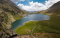
This is a variation on the traditional hikes to the magnificent lakes of Vens. Although the last section on tarmac between Le Pra and the car park at the start is not the most attractive, this circular route takes you through both the Vens and Tortisse valleys, with a more pleasant climb along the torrent and a breathtaking descent from the Col de Fer.
Gardetta Mountain Hut – Marmora
 11.77 mi
+1,906 ft
-5,551 ft
7h 05
Difficult
Departure from Canosio (Cuneo)
11.77 mi
+1,906 ft
-5,551 ft
7h 05
Difficult
Departure from Canosio (Cuneo)
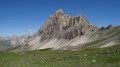
On this sixth day, you’ll walk alongside Rocca la Meja, then cross two magnificent passes (Ancoccia and del Mulo). Along the way, you’ll come across many more structures from the Vallo Alpino. The long descent into the valley offers a chance to relax by the shores of Lake Resile. You’ll then need to pass through the many small hamlets that make up Marmora before arriving at the Locanda Ceaglio.
The Lacs de Vens from Le Pra
 9.74 mi
+3,481 ft
-3,478 ft
7h 30
Difficult
Departure from Saint-Étienne-de-Tinée (Alpes-Maritimes)
9.74 mi
+3,481 ft
-3,478 ft
7h 30
Difficult
Departure from Saint-Étienne-de-Tinée (Alpes-Maritimes)
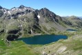
A magnificent hike in the Haute-Tinée offering varied panoramas and one of the most beautiful series of lakes in the Mercantour!
The climb from Le Pra is gradual and easy, with the Cime de la Bonnette behind you. You then pass under the strange Aiguilles de Tortisse before arriving at the Col du Fer (view of Mont Viso).
After the Collet de Tortisse, you arrive at the arch, where you can enjoy a splendid panorama of the Lacs de Vens and the peaks of the Trou de l'Âne!
Le Pra – Vens Mountain Hut
4.69 mi
+2,792 ft
-417 ft
4h 35
Moderate
Departure from Saint-Dalmas-le-Selvage (Alpes-Maritimes)
A first day to stretch your legs and discover the magnificent natural setting of the Vens lakes.
Note: as this route ends in Saint-Étienne-de-Tinée, it is advisable, if possible, to park a second car in Saint-Étienne-de-Tinée to shuttle back to the starting point. Otherwise, allow around €25 for the taxi journey from Saint-Étienne-de-Tinée to Le Pra, but please note that booking is required a few hours in advance.
The Mont Ténibre circular from Saint-Étienne-de-Tinée
 12.42 mi
+6,496 ft
-6,476 ft
8 hrs
Very difficult
Departure from Saint-Étienne-de-Tinée (Alpes-Maritimes)
12.42 mi
+6,496 ft
-6,476 ft
8 hrs
Very difficult
Departure from Saint-Étienne-de-Tinée (Alpes-Maritimes)
A long and demanding circular in the Mercantour National Park that will first take you to Lac de Rabuons, the largest lake in the Alpes-Maritimes, which is worth the detour in itself, before climbing Mont Ténibre, the highest peak in the Tinée at 3,031 metres.
You are in the Mercantour National Park, where there are regulations to be observed, with fines of up to €1,500 for non-compliance. See practical information.
Read the reviews before committing.
Saint-Etienne-de-Tinée - Lacs de Vens - Small Pass of Tortisse
 7.52 mi
+5,942 ft
-1,342 ft
7 hrs
Very difficult
Departure from Saint-Étienne-de-Tinée (Alpes-Maritimes)
7.52 mi
+5,942 ft
-1,342 ft
7 hrs
Very difficult
Departure from Saint-Étienne-de-Tinée (Alpes-Maritimes)
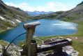
First stage of a two-day hike in the Haute-Tinée.
Ascent to the magnificent Lacs de Vens and the small pass of Tortisse via the Claï valley and Lac des Babarottes.
Plenty of marmots and chamois around the Lacs de Vens and below the small pass of Tortisse.
Saint-Étienne-de-Tinée - Rabuons Refuge
 4.55 mi
+4,951 ft
-423 ft
6h 25
Difficult
Departure from Saint-Étienne-de-Tinée (Alpes-Maritimes)
4.55 mi
+4,951 ft
-423 ft
6h 25
Difficult
Departure from Saint-Étienne-de-Tinée (Alpes-Maritimes)
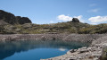
This first stage will take you to the Rabuons mountain hut, on the shores of the largest lake in the Alpes-Maritimes.The landscape is very rocky. You’ll come across plenty of Italians, as just across the border there are several mountain huts offering lovely routes via the nearby Pas de l’Ischiator.
⚠️ Allow around 4 hours for an average hiker in good physical condition to complete this walk.
Sélasse route
 3.81 mi
+2,221 ft
-2,234 ft
3h 40
Moderate
Departure from Saint-Étienne-de-Tinée (Alpes-Maritimes)
3.81 mi
+2,221 ft
-2,234 ft
3h 40
Moderate
Departure from Saint-Étienne-de-Tinée (Alpes-Maritimes)
A hike to discover the Ténibres valley from both sides as well as the architecture of the region.
Col and Cime d'Anelle
 5.96 mi
+2,277 ft
-2,251 ft
4h 45
Moderate
Departure from Saint-Étienne-de-Tinée (Alpes-Maritimes)
5.96 mi
+2,277 ft
-2,251 ft
4h 45
Moderate
Departure from Saint-Étienne-de-Tinée (Alpes-Maritimes)
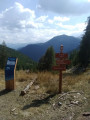
This morning route is an alternative to the Bois d'Anelle loop, passing via the Cime d'Anelle. The first section climbs through the Ublan countryside, then crosses the woods in the shade of the fir trees.
Tour of Mont Auron and Cime de la Bercha from Auron
 5.09 mi
+1,932 ft
-1,932 ft
4h 00
Moderate
Departure from Saint-Étienne-de-Tinée (Alpes-Maritimes)
5.09 mi
+1,932 ft
-1,932 ft
4h 00
Moderate
Departure from Saint-Étienne-de-Tinée (Alpes-Maritimes)
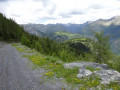
This route, with no significant elevation gain, takes you around Mont Auron, with its easily accessible summit, and back and forth to Cîme de la Bercha, starting from Auron.
Tour of the lakes starting from the Sant'Anna di Vinadio Sanctuary
 6.22 mi
+1,959 ft
-1,991 ft
4h 35
Moderate
Departure from Vinadio (Cuneo)
6.22 mi
+1,959 ft
-1,991 ft
4h 35
Moderate
Departure from Vinadio (Cuneo)
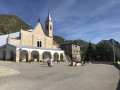
A superb hike starting from the Santa Anna di Vinadio Sanctuary in Italy. This 4-hour Lakes Route can be walked either clockwise or anti-clockwise.Be sure to check the warnings about snow conditions and the equipment you’ll need in the ‘Practical Information’ section.
Lake Apsoi
 10.63 mi
+3,839 ft
-3,839 ft
8h 15
Difficult
Departure from Larche (Alpes-de-Haute-Provence)
10.63 mi
+3,839 ft
-3,839 ft
8h 15
Difficult
Departure from Larche (Alpes-de-Haute-Provence)
A lovely circular walk to the Italian Lake Apsoi, starting not far from the Col de Larche.
Lake Roburent
 8.29 mi
+2,195 ft
-2,198 ft
5h 45
Moderate
Departure from Larche (Alpes-de-Haute-Provence)
8.29 mi
+2,195 ft
-2,198 ft
5h 45
Moderate
Departure from Larche (Alpes-de-Haute-Provence)
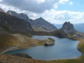
One of the most beautiful lakes in Haute-Ubaye. An easy hike with a slightly steep start, but it can be shortened if necessary.
Monte Scaletta via the Roburent lakes
 10.08 mi
+3,550 ft
-3,543 ft
7h 45
Difficult
Departure from Larche (Alpes-de-Haute-Provence)
10.08 mi
+3,550 ft
-3,543 ft
7h 45
Difficult
Departure from Larche (Alpes-de-Haute-Provence)
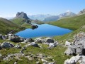
A magnificent and very varied hike, offering superb panoramic views of numerous peaks and lakes.
Numerous military remains bear witness to the strategic importance of this summit (bunkers, shelters, tunnels, cable car with the wheel still in place).
The return route, equipped with chains and handrails on a fairly short section, then follows a splendid balcony path in a dolomitic landscape.
This is an aerial route, so you must not be prone to vertigo.