Country:

 City:
City:


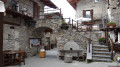
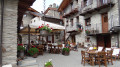


The route of this walk follows the Percorso Occitano trail for the most part.
On maps, particularly OpenStreetMap, it is labelled Percoso(i) Occitano(i) and often simply P.O. or PO.
The route’s signposting – including signposts and markings on the ground – makes extensive use of these names.
For ease of reference, the abbreviation P.O. is used when the route follows the Percorso Occitano.
(S) From the refuge, follow the track eastwards until the first bend.
(1) Take the shortcut on the left to rejoin the track.
(2) Continue along the track again until you reach a 90° bend.
(3) Take the P.O. path on the left, then rejoin the track until you reach Agriturismo la Meja. At the junction of the two tracks, turn right to reach the Agriturismo.
(4) Leave the P.O. on your right and take the path that runs as close as possible to Rocca la Meja. Walk through the woodland until you rejoin the P.O. further on; ignore all adjacent paths.
(5) Continue along the P.O. to reach the Col d’Ancocchia.
(6) Cut across the hairpin bend in the track (P.O.) and head for a new junction. Continue along the P.O., ignoring all the startings of paths or tracks, until you reach the Colle del Mulo.
(7) Descend the hairpin bends, which are quite steep at first, and reach another track.
(8) Cross the track, take the path that cuts across a bend and continue along the track for a few metres. Carry on along the P.O. until you reach a road.
(9) Cross the road and carry on straight ahead along the P.O. Join this road again.
(10) Follow it to the junction at Lago Resile.
(11) Turn left onto the path – this is still the P.O. Walk through the woods to Lago Resile and enjoy the tranquillity of the lake whilst taking a break.
(12) Return to your chosen path. Further on, rejoin the road, turn left onto it and, at the next hairpin bend, continue along the path. Keep heading due north, occasionally rejoining the road but staying on the P.O. Reach the Combale dell’Oliveto stream.
(13) Follow the road for a few metres, then leave it quickly to stay on the P.O.
You’ll reach the first hamlet of Marmora (Torello).
(14) Staying on the P.O., pass the second hamlet, San Sébastiano. Follow the P.O. to reach Finello.
(15) Stay on the P.O. until you come out onto a road. Cut across the bend (shortcut) and finally arrive at the Locanda Ceaglio (E).
 Visorando Member
 Moderate

 Very difficult