Vens Mountain Hut – Rabuons Mountain Hut

A more challenging second day to explore the ‘Chemin de l’Énergie’ and its panoramic views of the Haute Tinée.
Important: check with the refuge warden to see if the diversion via Lac Fer is still in place. This diversion requires a good level of fitness and/or a head for heights.

This walk is part of a multi-day hike: Lacs de Vens et de Rabuons par le Chemin de l'énergie

Details

n°3956324
Creation:
Last update:
Last review:
  • Walking
    Activity: Walking
  • ↔
    Distance: 8.38 mi
  • ◔
    Average duration: 6h 10 
  • ▲
    Difficulty: Difficult

  • ⚐
    Back to start: No
  • ↗
    Ascent: + 2,677 ft
  • ↘
    Descent: - 2,188 ft

  • ▲
    Highest point: 8,383 ft
  • ▼
    Lowest point: 7,510 ft

Description of the walk

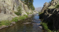
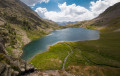
(S) From the Vens refuge, head down and follow the lake to the right. The path stays on the right-hand bank at all times; do not cross the torrent. Walk in this way from lake to lake through very picturesque scenery, passing a succession of glacial moraines and a beautiful waterfall. Reach marker 26.

(1) Cross a footbridge over the spillway of the third lake and begin the fairly steep climb towards the Babarottes ridge. Reach Lac des Barbarottes.

(2) Pass to the right of the lake and climb up the right-hand side via a series of switchbacks to reach a small hollow.

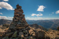
(3) From the summit, descend on the other side; the official path initially veers slightly to the right – do not follow the track heading straight ahead, as the former offers better footing. You will reach the rocky scree below.

(3) Follow the barely visible path on the left to reach the Chemin de l’Énergie.
Be careful here: if you come across marker 113, you must turn back to return to the previous junction.

(4) Turn right onto it, then follow a perfectly flat path; progress is quicker and the going is easy. You’ll reach marker 112.

(5) Continue to follow the Chemin de l’Énergie to the left. Pass through two small tunnels and you’ll reach the barracks overlooking the Plan de Ténibre at marker 111.

(6) Important note here: in August 2020, the Mercantour National Park was still carrying out stabilisation work on the Chemin de l’Énergie following a rockslide. This route follows the diversion put in place by the authorities at that time. Allow for an additional 200 metres of ascent/descent and 1 hour to 1 hour 30 minutes’ walking time on top of the walking times indicated on the signposts. In the absence of specific signposting on the ground, continue to follow the Chemin de l’Énergie.
At marker 111, the path is blocked. Take the diversion to the left via Lac Fer, following the clearly visible yellow signposts. Climb the steep slope through a scree slope to reach Lac Fer.

(7) Walk to the right of the lake, facing Mont Ténibre. Descend on the other side via an easier, specifically signposted path to return to the Chemin de l’Énergie above the small Lac Pétrus.
Turn left onto it, then keep left at marker 110 towards the Rabuons refuge. Pass in front of some old hay-drying racks. You’ll reach the junction at marker 103.

(8) Turn left again; you’re still on the Chemin de l’Énergie. You’ll then enjoy the most impressive section of the route. The path is carved directly into the cliff face and passes through several tunnels until you reach marker 104.

(9) Turn left and head uphill towards Lake Rabuons. Pass behind an EDF hydroelectric power station. Reach the lake’s old spillway. You will then come to marker 105; take the path on the left and cross a footbridge towards the CAF refuge at Rabuons (E).

Waypoints

  1. S : mi 0 - alt. 7,785 ft - Refuge de Vens
  2. 1 : mi 1.22 - alt. 7,510 ft - Marker 26
  3. 2 : mi 1.72 - alt. 7,949 ft - Lac des Babarottes
  4. 3 : mi 2.07 - alt. 8,215 ft - Crête des Babarottes
  5. 4 : mi 2.47 - alt. 7,667 ft - Junction on the ‘Chemin de l’Énergie’ trail
  6. 5 : mi 4.17 - alt. 7,635 ft - Marker 112
  7. 6 : mi 5.01 - alt. 7,638 ft - Marker 111 (Ténibre map)
  8. 7 : mi 5.6 - alt. 8,363 ft - Lac Fer
  9. 8 : mi 6.72 - alt. 7,799 ft - Marker 103
  10. 9 : mi 7.9 - alt. 8,018 ft - Marker 104
  11. E : mi 8.38 - alt. 8,274 ft - Refuge de Rabuons

Notes

We recommend setting off before 11.00 am so as not to miss dinner at the Rabuons refuge.
Walking poles and good hiking boots are recommended, as you’ll be walking in rugged mountain terrain.
The detour via Lac Fer requires experience of mountain walking and a good level of fitness. This route is not particularly suitable for children and can prove challenging in bad weather. Check the weather forecast before setting off from the Vens refuge in the morning.
The Chemin de l’Énergie is a safe and well-signposted route but does include some exposed sections. Watch out for falling rocks. Those prone to vertigo or agoraphobia may find it daunting, particularly in bad weather.
Important note for summer 2020 regarding Covid-19: For the Rabuons mountain hut,please remember to book your overnight stay or dinner in advance (booking essential), either online or by telephone. Face masks must be worn inside the hut; please remember to bring your own sleeping bags. There are no electrical sockets for charging mobile phones or cameras.

This route passes through a protected area, which may be subject to special regulations:

Worth a visit

(S) The Vens Lakes and mountain refuge
(7) Lac Fer
Between (4) and (E) The Energy Trail
(E) Rabuons Lake and mountain refuge.

Reviews and comments

5 / 5
Based on 1 review

Reliability of the description
5 / 5
Ease of following the route
5 / 5
Route interest
5 / 5
Duche
Duche

Overall rating : 5 / 5

Date of your route : Jul 24, 2026
Reliability of the description : ★★★★★ Very good
Ease of following the route : ★★★★★ Very good
Route interest : ★★★★★ Very good
Very busy route : Yes

A lovely start as you leave the Vens refuge, with a succession of small lakes.
As mentioned in the description, the section on the Chemin de l’Énergie is still closed, which means a fair climb to get round this bit.
The ‘Chemin de l’Énergie’ is remarkable for the amount of work it must have taken to build, and ends with a slightly challenging section that makes you really appreciate arriving at the refuge
A relaxed welcome at the Rabuons refuge, a good beer and a shower that couldn’t be more unusual – especially, as was the case during our visit, when the wind picks up – pure pleasure.

Machine-translated

Other walks in the area

For more walks, use our search engine .

The GPS track and description are the property of this route's author. Please do not copy them without permission.