Country:

 City:
City:


Park your car in the car park situated just before the Col de Larche, about 1 km from the Ubaye Valley.
(S/E) Take the path heading towards the Lacs de l’Orrenaye and Roburent.
The path climbs steeply.
(1) Once you reach the plateau, hikers have two options: either follow the signposted path (yellow and red), or turn right (there is a red and yellow marker cross). The two paths meet at the next waypoint, but this route heads off to the right – the one shown on the map, which is the shorter route.
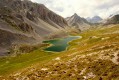
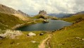
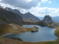
(2) Continue south-east to Lac de l’Orrenaye.
(3) Once you reach the lake, take the path branching off to the left.
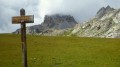
(4) Shortly afterwards, a signpost indicates the direction of the Col de Feuillas. Follow the direction indicated. When we were there, there were no longer any tracks in this grassy section, just paint marks on the posts.
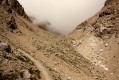
After this grassy section, cross a tiny stream towards a rocky area. The trail reappears. Ignore a path that climbs to the left of the scree and stay on the trail until you reach the pass.
(5) Once at the pass, follow the red/blue markings heading off to the right and do not take the detour from the small ledge situated just below the pass post.
Continue along the path as it descends, passing by Enrico Mario’s bivouac (apparently the start of the Via Ferrata is here).
Shortly afterwards, a fork in the path offers the hiker a choice: either take the R. Cavallero path – which, according to online sources, is relatively exposed – towards the Col de Scaletta (1h30); or descend to the bottom of the valley (2h30). The route shown is the one that descends towards the valley.
During the descent, a sheepfold will come into view in the distance; keep it in your sights.
(6) Once you reach the sheepfold, walk round it, following the red/blue markings.
On two occasions, you will need to cross an electric fence via a designated gap. Follow the path until you reach a forest track.
(7) When you reach the track, turn right (S10).
(8) Continue along the forest track to the next signpost and head towards S10-Passo Scaletta. Shortly before reaching the pass, the R. Cavallero path will join from the right, coming from the Col de Feuillas.
Follow the S10 path to the pass and then continue along the path (south-west).
(9) Note a fortification on the right just before the winding descent towards Lac de Roburent.
(10) Once at the lake, take the path on the right leading back towards France.
(11) Just before the pass, ignore a path branching off to the left (which runs alongside Lac de l’Orrenaye). Our path (shown on the map) passes a little higher up and rejoins the junction leading to the Col de Feuillas.
(3) From there, follow the path you took on the way out to return to the car park (S/E).


 Visorando Member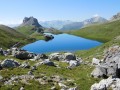
 Difficult
 Moderate
 Easy
Easy