Country:

 City:
City:


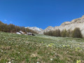
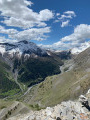
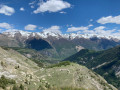
The route starts on the Demandols road/track leading to the dairy of the same name, from marker 82. To get there, once you reach Saint-Étienne-de-Tinée, take the road that goes straight on after the Télépulse (a sign indicates that this road is closed to traffic on Monday mornings), then take the road immediately on the left which climbs up into the Demandols valley (D139 or M139 on IGN maps). Park at the end of the tarmac section, right next to marker 82 (just before or just after a small metal bridge).
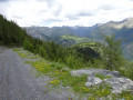
(S/E) From the metal bridge, follow the track towards the Demandols valley as indicated by marker 82; shortly afterwards, you’ll pass marker 162 (the second hairpin bend on the track), and you’ll need to continue following the direction of the Demandols valley. The route follows a wide track.
(1) Turn right towards the Chabanals barns at marker 88. From this point, the route follows a well-marked but steep path.
(2) There is a ruin marked with a yellow sign, which may be misleading as to the direction to take.
Caution: do not carry on straight ahead.
Turn right (the path is poorly marked here but makes a hairpin bend). From this point, the path becomes a little overgrown, but the yellow markings clearly show the direction to follow.
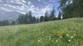
(3) Leave the larch forest and emerge onto a magnificent plateau where the Chabanals barns are situated. Continue straight on, along a grassy track, towards the barn visible ahead.
(4) Go round the barn on the right (keeping it on your left) and reach marker 89, which is situated just above it. The marker does not indicate the direction to follow. Continue straight on along a small, relatively well-defined path, which will gradually become less distinct. You must then follow the yellow markings.
(5) You’ll reach an alpine barn where the path disappears completely. Turn left as you face the barn, heading south-south-east towards the ridge.
(6) Follow the ridge upwards, heading south-west. A faint track and a few cairns leave little doubt as to which way to go. You’ll reach the summit of Chabanals Supérieur (marked by a small cairn).
(7) Head back down to marker 89.
(4) Back at marker 89, there are two options:
-Option 1: follow the outward route in the opposite direction to return to the starting point via marker 88.
-Option 2, shown on the map: turn sharply right, heading west, onto a track that leads back into the Demandols valley. Follow this track – which presents no technical difficulties – until you rejoin the Demandols track/road.
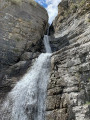
(8) Turn left, heading north-east, onto the Demandols track (marked D139 or M139 on IGN TOP 25 maps). Follow the track, which passes close to the Chabanals Waterfall.
(9) Reach marker 88, which you passed on the way out.
(1) Follow the route back in the opposite direction to the outward journey, heading for marker 162 to return to the start (S/E)..

 Visorando Member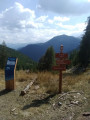
 Average
 Very difficult