Country:

 City:
City:


(1) Take the path heading north. Pass the small pass of Tortisse (marker 35a) heading north towards the Col du Fer (marker 35).
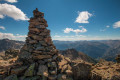
(2) Make a round trip to the Cime du Fer to enjoy the 360° panorama. To do this, follow the path that zigzags along the northern ridge, then climb straight up through the grass. The slope is steep but not difficult.
From the Col du Fer, follow the path down alongside the Tortisse torrent heading north-west to the Maisons Forestières of the same name (just past marker 34).
(3) From marker 34, begin the ascent towards the Lacs de Vens, heading south-east. After the pass on the Crête de la Côte, follow the ledge path to marker 23.
(4) Join the path below, heading south-east, to avoid descending back towards marker 22, and head south-west to marker 27.
(5) Continue south-west to marker 26.
(6) Cross the footbridge and climb up to the Crête des Babarottes via the lake, then descend through the Baussayer scree slope to marker 113.
(7) Continue in the same direction (south-east) to reach the Chemin de l’Énergie. A more or less wide, level path. Watch out for rockfalls! In June 2015, the path was closed between markers 112 and 110.
(8) At marker 112, head down towards Les Granges de Fournels (marker 109), heading south-west. A long, steep descent with hairpin bends.
(9) 600 metres further down, at marker 109, continue descending westwards to the village. Another 600 metres to go!

 Visorando Member
 Moderate
 Very difficult