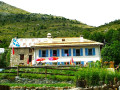
Le Pra – Vens Mountain Hut

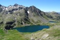
A first day to stretch your legs and discover the magnificent natural setting of the Vens lakes.
Note: as this route ends in Saint-Étienne-de-Tinée, it is advisable, if possible, to park a second car in Saint-Étienne-de-Tinée to shuttle back to the starting point. Otherwise, allow around €25 for the taxi journey from Saint-Étienne-de-Tinée to Le Pra, but please note that booking is required a few hours in advance.

This walk is part of a multi-day hike: Lacs de Vens et de Rabuons par le Chemin de l'énergie

Details

3879646
Creation:
Last update:
Last review:
  • Walking
    Activity: Walking
  • ↔
    Distance: 4.69 mi
  • ◔
    Average duration: 4h 35 
  • ▲
    Difficulty: Moderate

  • ⚐
    Back to start: No
  • ↗
    Ascent: + 2,792 ft
  • ↘
    Descent: - 417 ft

  • ▲
    Highest point: 7,966 ft
  • ▼
    Lowest point: 5,407 ft

Description of the walk

Park in the car park at the hamlet of Le Pra along the M64. It’s also possible to park a little further down.

(S) Head to marker 32, then take the PR® path marked in yellow towards the Lacs de Vens.
Climb the winding path through a sparse larch forest. It is not particularly difficult to reach marker 33 via a series of hairpin bends

(1) Take the path on the right towards the Tortisse forest lodge. Walk past it to quickly reach the junction marked by marker 34.

(2) Here you have two options:
- keep left to climb to the small pass of Tortisse via the Col du Fer to enjoy a magnificent view of the Lacs de Vens before descending back to the refuge; this adds around 200 metres of additional elevation gain,
- turn right – this is the route shown on the map – and head for the junction marked with signpost 23.

(3) Take the path on the left towards the Vens refuge. Cross some scree without difficulty and reach the refuge (E).

Waypoints

  1. S : mi 0 - alt. 5,407 ft - Le Pra
  2. 1 : mi 1.95 - alt. 7,057 ft - Marker 33
  3. 2 : mi 2.92 - alt. 7,369 ft - Marker 34. Alternative route possible
  4. 3 : mi 3.91 - alt. 7,890 ft - Marker 23
  5. E : mi 4.69 - alt. 7,785 ft - Refuge de Vens

Notes

There is no mobile phone signal along the entire route, so please remember to let your loved ones know.
Plan to arrive by 6 pm at the latest to check in at the refuge. Dinner is served at 7 pm.
There are no power sockets at the Vens refuge to charge your mobile phones. However, a bike with a dynamo is available for the more active among you; allow an hour’s cycling for an 80% charge. Bring a power bank and a charging cable.
(E) Enjoy a nice beer at the refuge with a view of the lake. A superb spot for camping is available a 5-minute walk above the refuge; follow the pipe supplying the fountain in front of the terrace uphill to reach a flat area with a view of the lake. Ask the warden for advice if needed.
(E) Covid-19:Bookings are compulsory for overnight stays and dinners.
Face masks must be worn inside the refuge.

This route passes through a protected area, which may be subject to special regulations:

Worth a visit

(S) Hameau du Pra
If taking this route: Arches and rock formations, with views of the lake, below the small pass of Tortisse
(E) Vens Mountain Hut
(E) Vens Lakes

Always be cautious and plan ahead when you're outdoors. Visorando and the author of this route cannot be held responsible for any accidents occurring on this route.

The GR® and PR® markings are the intellectual property of the Fédération Française de Randonnée Pédestre.

Reviews and comments

5 / 5
Based on 3 reviews

Reliability of the description
5 / 5
Ease of following the route
5 / 5
Route interest
5 / 5
Duche
Duche

Overall rating : 5 / 5

Date of your route : Jul 24, 2026
Reliability of the description : ★★★★★ Very good
Ease of following the route : ★★★★★ Very good
Route interest : ★★★★★ Very good
Very busy route : Yes

A lovely climb starting from the valley; the walk to the mountain hut offers a stunning view of the lake.
A very cosy mountain hut – rustic, but that’s part of its charm.

Machine-translated

slav92
slav92
• Edited:

Overall rating : 5 / 5

Date of your route : Sep 15, 2025
Reliability of the description : ★★★★★ Very good
Ease of following the route : ★★★★★ Very good
Route interest : ★★★★★ Very good
Very busy route : No

A very beautiful hike, easy to follow. We had our picnic next to the forest house surrounded by marmots, it was splendid.
At the start of the hike, the Hameau du Pra is closed, but there is a small car park nearby which fills up quite quickly. Otherwise, you have to park further down.

Machine-translated

kbastien@rh-groupe.fr

Overall rating : 5 / 5

Date of your route : Aug 20, 2023
Reliability of the description : ★★★★★ Very good
Ease of following the route : ★★★★★ Very good
Route interest : ★★★★★ Very good
Very busy route : Yes

A lovely walk with magnificent lakes

Machine-translated

Other walks in the area

For more walks, use our search engine .

The GPS track and description are the property of this route's author. Please do not copy them without permission.