Rabuons Mountain Hut – Saint-Étienne de Tinée

The final day is less demanding than the previous one, consisting entirely of a descent. It’s a chance to walk the ‘Chemin de l’Énergie’ one last time before a long descent to Saint-Étienne-de-Tinée.

This walk is part of a multi-day hike: Lacs de Vens et de Rabuons par le Chemin de l'énergie

Details

3879648
Creation:
Last update:
Last review:
  • Walking
    Activity: Walking
  • ↔
    Distance: 4.93 mi
  • ◔
    Average duration: 2h 25 
  • ▲
    Difficulty: Moderate

  • ⚐
    Back to start: No
  • ↗
    Ascent: + 164 ft
  • ↘
    Descent: - 4,642 ft

  • ▲
    Highest point: 8,274 ft
  • ▼
    Lowest point: 3,796 ft

Description of the walk

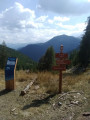
(S) From the Rabuons refuge, head back down and take the footbridge over the lake’s spillway to marker 105. At this marker, turn left and head back down towards Saint-Étienne-de-Tinée along the path taken the previous day. Pass behind the hydroelectric power station and reach marker 104.

(1) Turn right and follow the ‘Chemin de l’Énergie’. Enjoy the panoramic views and head for marker 103. Do not descend via the winding path.

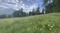
(2) Leave the ‘Chemin de l’Énergie’ and head down to the left towards Saint-Étienne-de-Tinée. The path is well signposted and winds through sparse mountain pastures. You’ll reach the first junction.

(3) Stay on the left-hand path and continue the descent through a beautiful larch forest. You’ll reach marker 102.

(4) Turn left and continue the descent. You will soon come to marker 106 at a cross at the next junction.

(5) Turn slightly left and begin the final descent to reach marker 100 at Saint-Étienne-de-Tinée (E).

:

Waypoints

  1. S : mi 0 - alt. 8,274 ft - Refuge de Rabuons
  2. 1 : mi 0.51 - alt. 8,012 ft - Marker 104
  3. 2 : mi 1.66 - alt. 7,818 ft - Marker 103
  4. 3 : mi 2.56 - alt. 6,578 ft - Sélasse Forest
  5. 4 : mi 2.99 - alt. 5,991 ft - Marker 102
  6. 5 : mi 3.33 - alt. 5,623 ft - Marker 101
  7. E : mi 4.93 - alt. 3,796 ft - Saint-Etienne-de-Tinée - Tinée (rivière)

Notes

Note on this final stage: With your knees likely to be aching, the end of the descent also marks the end of the hike. You can relax and go for a swim in the village lake (free of charge) on the other side of the bridge. Then take a taxi back to the hamlet of Le Pra (booking a few hours in advance is advised; expect to pay around €25) or use a second car (parked before the hike) as a shuttle.
Walking poles and sturdy walking shoes are recommended, as you’ll be tackling a long descent that’s hard on the knees!
Booking a taxi is recommended from waymark 103 for walkers who do not have their own transport to return to the starting point of the 3-day route.

This route passes through a protected area, which may be subject to special regulations:

Worth a visit

Chemin de l’Énergie
Saint-Étienne-de-Tinée Lake (free)
Visit to Saint-Étienne-de-Tinée
Sélasse Forest (larch).

Reviews and comments

4.9 / 5
Based on 3 reviews

Reliability of the description
5 / 5
Ease of following the route
5 / 5
Route interest
4.7 / 5
Piter
Piter

Overall rating : 5 / 5

Date of your route : Aug 03, 2026
Reliability of the description : ★★★★★ Very good
Ease of following the route : ★★★★★ Very good
Route interest : ★★★★★ Very good
Very busy route : Yes

Setting off early from the refuge, we reach the larch forest just as the sun starts to beat down, so the next 1,000 metres are covered in the shade.
That doesn’t stop our knees and quadriceps from being very glad to have made it!

Machine-translated

Mareve
Mareve

Overall rating : 5 / 5

Date of your route : Aug 21, 2023
Reliability of the description : ★★★★★ Very good
Ease of following the route : ★★★★★ Very good
Route interest : ★★★★★ Very good
Very busy route : No

A really lovely, easy walk.

Machine-translated

mo.renault
mo.renault

Overall rating : 4.7 / 5

Date of your route : Jun 28, 2023
Reliability of the description : ★★★★★ Very good
Ease of following the route : ★★★★★ Very good
Route interest : ★★★★☆ Good
Very busy route : No

A route that’s mostly downhill and mostly in the shade; a beautiful forest. The significant elevation gain is hard on the knees!

Machine-translated

Other walks in the area

For more walks, use our search engine .

The GPS track and description are the property of this route's author. Please do not copy them without permission.