Country:

 City:
City:


Park your car in the car park situated just before the Col de Larche, about 1 km from the Ubaye Valley.
(S) Take the path heading towards the Lacs de l’Orrenaye and Roburent.
The path climbs steeply.
(1) You’ll pass near the source of the Pains Bouillis.
(2) Once you reach the plateau, you have two options.
Either follow the signposted path (yellow and red), or turn right (there is a red and yellow marker cross).
You must continue along the marked path.
(3) When you reach the junction where you can rejoin theGRP® Tour du Chambeyron, leave the path and head towards the metal structure slightly further up.
Carry on straight ahead across the slopes until you reach a small plateau.
(4) Take the track slightly to the left on the slope.
(5) Once you have climbed the short steep section, join the path coming from Lac de l’Orrenaye. To do this, you must first head straight towards the ridge, following a hollow; then, when the hollow fades away, turn right to rejoin the path that crosses the scree slope.
(6) Once on the path, turn left towards the Col du Bœuf.
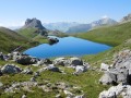
(7) After the pass, descend on the Italian side via the winding path to the small lake ‘Delle Munie’.
(8) When we were hiking there, there was a herd of cows by this lake, so we veered slightly to the right at the foot of the slope.
(9) Join the path leading to Lake Apsoi.
(10) We had a picnic by the lake.
Head back along the path we came up on.
(11) Once you reach Lac delle Munie, carry on straight ahead towards the Col des Monges.
(12) At the pass, head back down, following theGRP® “Tour du Soubeyran”.
(13) A section overlooking Lac de la Montagnette.
(14) Carry on to the left towards the Larche Valley until you reach the signpost for the Tête Dure and the Col de la Gipière.
(15) Follow this direction until you reach a mountain hut.
(16) Turn right towards Tête Dure.
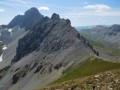
The path winds its way up through the rocky terrain (follow the yellow markings), eventually reaching the Col de Rémy after passing a few slightly slippery stony sections.
(17) At the pass, either head towards the Tête Dure by continuing along the path. This will then swing round to join the track.
For our part, we cut straight across the slope, heading for the hut and the track visible from the pass.
(18) Once at the hut, take the track on your left, which will lead you back to your starting point (E). (Those who have climbed the Tête Dure will arrive from the right).

 Visorando Member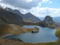
 Moderate
 Very difficult
 Easy
Easy