Col de Larche – Rifugio della Gardetta

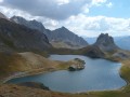
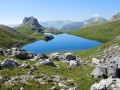
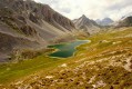
On this fourth day, you’ll head briefly back into France to walk through the Orrenaye valley with its magnificent lake. You’ll return to Italy at the Col du Ruburent, then enjoy the beauty of Lake Ruburent as you walk around it. You’ll cross the very rocky Passo della Scaletta, which contrasts with the mountain pastures as you climb to the Passo della Gardetta.

This walk is part of a multi-day hike: A circular route from the Val Maira to the Ubaye Valley

Details

n°2291407
Creation:
Last update:
Last review:
  • Walking
    Activity: Walking
  • ↔
    Distance: 10.06 mi
  • ◔
    Average duration: 8h 10 
  • ▲
    Difficulty: Difficult

  • ⚐
    Back to start: No
  • ↗
    Ascent: + 4,019 ft
  • ↘
    Descent: - 2,877 ft

  • ▲
    Highest point: 8,625 ft
  • ▼
    Lowest point: 6,342 ft
  • ⚐ Country: France
  • ⚐
    Areas: Alps, Ubaye Valley
  • ⚐ City: Larche (04540|04530)
  • ⚑
    Start: N 44.421568° / E 6.898268°
  • ⚑
    End: N 44.409294° / E 7.012121°
  • ❏
    IGN map(s): Ref. 3538ET, 3538ETR
  • Hour-by-hour weather

Photos

Description of the walk

(S) From Rifugio della Pace, cross the road and head to the far end of the car park.
Look out for the path that climbs northwards into the Orrenaye valley. Follow the stream on your left, then, after crossing the Orrenaye, you’ll reach the junction with the path on the right bank.

(1) Walk at a leisurely pace to Lac de l’Orrenaye.

(2) Follow the path around the lake’s edge to reach the Col de Ruburent.

(3) Head down towards Lac de Ruburent on its western shore.

(4) Walk round the lake to reach the eastern shore, then continue northwards until you reach a junction with the Pas de la Scaletta path.

(5) Take the hairpin bends of the Pas de la Scaletta and pass the path leading up to the summit of the Scaletta to reach the pass.

(6) From the Pas de la Scaletta, heading east-southeast, begin the descent to the Passo de l’Escalon (2,415 m).

(7) Continue the descent, passing a path on the right that leads to Colletto Vittorio and Bivacco Due Valli. Continue down to a junction with another path leading to Bivacco Due Valli (signpost).

(8) The Gardetta valley is clearly visible opposite, running east then north-north-east; reach a cattle shed (Grange Calandra, 1,940 m) at the very bottom of the valley.

(9) Cross the stream and join the track, continuing to a junction after a sharp bend.
At the junction, take the path leading uphill to the east (signposted for the Rifugio della Gardetta). Continue to the Passo della Gardetta.

(10) From the Passo della Gardetta, the Rifugio is clearly visible. You can reach it quickly by following the few hairpin bends (E).

Waypoints

  1. S : mi 0 - alt. 6,552 ft - Col de Larche
  2. 1 : mi 1.22 - alt. 7,228 ft - Junction with path to the other side
  3. 2 : mi 2.53 - alt. 7,917 ft - Lac de l'Orenaye
  4. 3 : mi 3.49 - alt. 8,202 ft - Col du Reburent
  5. 4 : mi 3.73 - alt. 8,005 ft - Circular walk around Lake Ruburent via the western route
  6. 5 : mi 4.57 - alt. 7,979 ft - Scaletta Pass trail
  7. 6 : mi 5.26 - alt. 8,507 ft - Scaletta Pass
  8. 7 : mi 5.95 - alt. 7,999 ft - Passo dell’Escalon
  9. 8 : mi 6.63 - alt. 7,156 ft - Path to the Due Valli bivouac
  10. 9 : mi 7.42 - alt. 6,371 ft - Cattle shed
  11. 10 : mi 9.31 - alt. 7,992 ft - Gardetta Pass
  12. E : mi 10.06 - alt. 7,674 ft - Rifugio della Gardetta

Notes

Worth a visit

  • Lake Orrenaye.
  • Ruburent Pass and Lake.
  • Colle della Scaletta, Monte Scaletta.
  • Gardetta Pass.
  • Gardetta Mountain Hut.
  • Rocca la Meja.

Reviews and comments

3.8 / 5
Based on 2 reviews

Reliability of the description
3.5 / 5
Ease of following the route
3.5 / 5
Route interest
4.5 / 5
DanielANDRE
DanielANDRE

Overall rating : 4.3 / 5

Date of your route : Sep 06, 2023
Reliability of the description : ★★★★☆ Good
Ease of following the route : ★★★★☆ Good
Route interest : ★★★★★ Very good
Very busy route : No

We didn’t walk all the way round Lake Roburent; we stayed to the north of the lake
Obviously, the map of the Italian side is ‘very poor’!

Machine-translated

Diablet
Diablet

Overall rating : 3.3 / 5

Date of your route : Sep 07, 2018
Reliability of the description : ★★★☆☆ Average
Ease of following the route : ★★★☆☆ Average
Route interest : ★★★★☆ Good

The area was very poorly signposted, so we had to change a large part of the route...

Machine-translated

Other walks in the area

For more walks, use our search engine .

The GPS track and description are the property of this route's author. Please do not copy them without permission.