Rabuons Refuge – Vens Refuge

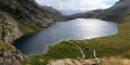
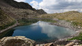
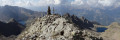
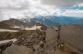
After a night at the Rabuons Mountain Hut, you’ll be ready to climb Mont Ténibre, the main highlight of this second stage. The route is challenging but you’ll be richly rewarded by the panoramic views that await you. To the south, you’ll recognise the Refuge de Rabuons and the lake; to the north and west, there are numerous lakes and the peaks on the border with Italy. After a more leisurely walk along the Chemin de l’Énergie, the scenery will become more pastoral as you approach the Lacs de Vens.
You are now in the Mercantour National Park; there are regulations to be observed, and failure to do so may result in a fine of up to €1,500 – please see the practical information.

This walk is part of a multi-day hike: Circuit de Rabuons à Vens par le Mont Ténibre

Details

1678886
Creation:
Last update:
Last review:
  • Walking
    Activity: Walking
  • ↔
    Distance: 9.54 mi
  • ◔
    Duration according to the author: 7 hrs 
  • ▲
    Difficulty: Very difficult

  • ⚐
    Back to start: No
  • ↗
    Ascent: + 3,383 ft
  • ↘
    Descent: - 3,875 ft

  • ▲
    Highest point: 9,915 ft
  • ▼
    Lowest point: 7,497 ft

Photos

Description of the walk

Please note: from (3) to (8) – T3 rating

(S) From the Rabuons Refuge, head for marker 105.

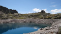
(1) Follow the path to the right, heading north, which runs alongside Lake Rabuons. At the end of the lake, you’ll reach marker 106.

(2) Continue northwards along a well-marked path, passing Lakes Chaffour and Cimon. Then make your way across scree (red markings and numerous cairns) to the Pas de Rabuons. This point marks the French-Italian border.

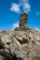
(3) Leave the path leading up to Rocca Rossa on your right. Continue to the left, over scree and large boulders at times, but the route is always clearly marked. Reach the summit after a short exposed section (where you’ll need to use your hands).

(4) Begin the descent down the south-west face with extreme caution. The path is well marked (cairns and red markings), but the slope is very steep (you’ll need to use your hands).

(5) Continue northwards towards the “Pas de Ténibre”.

(6) Pass the “Pas de Ténibre” path on your right and continue for about 150 metres along an almost flat track.

(7). Turn left into a scree-filled gully to reach the Lacs Varicles via a series of terraces.

(8) Walk alongside the large Lac Varicles, continue to the junction with a wide track (Chemin de l’Énergie), and reach the buildings at Plan de Ténibre.

(9) Return to marker 112 via the Chemin de l’Énergie, which is much easier going.

(10) At marker 112, turn right, staying on the Chemin de l’Énergie. Head for marker 113

(11) At marker 113, head north towards the Lacs de Vens. Climb up through the Baussayer scree (quite steep) to reach the Crête des Babarottes.

(12) Descend and walk alongside Lac des Babarottes, then head down again towards the Lacs de Vens. Cross the Vens torrent and head for marker 26.

(13) Follow the shore of two other small lakes to reach marker 27.

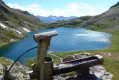
(14) Continue along the lake, following the markings carefully, and reach the Upper Lake of Vens after a final climb. Walk at a leisurely pace through stunning scenery to the Refuge de Vens (E)

Waypoints

  1. S : mi 0 - alt. 8,264 ft - Refuge de Rabuons
  2. 1 : mi 0.12 - alt. 8,209 ft - Marker 105
  3. 2 : mi 0.83 - alt. 8,320 ft - Marker 106
  4. 3 : mi 2.13 - alt. 9,409 ft - Pas de Rabuons, Marker 107
  5. 4 : mi 2.63 - alt. 9,895 ft - Mont Ténibre
  6. 5 : mi 2.77 - alt. 9,724 ft - End of the very steep descent
  7. 6 : mi 2.9 - alt. 9,633 ft - Pas de Ténibre Trail
  8. 7 : mi 2.97 - alt. 9,596 ft - Turn left
  9. 8 : mi 3.79 - alt. 7,995 ft - Varicles Lakes
  10. 9 : mi 4.3 - alt. 7,641 ft - Map of Ténibre – Marker 111
  11. 10 : mi 5.14 - alt. 7,641 ft - Marker 112
  12. 11 : mi 6.91 - alt. 7,684 ft - Marker 113
  13. 12 : mi 7.42 - alt. 8,225 ft - Babarottes Ridge
  14. 13 : mi 8.28 - alt. 7,513 ft - Marker 26
  15. 14 : mi 8.6 - alt. 7,605 ft - Marker 27
  16. E : mi 9.54 - alt. 7,772 ft - Refuge de Vens

Notes

Mercantour National Park regulations – full details via this link:
- Bivouacking and camping: permitted only more than an hour’s walk from road access points and the park boundaries, between 7.00 pm and 9.00 am. It is forbidden to spend the night in your vehicle in a car park or at the side of the road within the heart of the Mercantour National Park.
- Dogs are not permitted, even when kept on a lead
- Fires are prohibited in the core area of the park and also throughout the Alpes-Maritimes department
by prefectural decree.
- Parking may be prohibited at the start of certain hikes due to the risk of
torrential mudslides and rockfalls.

  • A challenging route reserved for experienced walkers
  • This route includes a long section rated T3. (Ascent and, in particular, descent of Mont Ténibre).
  • A quick reminder about route difficulty ratings: see this page.

This route passes through a protected area, which may be subject to special regulations:

Worth a visit

  • Rabuons Lakes.
  • Mont Ténibre (3,031 m).
  • Rabuons Pass.
  • Ténibre Pass.
  • Vens Lakes.
  • The Energy Trail.

Reviews and comments

4.8 / 5
Based on 2 reviews

Reliability of the description
5 / 5
Ease of following the route
4.5 / 5
Route interest
5 / 5
mo.renault
mo.renault

I completed the Lacs de Vens–Lac de Rabuons route at the end of June 2023 (in the opposite direction to the suggested route) without going via Mont Ténibre (due to stormy weather), taking the route that runs to the south; Plan de Ténibre (a brilliant spot for camping) and the ‘Sentier de l’Énergie’; this path is cut off shortly after Plan de Ténibre; a diversion has been put in place (more elevation gain but magnificent scenery and a small lake reflecting the snowfields).
A very nice alternative for those who don’t wish to climb to 3,000 metres

Machine-translated

Patrick L
Patrick L

Overall rating : 5 / 5

Date of your route : Sep 20, 2022
Reliability of the description : ★★★★★ Very good
Ease of following the route : ★★★★★ Very good
Route interest : ★★★★★ Very good
Very busy route : No

A very beautiful route that follows paths which are at times technical and difficult to follow (keep a close eye out for the cairns), but which takes you to the highest peak in the area: the Tennibre.
The finish via the lakes at the Vens refuge is magnificent.

Machine-translated

bernardino
bernardino ★

Hello, and many thanks for these comments, which only serve to confirm the points already mentioned by the author.
Have a lovely day and enjoy your future walks.

Machine-translated

amandjneh
amandjneh

Overall rating : 4.7 / 5

Date of your route : Aug 11, 2019
Reliability of the description : ★★★★★ Very good
Ease of following the route : ★★★★☆ Good
Route interest : ★★★★★ Very good

We covered the first part of the description of this walk, then headed back to Saint-Étienne-de-Tinée.
We set off from the Rabuons mountain hut, then passed through the Pas de Tenibre to reach the summit of Mont Tenibre.
The climb over the scree was quite difficult, and we lost the path. It was the same on the way down the other side; the path is marked with red dots, but we lost it several times. Fortunately, an experienced hiker helped us and put us back on a more manageable path (it wasn’t easy to begin with, but it was even harder going completely off-trail!). Once we reached Lac de Varicles, the hardest part was over.
The Chemin de l’Energie is only accessible via a significant detour, and we were advised against taking it. It’s partially closed due to a rockslide. So we headed back via marker 108, if I remember correctly. The descent through the forest is quite long.
I’d recommend it, but only for sufficiently experienced walkers.

Machine-translated

Other walks in the area

For more walks, use our search engine .

The GPS track and description are the property of this route's author. Please do not copy them without permission.