Lakes Varicles and Ténibre

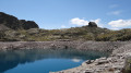
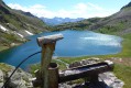
Two high-altitude lakes, amongst the many above Saint-Étienne-de-Tinée, less well-known and less frequented than Lac du Rabuons, but offering a beautiful viewpoint over the Auron valley and beyond.

Details

n°9276159
Creation:
Last update:
–
Last review:
  • Walking
    Activity: Walking
  • ↔
    Distance: 8.35 mi
  • ◔
    Average duration: 7h 55 
  • ▲
    Difficulty: Difficult

  • ⚐
    Back to start: Yes
  • ↗
    Ascent: + 4,656 ft
  • ↘
    Descent: - 4,669 ft

  • ▲
    Highest point: 8,340 ft
  • ▼
    Lowest point: 3,743 ft

Photos

Description of the walk

Park in the car park opposite the Maison du Mercantour.

(S/E) As you leave the car park, turn left onto the road towards Jausiers.

(1) Turn left after the bridge and continue along Boulevard Issautier for about a hundred metres; signpost 108 is on the right, immediately after a wash house (Torrent de Ténibres).

(2) Take the path on the right bank of the Torrent de Ténibres. Gradually leave the path and walk past the houses in Champés. Continue uphill to reach the telecommunications mast.

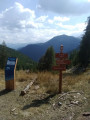
(3) Shortly after the mast, turn right to head east, then generally north again. Continue climbing until you reach an alpine hut. You’ll soon come to a crossroads with an unnumbered marker. Here, a few stones lie across the path, whilst others are lined up to indicate the direction.

(4) Turn left as indicated by the signpost: ‘walking route’. Continue due north, along the right-hand edge of a small meadow. The path is faint in places, but the yellow markings on the trees are clearly visible. Take care to follow them closely until you reach a hairpin bend to the right, which takes you back onto the main route. Follow the yellow mark at a right angle to the ground. Shortly after the house, veer left to reach marker 109.

(5) Cross the path and carry on straight ahead, heading roughly north-east whilst staying broadly on the ridge. Via a series of small hairpin bends, reach marker 112 at the junction with the Chemin de l’Énergie.

(6) Turn right onto this path and walk along it – on almost level ground – to reach the Plan de Ténibre at marker 114.

(7) Shortly afterwards, leave the Chemin de l’Énergie and turn left, generally following the intermittent stream flowing from the Lacs Varicles. Walk along the left-hand side of the lower lake, then reach the springs of the lakes.

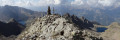
(8) Continue on, then turn left to begin the final ascent and reach the Ténibre Lakes.

(8) Then follow the same route back in the opposite direction to return to the car park at marker 108 (S/E).

Waypoints

  1. S/E : mi 0 - alt. 3,757 ft - Car park opposite the Maison du Mercantour on the banks of the - Ardon (rivière) Affluent de la Tinée
  2. 1 : mi 0.11 - alt. 3,753 ft - Turn left after the bridge at the - Tinée (rivière)
  3. 2 : mi 0.22 - alt. 3,806 ft - Marker 108
  4. 3 : mi 0.86 - alt. 4,905 ft - Antenna
  5. 4 : mi 1.22 - alt. 5,397 ft - Unnumbered marker
  6. 5 : mi 1.53 - alt. 5,748 ft - Marker 109
  7. 6 : mi 2.66 - alt. 7,651 ft - Marker 112
  8. 7 : mi 3.48 - alt. 7,641 ft - Marker 111
  9. 8 : mi 4.02 - alt. 8,071 ft - Sources
  10. S/E : mi 8.34 - alt. 3,757 ft - Car park opposite the Maison du Mercantour

Notes

There is no water along the route until marker 111.
Alternative route: for those who do not wish to take a dip in either lake, the climb up to the Chemin de l’Energie is a destination in itself. The full panorama has now come into view and the elevation gain is already substantial (1,200 m).

This route passes through a protected area, which may be subject to special regulations:

Worth a visit

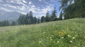
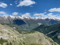
As you make your way up, the view unfolds: first the village with the lake at your feet, then the village centre with its bell tower further to the left. Next comes the wilder Demandols valley, bounded at the far end by the Cime de Pal with its distinctive pyramidal shape. Next come the Cime de Bercha, the Cime de Las Donnas and the Auron ski area. Finally, in the background, the Mounier, the Col de Crousette, the Cime Nègre, the Col de Crous and the Cime de Pal, already mentioned. A panorama that unfolds like a theatre scene, as the curtain gradually rises.

Reviews and comments

5 / 5
Based on 1 review

Reliability of the description
5 / 5
Ease of following the route
5 / 5
Route interest
5 / 5
La Sand
La Sand

Overall rating : 5 / 5

Date of your route : Oct 05, 2023
Reliability of the description : ★★★★★ Very good
Ease of following the route : ★★★★★ Very good
Route interest : ★★★★★ Very good
Very busy route : No

A magnificent route! On the Chemin de l’Energie, at a bend leading out onto the Plan de Ténibre, a lovely little plateau below was occupied by mouflons!! It’s been years since I’ve had the chance to spot any in the area. Note that on the map, at no. 6, marker 114 is indicated for the Plan de Ténibre. This marker is actually numbered 111. For those wishing to complete the circular route and descend further along the Chemin de l’Energie: “Following a rockfall in part of the third tunnel, the section of the Chemin de l’Energie between markers 111 and 110 is dangerous and closed by municipal order. The Alpes-Maritimes Department and the Mercantour National Park have set up a diversion route via Lac Fer”. The start of this diversion follows the path to the Varicles lakes for a short distance before branching off. As for the Ténibre Lakes, they are magnificent. A splendid hike, especially at this time of year when the paths are much less busy.

Machine-translated

Other walks in the area

For more walks, use our search engine .

The GPS track and description are the property of this route's author. Please do not copy them without permission.