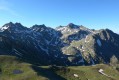
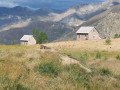
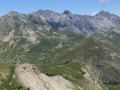
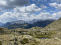
A demanding route, partly off-trail with several very tricky sections best left to experienced walkers, particularly the descent of the Claï via its north face, which will require patience and concentration (see practical information).


 Country:

 City:
City:



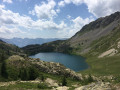
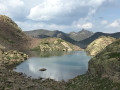
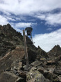
Pass through Saint-Étienne-de-Tinée towards the Col de la Bonnette, then park at the Vens car park, just past the waterfall and a few kilometres before reaching Le Pra. If the car park is full, there are additional spaces further up the track on the right, just before the barrier.
(S/E) Take the track towards the Vens ford as far as marker 21.
(1) Here, stay on the Piste de l’Eau, ignoring the path that climbs to the left towards the Vens lakes. The track is fairly quiet and will get you into your stride gently. Carry on to marker 114, which should take you about an hour.
(2) Take the path on the left towards the Chemin de l’Énergie. This is where the climb begins. You’ll come across the last few streams – make the most of them if you need to.
(3) At marker 113, turn right towards the Chemin de l’Énergie, which begins a few metres further on. The path is flat and very pleasant, with a magnificent view of the Mounier range opposite. Keep an eye out until, a little further on, you spot a cairn on the left marking the climb towards the Lacs Marie.
(4) Leave the path here and head straight off-trail. Look at the photos to see where to turn off. There are very few cairns, so you’ll need to be vigilant all the way. Head up the valley opposite you until you reach the next crossing point; the direction to follow is fairly intuitive.
(5) From here, you should see a ‘T’-shaped cairn right at the top and to your left. Continue climbing, keeping this cairn as your landmark; the Marie Lakes are just behind it.
(6) Walk along the right-hand side of the first lake until you reach a large scree slope which you’ll need to climb to reach the ridge.
(7) There’s still no cairn, but the route to take is fairly obvious – see photos. Climb towards the ridge, looking for the best way up. The scree slope isn’t very stable, so take care. Cross the first section, then turn left (north), heading up towards the foot of the Roche Nègre.
(8) Look out for a very large cairn further up at the top of the ridge. Continue climbing towards it, keeping a northerly direction.
(9) At the cairn, the view opens up and you can see the Ténibre and its lakes to the east. You will now need to continue climbing over the scree, following the Crête de Marie to the right. There are a few scattered cairns, and your next objective is now visible straight ahead: the Brèche Borgonio. This is a narrow pass at the top of the ridge, with a post standing right in the middle which you should be able to see clearly. Halfway between the cairn and the pass, you should be able to see another small wooden post. Keep it in your sights and carry on to the pass.
(10) Turn left, skirting the Tête des Lacs Marie on its right-hand side (north). From here to the Claï, you’ll see a few cairns to guide you.
(11) At this point, the cairns indicate that you should climb up to the left to reach the ridge. Continue to follow them until you reach the next crossing point. You may need to use your hands a little.
(12) A slightly tricky section as the cairns seem to have disappeared. In fact, you need to descend a little to the left to spot the next one, and this will take you to the foot of a somewhat unstable ledge on the right which you’ll need to climb to finally reach the summit. There’s no room for error here, so be very careful. The summit cairn is, however, visible to the north-west.
(13) At the summit, take in the magnificent view before getting down to the really serious business. If the Claï is your only objective, I can only advise you to make a round trip by descending towards the Lacs Marie, thus avoiding the north face, which is particularly difficult.
Otherwise, descend the north face of Le Claï over extremely treacherous scree to reach Lac de la Montagnette. Here again, there are no cairns: I personally skirted the summit to the north-west for a few metres before cutting across to the north face, then descended north-west over the scree.
It’s very unstable, and you’ll need to find the best route to reach the foot of the mountain. Rocks, scree, earth – nothing stays in place. Take particular care if you’re in a group or if you see other walkers below, as a rockfall can start very quickly.
(14) Once you reach the foot of the scree, you’ll need to head slightly north-east to reach another scree slope made up of large blocks of pinkish stone. Head north-north-east and you’ll eventually catch sight of Lac de la Montagnette in the distance. Then make your way to its shores, passing between grassy slopes and large scree slopes.
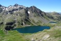
(15) Walk round the lake to the west, then pass through the narrow pass at its northern end. Descend a little over the scree and you’ll soon catch sight of Lac Fourchas below.
(16) Make your way down the scree gently towards the north-west to reach the lake.
(17) You will now need to follow the Ruisseau de Terre Rousse to the Refuge de Vens. From the shore of Lac de Fourchas, look out for a path (at last!) that winds its way up a small mound to the north-east. This is the one to take. From there, follow the stream and the cairns to the refuge.
(18) Take the time to enjoy a small blueberry tart at the refuge, as there’s still a bit of the way to go. Head down towards the large lake, following its northern shore. You’ll need to walk past the five lakes until you reach marker 26.
(19) Here, you can shorten the route by heading up to the right towards the Pas des Pêcheurs and then descending directly back to the car park. This will save you an extra climb and a few kilometres. Otherwise, carry on straight ahead.
(20) When you reach the Lower Lac de Vens, stay on the path and head towards Lac des Babarottes. It climbs a little further – hang in there.
(21) The final lake on the route: walk along the western shore and follow the path which climbs up to the Chanier ridge.
(22) End of the climb: all you have to do now is head back down to marker 113, which you passed earlier and should be able to see from the top of the ridge, then return to the Piste de l’Eau. If you’ve still got a bit of energy left, the Claï Inférieur is just a few steps to the west. Otherwise, carry on straight ahead.
(3) Follow the ascent path to reach the car park (S/E).



 Visorando Member
 Difficult
 Moderate