Country:

 City:


(S) From the Vens mountain refuge, take the path heading north signposted “Collet de Tortisse, Col du Fer”, pass marker 25, and continue to the right until you reach marker 24.
(1) Leave the Col du Fer path on your right and turn left onto the balcony path until you reach marker 23.
(2) Descend to the left along a winding path to marker 22. Then turn south-east, reach the Vens lakes via the Pas des Pêcheurs and continue to marker 27.
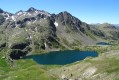
(3) Turn right and walk alongside the lakes, passing the waterfall and marker 26. Then cross the footbridge over the Torrent de Vens and head up to the Lac des Babarottes.
(4) Walk along the lake, reach the Babarottes ridge, then descend via the Baussayer scree and head for marker 113.
(5) Turn right towards Claï Haute. Begin the long, steep descent, passing close to a hut at Clot de Nières, and arrive at Claï Haute (marker 114).
(6) Turn left and follow the almost flat, balcony-like path that crosses the Marie Lakes valley, one level below the Chemin de l’Energie. Descend via a few hairpin bends to the Fournels barns and marker 109.
(7) Take the path on the right towards Saint-Étienne-de-Tinée, and continue the descent to the M2205 road after crossing the Ténibres torrent.
(8) Turn left onto Boulevard Issautier as far as the bridge over the Tinée, turn right onto Boulevard de la Digue and return to the car park at the first street on the right (E).
 Visorando Member
 Moderate
 Very difficult