


Refine your search for walks in Neuvic-Entier
Neuvic-Entier walks


 The Neuvic-Entier route
 Visorando Member
 9.93 mi
 +971 ft
 -988 ft
 5h 25
5h 25
 Moderate
 Departure from Neuvic-Entier (Haute-Vienne)
A hilly route that will allow you to explore the countryside and hills near the village of Neuvic-Entier.
The Gorges de la Vienne starting from Bussy Varache
7.38 mi
+1,129 ft
-1,129 ft
4h 25
Moderate
Departure from Eymoutiers (Haute-Vienne)
A forest walk along the Gorges de la Vienne and on the hillsides above the river, starting from Bussy Varache. Few viewpoints, as the gorges are currently very wooded (2026). The Vienne is visible thanks to a round trip that branches off the main route.
Mont Gargan
 1.60 mi
+367 ft
-367 ft
1h 05
1.60 mi
+367 ft
-367 ft
1h 05
 Easy
Departure from Saint-Gilles-les-Forêts (Haute-Vienne)
Easy
Departure from Saint-Gilles-les-Forêts (Haute-Vienne)
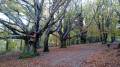
During a short climb and a small circular route, Mont Gargan, a memorial site steeped in history, offers landscapes of moors and woods, unobstructed views and heritage.
Boucle de la Chapelle Saint-Dulcet
 4.30 mi
+456 ft
-469 ft
2h 20
Easy
Departure from Chamberet (Corrèze)
4.30 mi
+456 ft
-469 ft
2h 20
Easy
Departure from Chamberet (Corrèze)
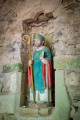
A very pleasant loop in the Monédières, with many sections in the forest, leading to the charming and unusual Saint-Dulcet Chapel. A very easy circuit with little elevation gain, making it accessible to all fitness levels.
Tour of Vassivière Island
4.05 mi
+108 ft
-108 ft
1h 55
Easy
Departure from Beaumont-du-Lac (Haute-Vienne)
An artistic tour of Vassivière Island along a path lined with numerous works from the International Centre for Art and Landscape. The route also takes you through the heart of the island, where you’ll find the museum, the old castle, a bread oven and a shop selling local crafts.
The Auchaise and Auphèle embankments
3.05 mi
+315 ft
-331 ft
1h 40
Easy
Departure from Royère-de-Vassivière (Creuse)
A short walk that takes you up to a slight elevation as you pass through the hamlet of Auchaise, with its traditional houses, before descending to the lakeside, crossing its two embankments, and then heading down to the foot of the dam on the Maulde.
Route around Lake Vassivière
 23.57 mi
+1,280 ft
-1,286 ft
2 days
Moderate
Departure from Royère-de-Vassivière (Creuse)
23.57 mi
+1,280 ft
-1,286 ft
2 days
Moderate
Departure from Royère-de-Vassivière (Creuse)
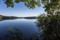
This two-stage route of 2 x 18 km will take you on a journey of discovery around one of the largest artificial lakes in France.
You can expect to see mid-mountain landscapes, varied vegetation including fir forests, moors and peat bogs, and wild flora and fauna on this tour of Lake Vassivière, commonly known as "Little Canada".
The highlight of the route: a stopover at the Pourvoirie du Lac stopover lodge (accommodation, breakfast and dinner with a panoramic view of the lake).
From the Vassivière Dam to Nergout
 11.99 mi
+614 ft
-551 ft
6h 05
Moderate
Departure from Royère-de-Vassivière (Creuse)
11.99 mi
+614 ft
-551 ft
6h 05
Moderate
Departure from Royère-de-Vassivière (Creuse)
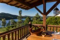
This first stage takes you through unspoilt countryside, with a route that is both wild and surprising.
Circular route on the slopes of the Puy des Fages
 5.06 mi
+538 ft
-564 ft
2h 50
Moderate
Departure from Soudaine-Lavinadière (Corrèze)
5.06 mi
+538 ft
-564 ft
2h 50
Moderate
Departure from Soudaine-Lavinadière (Corrèze)
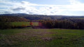
Starting from the village of Soudaine-Lavinadiaire, with its beautiful church and archaeological remains, you follow the valley of the River Soudaine before climbing the slopes of the Puy des Fages, from where you can enjoy sweeping views. To complete the picture, there are a few refreshing streams and green pastures, where Limousin cows and horses graze.
Route of the two dykes at Vassivière
 Tourist office
 4.35 mi
+417 ft
-413 ft
2h 20
Easy
Departure from Royère-de-Vassivière (Creuse)
4.35 mi
+417 ft
-413 ft
2h 20
Easy
Departure from Royère-de-Vassivière (Creuse)
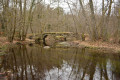
The dam is complemented by the Auchaise dyke, which seals off a depression in the ground on the right bank about 400m from the main structure. This reservoir also receives water diverted from the upper basins of the Taurion (La Vaud-Gelade), Vienne, Dorat and Chandouille (Faux-la-Montagne) rivers.
Route des Deux Digues (Saint-Martin route)
 5.88 mi
+459 ft
-446 ft
3h 05
Moderate
Departure from Royère-de-Vassivière (Creuse)
5.88 mi
+459 ft
-446 ft
3h 05
Moderate
Departure from Royère-de-Vassivière (Creuse)
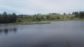
The embankments and the beautiful view of the lake, the sweeping landscapes beyond Le Chataignoux, the lovely rows of trees, the walk around Peu de Vaux, and the arrival at Auchaise are all delightful surprises on this walk near Lake Vassivière.
Nergout - Vassivière Dam
11.57 mi
+666 ft
-735 ft
5h 55
 Difficult
Departure from Beaumont-du-Lac (Haute-Vienne)
Difficult
Departure from Beaumont-du-Lac (Haute-Vienne)
Nature and Land Art for this second stage, around the 5th largest artificial lake in France!
The Chassagnas Peninsula on Lake Vassivière
 4.49 mi
+364 ft
-371 ft
2h 25
Easy
Departure from Royère-de-Vassivière (Creuse)
4.49 mi
+364 ft
-371 ft
2h 25
Easy
Departure from Royère-de-Vassivière (Creuse)
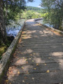
Chassagnas, of Latin origin, Cassania or Gallic Cassanus, refers to the oak tree. Chassagnas consists of a wooded slope down to the edge of Lake Vassivière and a partially cleared summit offering a 180° view of the lake.The Chassagnas peninsula, jutting out into the heart of Lake Vassivière, forms the boundary between Creuse and Haute-Vienne. Together with its twin, the Puy du Rocher, which overlooks Vauveix, it acts as a barrier between the lake's two main bays.
Route des Tourbières - Vassivière
 8.83 mi
+837 ft
-843 ft
4h 45
Moderate
Departure from Royère-de-Vassivière (Creuse)
8.83 mi
+837 ft
-843 ft
4h 45
Moderate
Departure from Royère-de-Vassivière (Creuse)
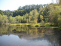
Peat bogs develop in granite basins called alveoli, where the acidic, poor soil provides favourable conditions for their growth. These fragile environments are home to a specific flora composed of very particular primitive plants: sphagnum mosses. The different stages are visible here: low marshes covered with quaking bogs, active raised bogs, and peat heaths bordered by willows and birches.
Chalucet castle and Ligoure woodland
 4.47 mi
+499 ft
-518 ft
2h 30
Moderate
Departure from Saint-Jean-Ligoure (Haute-Vienne)
4.47 mi
+499 ft
-518 ft
2h 30
Moderate
Departure from Saint-Jean-Ligoure (Haute-Vienne)
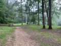
A lovely walk in the woodlands along the Ligoure and Briance rivers, with a visit to Chalucet castle.
This walk has been created in memory of Bernard, from the Amis de Chalucet Association and a great Camino walker who also walked to Rome and Bremen.
Route des Bordes
 6.69 mi
+988 ft
-958 ft
3h 55
Moderate
Departure from Royère-de-Vassivière (Creuse)
6.69 mi
+988 ft
-958 ft
3h 55
Moderate
Departure from Royère-de-Vassivière (Creuse)
The Bordes route offers typical landscapes as well as varied panoramic views of the Limousin countryside.
Le Père Castor, Meuzac Évasions trail
 Association / Club / Walk leader5.15 mi
+322 ft
-328 ft
2h 40
Easy
Departure from Meuzac (Haute-Vienne)
Association / Club / Walk leader5.15 mi
+322 ft
-328 ft
2h 40
Easy
Departure from Meuzac (Haute-Vienne)
Meuzac welcomes you for a walk rich in natural heritage (Limousin bocage and forests) and architectural heritage (fortified Romanesque church). You will come across numerous ponds, including the Plan d'Eau de la Roche (swimming) and the Plan d'Eau de Forgeneuve (water skiing). Don't miss the Père Castor media library.
Throughout the walk, you will find a series of questions and answers (the question on one signpost, the answer on the next).
Along the Béraude via La Roche Branlante
 12.87 mi
+1,204 ft
-1,217 ft
7h 00
Difficult
Departure from Saint-Pierre-Chérignat (Creuse)
12.87 mi
+1,204 ft
-1,217 ft
7h 00
Difficult
Departure from Saint-Pierre-Chérignat (Creuse)
Explore the banks of the Béraude, a little-known river. This walk also takes you through the Epagne Forest, a listed site with soil that is unique to the region. Almost at the end of the route, the Roche Branlante, once again by the water’s edge, will amaze many.
 The Deer Trail
4.18 mi
+210 ft
-184 ft
2 hrs
Easy
Departure from Feytiat (Haute-Vienne)
From the12th-century church to the Château du Mas Cerise, this route takes you along avenues lined with majestic trees and a ridge path.
Circular route via the Puy de la Croix and Royère
8.17 mi
+663 ft
-653 ft
4h 20
Moderate
Departure from Royère-de-Vassivière (Creuse)
A walk starting from Lake Vassivière offering a variety of landscapes: the lake shore, heathland with heather or ferns, mixed woodland, pastures with Limousin cattle, peat bogs, and numerous ponds.
Le Puy de la Croix
1.39 mi
+194 ft
-194 ft
0h 50
Easy
Departure from Royère-de-Vassivière (Creuse)
A pleasant walk on the Puy de la Croix, which overlooks Lake Vassivière, along beautiful paths through heathland covered in heather and gorse (which flower in late summer), passing by the Puy de la Croix viewpoint and then along the lake’s shore.
Circular loop from Saint-Pardoux-Morterolles to the Augerolles waterfalls
 10.06 mi
+1,453 ft
-1,470 ft
5h 55
Moderate
Departure from Saint-Pardoux-Morterolles (Creuse)
10.06 mi
+1,453 ft
-1,470 ft
5h 55
Moderate
Departure from Saint-Pardoux-Morterolles (Creuse)
A circular route starting from Saint-Pardoux-Morterolles that also allows you to discover the Cascades d'Augerolles site. This hike passes through meadows, woods, forests and the areas around the waterfalls. A few panoramic views, streams and a plank bridge complete the picture. It should be noted that the roads, where there are any, are forest roads, some paved and some unpaved, but in any case very little used.
The Font Faure
4.57 mi
+404 ft
-410 ft
2h 25
Easy
Departure from Benayes (Corrèze)
An easy route with magnificent views of Forsac Castle and the village of Masseret. You will pass by Font Faure, a devotional fountain that is the site of a pilgrimage where the clothes of the sick are placed on the cross. The fountain is located in the beautiful and large forest of the same name, part of which is a hunting reserve, near Forsac.
The Champs de Pierres and Augerolles waterfalls
 1.81 mi
+299 ft
-318 ft
1h 05
Moderate
Departure from Saint-Pardoux-Morterolles (Creuse)
1.81 mi
+299 ft
-318 ft
1h 05
Moderate
Departure from Saint-Pardoux-Morterolles (Creuse)
At the edge of the Millevaches plateau, set off on a walk, accompanied by information panels, to explore a listed natural site covering 50 hectares.
Route des 7 Peux
 7.98 mi
+538 ft
-538 ft
4h 10
Moderate
Departure from Royère-de-Vassivière (Creuse)
7.98 mi
+538 ft
-538 ft
4h 10
Moderate
Departure from Royère-de-Vassivière (Creuse)
The village of Royère-de-Vassivière was established on a strategic pass on the Millevaches plateau, at the crossing point of a prehistoric ridge path. The ridge paths (or pouges) allowed people to travel long distances. They favoured the granite peaks of the rounded hills, called Puy or Peux, and avoided the damp, peaty valley bottoms that only cattle frequented.
The Thaurion Valley
 8.57 mi
+692 ft
-676 ft
4h 35
Moderate
Departure from Royère-de-Vassivière (Creuse)
8.57 mi
+692 ft
-676 ft
4h 35
Moderate
Departure from Royère-de-Vassivière (Creuse)
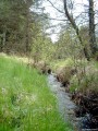
The Rigole du Diable is a picturesque site situated in the upper Thaurion valley. This site is a Natura 2000 site and is listed in the ZNIEFF inventory. The Rigole du Diable and its tributary are strewn with pebbles and boulders. Here you’ll find the unusual Rocher du Diable near the old Planchette mill. Legendary stones are common in Limousin. These strangely shaped boulders, formed by the erosion of exposed granite, have often captured the imagination of local people.
Haute Faye route
 5.91 mi
+827 ft
-823 ft
3h 25
Moderate
Departure from Royère-de-Vassivière (Creuse)
5.91 mi
+827 ft
-823 ft
3h 25
Moderate
Departure from Royère-de-Vassivière (Creuse)
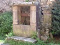
Discover the local heritage (crosses, fountains, wells...) and the skills of our ancestors.
Along the Mourne to the Roches Mazuras
 7.40 mi
+712 ft
-696 ft
4h 00
Moderate
Departure from Bourganeuf (Creuse)
7.40 mi
+712 ft
-696 ft
4h 00
Moderate
Departure from Bourganeuf (Creuse)
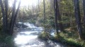
The first part of the circuit takes you along La Mourne, a lively little river with numerous waterfalls and cascades. The second part takes you through the Faux-Mazuras forest, and the third part finally takes you to the top of the Roches Mazuras, in a corner of moorland, where you can enjoy unobstructed views.
The Sully Linden Tree
 4.55 mi
+486 ft
-499 ft
2h 30
Easy
Departure from Montgibaud (Corrèze)
4.55 mi
+486 ft
-499 ft
2h 30
Easy
Departure from Montgibaud (Corrèze)
Sully, then a minister under Henry IV, donated a lime tree to the village of Montgibaud. Now lost following the storm of 1999, this lime tree, planted in front of the church, was intended to provide shelter for the villagers’ gatherings held after mass.
This route through the Limousin countryside follows springs that flow along the paths, passes through woodland, and leads to hamlets or opens out onto rolling meadows. You’ll enjoy a beautiful view of the motte at Coursaleix and Plazat.
The Gorges du Verger in Bourganeuf
 3.47 mi
+433 ft
-433 ft
2h 00
Easy
Departure from Bourganeuf (Creuse)
3.47 mi
+433 ft
-433 ft
2h 00
Easy
Departure from Bourganeuf (Creuse)
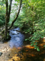
The unmissable walk in Bourganeuf, featuring gorges, a rushing stream and exceptional views of the medieval town. In short, an absolute must to discover the rich natural and architectural heritage of this town founded by the Knights Hospitaller inthe 12th century.
The Bois des Bœufs route in Bourganeuf
 8.67 mi
+794 ft
-804 ft
4h 40
Moderate
Departure from Bourganeuf (Creuse)
8.67 mi
+794 ft
-804 ft
4h 40
Moderate
Departure from Bourganeuf (Creuse)
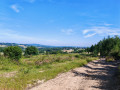
Starting from the medieval town of Bourganeuf, this route immerses you in a haven of countryside. Between the murmur of the Mourne waterfalls and the rocky panorama of the Roches de Mazuras, you’ll pass through a sanctuary of greenery where time seems to have stood still.
Route No. 45: Le Bois des Bœufs.
Tour of Puy d'Orliac
 5.00 mi
+600 ft
-607 ft
2h 50
Moderate
Departure from Veix (Corrèze)
5.00 mi
+600 ft
-607 ft
2h 50
Moderate
Departure from Veix (Corrèze)
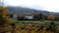
Starting from the charming Romanesque church in Veix, this is a pleasant circular forest route dotted with green pastures and beautiful old houses.
The oaks of Murat
0.99 mi
+118 ft
-115 ft
0h 35
Easy
Departure from Gourdon-Murat (Corrèze)
A mini-hike to discover the remarkable heritage of the hamlet of Murat: the Moulin de Travers site, the beautiful Saint-Pierre-aux-Liens church, a beautiful carved cross and two very beautiful oak trees.
Longerade bog
 5.93 mi
+607 ft
-594 ft
3h 15
Easy
Departure from Gourdon-Murat (Corrèze)
5.93 mi
+607 ft
-594 ft
3h 15
Easy
Departure from Gourdon-Murat (Corrèze)
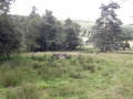
Discover the peat bog via beautiful forest tracks.
 From Muret to the edge of Les Vergnes
7.74 mi
+558 ft
-551 ft
2 hrs
Easy
Departure from Ambazac (Haute-Vienne)
This walk is situated at the foot of the foothills of the Monts d’Ambazac range. Rich in varied landscapes, it alternates between forest trails, visits to small villages and sections across the plains.
The Muret Heights
7.60 mi
+702 ft
-709 ft
3 hrs
Moderate
Departure from Ambazac (Haute-Vienne)
To ease into the climb up the small Monts d’Ambazac mountain range, I suggest you take the lovely forest paths overlooking the Domaine du Muret in Ambazac.
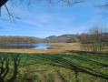
Valleys and forests of the Ambazac mountains from Jonas Pond.
 8.60 mi
+1,129 ft
-1,145 ft
4h 55
Moderate
Departure from Ambazac (Haute-Vienne)
8.60 mi
+1,129 ft
-1,145 ft
4h 55
Moderate
Departure from Ambazac (Haute-Vienne)
Circular route with varied scenery, often through woodland, partly along the Monks’ Trail. Magnificent in the autumn colours of the LimousinNote from the moderator: the route was amended on 11 May 2023 due to issues with private land; instead of heading to point 4 across the fields after going round the pond, the route now passes through Bourdaleine.
Tour of the puys starting from Pradines
 21.77 mi
+3,412 ft
-3,422 ft
13h 00
21.77 mi
+3,412 ft
-3,422 ft
13h 00
 Very difficult
Departure from Pradines (Corrèze)
Very difficult
Departure from Pradines (Corrèze)
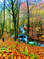
Prepare your calves and set off to conquer the Monèdières peaks, pushing your limits. A hike that is as breathtaking as it is exhausting. Beautiful forests and superb panoramic views. Bring a spare pair of socks: there are a few streams to cross. A few kilometres of road in total (~5), but very, very little traffic.