Country:

 City:
City:


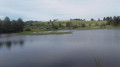
Head for the hamlet of Bussy Varache. Coming from the east, from Eymoutiers, as soon as you enter the hamlet, take the hairpin bend to the left onto Route des Ribières. Walk for about 150 m, then, at a hiking signpost, turn right up to a hikers’ car park near an abandoned tennis court.
(S/E) Return to the entrance of the car park, at the Bussy Varache signpost, and take the road to the right towards the Grand Circuit des Gorges de la Vienne. This is an ‘official’ route published by the Plateau de Millevache Regional Nature Park in Limousin, marked with purple symbols on a white background – markings you will follow for almost the entire route.
At the right-hand bend in the road, take the path straight ahead. At the fork in the road, keep left.
(1) The path takes a hairpin bend to the left; ignore the unmarked path branching off to the right. At the Étang de Farsac, you’ll come to an old road.
(2) Turn right onto it and you’ll soon reach the D129a. Follow it for about 1 km (it has very little traffic); you’ll see Farsac Castle on your right.
(3) Take a path on the left.
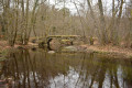
(4) The path bends to the left just as you begin to hear the sound of the River Vienne. Further on, the path runs alongside the railway line below, then a canal : this carries water from the River Vienne to the Bussy power station. The River Vienne below is not visible. A castle can be seen on the plateau on the other side of the gorges.
(5) Pass a flight of steps on your right leading down to the railway line, then cross a canal spillway. Further on, cross a footbridge over another spillway and you’ll reach the end of this penstock.
(6) Further on, the path crosses a road. It goes over a stream and then reaches the ‘Gorge de la Vienne Moulin de la Rivière’ signpost. Turn right and you’ll soon reach a second signpost bearing the same name.
(7) Turn right for a short round trip to see the River Vienne, which is only visible at this point along the route.
(8) Follow the riverbank back the way you came.
(7) Carry on to the right. The path continues to run alongside the railway line below.
(9) When you reach some ruins, ignore a path on the left. You’ll come to a road; follow this to reach the hamlet of La Varache. Look for the signpost of the same name and carry on straight ahead along the road for about a hundred metres.
(10) Take a path that winds sharply to the left. Follow it until you reach a small road near a glamping site.
(11) Follow the road. At the junction with the D129a, turn right and continue for about fifty metres before turning left onto a path.
(12) At the junction of four paths, turn left. Just before joining the D129a at Bussy, the ‘official’ path heads up to the right before descending further on. We preferred to join the road by going straight on, then crossing the hamlet by following it to the right. Head up the Route des Ribières to reach the car park (S/E).
 Visorando Member

 Easy
Easy 

 Tourist office