Tour of Vassivière Island

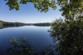
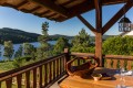
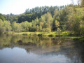
An artistic tour of Vassivière Island along a path lined with numerous works from the International Centre for Art and Landscape. The route also takes you through the heart of the island, where you’ll find the museum, the old castle, a bread oven and a shop selling local crafts.

Fiche technique

107407850
Creation:
Last update:
Last review:
  • trace_mode_pedestrian
    Activité: trace_mode_pedestrian
  • ↔
    label_distance: 4.05 mi
  • ◔
    Durée calculée: 1h 55 
  • ▲
    Difficulte: Facile

  • ⚐
    Retour point de depart: Oui
  • ↗
    label_elevation_gain: + 108 ft
  • ↘
    label_elevation_loss: - 108 ft

  • ▲
    label_highest_point: 2,241 ft
  • ▼
    label_lowest_point: 2,129 ft

Description of the walk

Park in the car park designated for visitors to Île Vassivière (information signs).

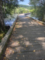
(S/E) Cross the bridges to reach the island.

The route round the island is marked in blue(Lake Shore Trail).

(1) Start your walk round the island on the left, following a small road at the start which quickly becomes a track, then a path. Look out for the first carved stones lining the path, on the left and right, sometimes set slightly apart. Always return to the lakeside path.

(2) At the junction of the paths, follow the signs for ‘Cœur de l’île’ for a round trip. Further on, walk past the garden, then the bread oven (where the brioches are very popular with the locals).

(3) Then take a stroll around the castle and the International Centre for Art and Landscape: carved stones, crafts, a fountain and a cross. Return to the bread oven.

(3) You can cross the garden to rejoin the path you took on the way there, then return to the junction on the riverbank.

(2) Continue your tour of the island to the right. The carved stones and other artworks become more scattered, but you’ll find them all along the route.

(4) Keep left at a fork in the road.

(5) At the junction, with the museum tower in sight, carry on to the left.

(6) At the next junction, carry on straight ahead along the riverbank, then ignore all the paths branching off to the right. This will take you back to the bridge.

(1) Cross the bridges again to return to the car park (S/E).

Points de passages

  1. D/A : mi 0 - alt. 2,146 ft - Visitor car park - Lac de Vassivière
  2. 1 : mi 0.38 - alt. 2,149 ft - Circular walk around the island
  3. 2 : mi 0.7 - alt. 2,142 ft - Return walk to the centre of the island
  4. 3 : mi 1.18 - alt. 2,211 ft - Heart of the island
  5. 4 : mi 1.83 - alt. 2,146 ft - Junction
  6. 5 : mi 2.25 - alt. 2,188 ft - Junction
  7. 6 : mi 2.54 - alt. 2,139 ft - Junction
  8. D/A : mi 4.05 - alt. 2,136 ft - Visitor car park

Informations pratiques

Easy hike; walking boots recommended.

A proximite

Photo album here

There are numerous carved stones along the route, each with its own information board: you should therefore allow a little more time to walk around the island than the 2 hours 20 minutes calculated by the software.

International Centre for Art and Landscape; see also this link for exhibitions in 2026.

Other walks in the area

For more walks, use our search engine .

Les descriptions et la trace GPS de ce circuit restent la propriété de leur auteur. Ne pas les copier sans son autorisation.