The Bois des Bœufs route in Bourganeuf

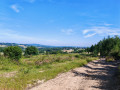
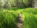
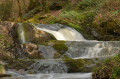
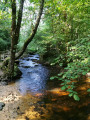
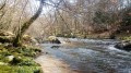
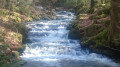
Starting from the medieval town of Bourganeuf, this route immerses you in a haven of countryside. Between the murmur of the Mourne waterfalls and the rocky panorama of the Roches de Mazuras, you’ll pass through a sanctuary of greenery where time seems to have stood still.

Route No. 45: Le Bois des Bœufs.

Details

100801739
Creation:
Last update:
Last review:
  • Walking
    Activity: Walking
  • ↔
    Distance: 8.67 mi
  • ◔
    Average duration: 4h 40 
  • ▲
    Difficulty: Moderate

  • ⚐
    Back to start: Yes
  • ↗
    Ascent: + 794 ft
  • ↘
    Descent: - 804 ft

  • ▲
    Highest point: 1,991 ft
  • ▼
    Lowest point: 1,381 ft

Description of the walk

Start at Rue Zizim, next to the church.

(S/E) Walk down the street and take the first alleyway on the left.

(1) Climb the steps towards the Chapelle de l’Arrier and go round the back of the building. Cross the D941 and head under the archway of Impasse Girardin. At the end, turn right. At the D51, turn left.

(2) Walk past the Pôle des Énergies (formerly the Museum of Water and Light). Above the car park, turn right. After the funeral parlour, head right. After 80 metres, turn left onto the tarmac path. Walk down to the river.

(3) Just before the footbridge, take the path on the left and follow the river. Go down the steps overlooking the waterfalls, then cross over to the other bank. Continue straight ahead, veering slightly to the right as the path climbs. In the Bois des Bœufs, take the path on the left through the undergrowth and follow a row of Douglas firs.

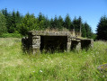
(4) Carry on straight ahead to the old factory below the Mourne Bridge. Join the road, turn right, then after the second bend, take the path on the right and carry on straight ahead.

(5) At the junction of the forest tracks, take the track leading uphill to the left. After 150 metres, turn left.

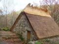
(6) At the junction, head straight on to the wayside shrine and the Chapel of Notre-Dame des Rochers.

(7) Then turn round and retrace your steps.

(6) Take the track on the left at the crossroads. In the hamlet of Petit Mazuras, turn right after thefirst farm, and pass several buildings. After the walnut tree, follow the signposting to the right along the meadow.

(8) Join the path and turn right. Enter the Faux-Mazuras State Forest and continue straight on until you reach the crossroads you passed on the way out.

(5) Head straight ahead, veering slightly to the right. Go through the wooden gate marked ‘Bourganeuf’.

(9) At the first crossroads, turn left and follow the signposts. Continue straight on towards the second wooden gate. On the forest track, turn right. Then, carry on straight until you reach the fork in the river you passed on the way out.

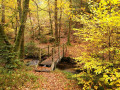
(3) At the bottom of the descent, cross the wooden footbridge and, following the route in the opposite direction to the outward journey, return to the (S/E).

Waypoints

  1. S/E : mi 0 - alt. 1,463 ft - Saint John’s Church
  2. 1 : mi 0.13 - alt. 1,447 ft - Arrier Chapel
  3. 2 : mi 0.42 - alt. 1,381 ft - Energy Centre
  4. 3 : mi 1.22 - alt. 1,391 ft - La Mourne. The junction on the circular route
  5. 4 : mi 2.99 - alt. 1,588 ft - The old hat factory
  6. 5 : mi 4.27 - alt. 1,781 ft - The point where the two circular loops meet
  7. 6 : mi 4.92 - alt. 1,988 ft - Carrefour. Return trip to the chapel
  8. 7 : mi 5.1 - alt. 1,952 ft - Notre-Dame des Rochers Chapel
  9. 8 : mi 5.62 - alt. 1,893 ft - Path
  10. 9 : mi 6.67 - alt. 1,703 ft - Carrefour
  11. S/E : mi 8.67 - alt. 1,463 ft - Saint John’s Church

Notes

·Makesure you have suitable footwear and clothing for hiking.

·Choosea hiking route that suits your ability.

·Packenough food and water for the route you’re taking.

·Respectthe natural environment: pick up your rubbish and do not pick plants indiscriminately.

·Be considerateof other users and follow the highway code.

·Theduration of the hike is given as a guide only.

When entering an area where there is a herd, ensure you keep a safe distance from both the herd and any dogs, dismount from your bike if necessary, keep your dog on a lead and close any gates securely.

Checklist for a worry-free ride

  • First-aid kit including a survival blanket, plasters, antiseptic and a tick remover.
  • Hiking boots or trail running shoes (more breathable and quicker to dry).
  • Windbreaker / waterproof jacket.
  • A fleece for snack breaks.
  • A snack for your breaks.
  • A bin bag.
  • A water bottle.
  • Hiking poles.
  • A head torch for the return journeys at the end of the season.
  • A camera.

Worth a visit

The medieval town of Bourganeuf and the Zizim Tower, the Energy Centre which traces the history of Bourganeuf’s electrification in the late19th century.

The River Mourne and the Faux Mazuras State Forest, the Chapelles des Roches in Petit Mazuras.

Other walks in the area

For more walks, use our search engine .

The GPS track and description are the property of this route's author. Please do not copy them without permission.