Country:

 City:
City:


Near the roundabout where the D3 and D3a1 meet, park in the car park for walkers on the Sentier de Rive and the sports ground (information signs).
(S/E) Head towards the car park entrance opposite the roundabout, cross the D3a1 road with care and take the path signposted ‘Broussas’ opposite. Cross a stone bridge (made of large flat stones) and you will immediately reach a junction of paths.
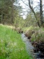
(1) Turn left and follow a very beautiful rocky path that runs alongside the stream. Cross the D3 carefully and continue straight ahead. You’ll soon pass an information board about pastoralism. At the fork in the road, keep left, moving away from the stream. Further on, the path crosses the stream and then climbs up through the beautiful heathland, covered in heather and gorse, which covers this slope of the Puy de la Croix. Pass close to two carved stones. You’ll reach a shelter with a carved lintel.
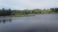
(2) Continue along the path, and just after this, ignore the turn-offs to the left and right. You’ll reach the viewpoint overlooking Lac de Vassivière (information boards).
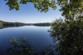
(3) The path winds down to the right, passing beneath the viewpoint. Cross the D3 with care and continue down the other side to quickly reach the lakeshore (which is unfortunately often dry at this point).
(4) Turn right and follow the Sentier de Rive. Pass a small terrace with benches and information boards about the lake’s flora and fauna. Continue along the path to reach the junction near the stream.
(1) Cross the stone bridge again and head back to the car park (S/E).
 Visorando Member
 Moderate
 Tourist office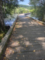
 Difficult