Country:

 City:
City:


Near the roundabout where the D3 and D3a1 meet, park in the car park for walkers on the Sentier de Rive and the sports ground (information signs). See the warnings in the Practical Information section.
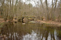
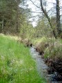
(S/E) Head towards the car park entrance opposite the roundabout, cross the D3a1 road and take the path signposted ‘Broussas’ on the opposite side. Cross a stone bridge (made of large flat stones) and you’ll immediately reach a junction of paths. Turn left and follow a very beautiful rocky path that runs alongside the stream.
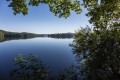
(1) Cross the D3 and continue straight ahead. You’ll soon pass an information board about pastoralism. At the Fork in the road, keep left, moving away from the stream. Further on, the path crosses the stream and then climbs up through the beautiful heathland, covered in heather and gorse, which covers this slope of the Puy de la Croix. You’ll pass close to two carved stones. You’ll come to a shelter with a carved lintel. Continue along the path, and just after this, ignore the paths branching off to the left and right. You’ll reach the viewpoint overlooking Lac de Vassivière (information boards).
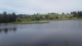
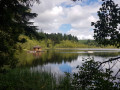
(2) The path descends in a hairpin bend to the right, passing beneath the viewpoint. Cross the D3 again and continue downhill on the other side to quickly reach the lakeshore (unfortunately, the lake is often dry at this point). Turn left, following the shore on your right.
(3) At the junction of the paths, ignore the blue-marked path to the right and head up the road following the yellow, orange and red markings. Follow the road to the right for about fifty metres, then take the path branching off to the left, following all the markings. Carry on, ignoring a path to the left. You’ll come to a road, near a carved stone cross, where you’ll find the red and white markings for the GR®46; follow these all the way to Royère.
(4) Take the old road opposite, which is a track suitable for vehicles in places. Follow it for a long way until you reach the junction with another small road near a hamlet (Le Villard).
(5) Turn right. At the junction with a wider road (the D8), which is hardly any busier (i.e. not at all), turn left and follow this road for about 250 m.
(6) Turn right onto Route de Jeansanetas.
(7) Stay on the road as you pass through this hamlet. After the last house, take a track on the right.
(8) At the junction of three paths, turn left; you’ll see a bog on your right. You’ll arrive at the Étang d’Arfeuille (private).
(9) You can take a short round trip along its embankment to the right (old wooden sculpture). Then retrace your steps to the junction.
(9) Join the GR® on the right. Stay on this path, ignoring the side paths branching off to the left and right. Pass through the hamlet of Arfeuille, then a pond with lots of water lilies (when we were there), at the end of which you’ll find a junction.
(10) Take the path branching off to the right. Follow it, ignoring all the side paths. Pass a mobile phone mast, a house with blue shutters (at a place called Puy des Bruges), then a water reservoir, and ignore a path branching off to the right (signposted Puy des Bruges). You’ll arrive at a square in Royère-de-Vassivière, with an old fountain which is unfortunately dry. Continue to the D3 road (you can ‘visit’ the village on the right, but I don’t find it particularly interesting).
(11) Follow the road to the left, leaving the GR® markings behind for about sixty metres, then turn right onto Chemin du Cloux, a small road that becomes a track further on. Follow the old yellow markings and the red mountain bike markings. Ignore the few side paths branching off (most are clearly private). You’ll come to a tarmac section and then immediately reach a junction.
(12) Turn slightly left. Further on, you’ll reach the D3A1; cross it and then turn left ( there’s a wide verge). About a hundred metres further on, set back to the right, is an information board about the lake development works. Continue along the road until you reach the car park (S/E).
 Visorando Member
 Easy
Easy 
 Tourist office
 Difficult