The Neuvic-Entier route

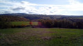
A hilly route that will allow you to explore the countryside and hills near the village of Neuvic-Entier.

Details

456611
Creation:
Last update:
Last review:
  • Walking
    Activity: Walking
  • ↔
    Distance: 9.93 mi
  • ◔
    Average duration: 5h 25 
  • ▲
    Difficulty: Moderate

  • ⚐
    Back to start: Yes
  • ↗
    Ascent: + 971 ft
  • ↘
    Descent: - 988 ft

  • ▲
    Highest point: 1,578 ft
  • ▼
    Lowest point: 1,119 ft

Photos

Description of the walk

The route starts from the church square in Neuvic-Entier.

(S) From the church square, with your back to the church, turn left onto Rue Jean Jaurès, then immediately turn right onto Allée des Garennes. Pass under the high-voltage power line and continue along the lane.

(1) After the bend to the right, take the road on the left round a tight bend alongside the Combade Bridge (RD15). The road turns into a grassy track. Enter the woodland, then leave it and walk alongside another woodland. Pass in front of Corneguère and continue along the same track.

(2) At the end, turn right onto a tarmac road. Ignore all the paths on the left.

(3) Take the path branching off to the left 70 metres before the D111. Pass the first junction, ignore a path on the left and follow the stream for a while. Pass a water retention basin, staying on the same path throughout. Enter the hamlet of Ribière via the road and, at the junction, take the road on the right. Pass under the high-voltage power line again.

(4) At the three-way junction, take the road on the left, heading towards Samarue, and pass through the hamlet, ignoring a road branching off to the left. At the end of the tarmac road, continue along the track and, at the bend, ignore the track branching off to the right, keeping left instead, until you reach another three-way junction.

(5) Continue along the track on the right. It leads to the D979. Follow it to the right, turn into the first road on the left, then take the track on the left. Pass Puy du Thé and follow the track. 80 metres after the bend, keep left and ignore the track on the right.

(6) At the end, take the path on the right opposite a building and carry on until you reach a road.

(7) Take the tarmac road on the left.

(8) As you come out of a tight bend, turn right onto the path leading to a pond.

(9) Go round the pond on the right, cross a stream and rejoin the D16. Follow it to the right for a few dozen metres.

(10) Turn right onto the Route de Riffataire Bas. Pass through a small cluster of houses. The tarmac road then turns into a track.

(11) At the two houses, take the road on the left as it bends. Return towards the D16, cross it and take the track opposite which runs alongside a house. Follow the track to the junction.

(12) Take the track on the left, then turn right at the end. The track makes a detour and crosses the Vergnas stream. You’ll reach the hamlet of Nézière.

(13) On reaching the hamlet of Nézière, follow the road to the right, then take the small path immediately to the left. At the next junction, take the path to the right. Ignore the first path on the left and carry on straight ahead. In the hamlet of Douas Vias, ignore the path on the right and you’ll come to a tarmac road.

(14) Follow the road to the left. Cross the stream and, 70 metres further on, take the path to the right. When you reach the D979, continue to the left and take the first road on the right.

(15) You’ll arrive at the hamlet of Le Bret; at the bend, take the path on the left before the building. Enter the hamlet of Sivergnat. To go round the last house, follow the path on the right, then the road on the left and finally the path on the right. Leave the hamlet and join the next road.

(16) Follow this road to the left until you reach Rue de l’Europe (D15); turn left onto it for a few metres, then take Rue Jean Jaurès immediately on the right. This will take you back to the starting point on Place de l’Église (S/E).

Waypoints

  1. S/E : mi 0 - alt. 1,362 ft - Church Square in Neuvic-Entier
  2. 1 : mi 0.44 - alt. 1,135 ft - A small hairpin bend to the left - Combade (rivière) - Affluent de la Vienne
  3. 2 : mi 1.25 - alt. 1,348 ft - Turn right
  4. 3 : mi 1.8 - alt. 1,207 ft - Turn left onto a small path
  5. 4 : mi 3.02 - alt. 1,480 ft - Turn left onto the road at the bend
  6. 5 : mi 3.42 - alt. 1,578 ft - At the three-way junction, take the path on the right
  7. 6 : mi 4.05 - alt. 1,493 ft - Opposite the house, take the path on the right
  8. 7 : mi 4.41 - alt. 1,398 ft - Turn left
  9. 8 : mi 4.7 - alt. 1,332 ft - At the end of the bend, take the path on the right
  10. 9 : mi 4.82 - alt. 1,263 ft - Take the path on the left, after the - Étang de Riffataire
  11. 10 : mi 5.17 - alt. 1,270 ft - Tarmac road on the right
  12. 11 : mi 5.51 - alt. 1,345 ft - Turn left
  13. 12 : mi 6.17 - alt. 1,325 ft - At the crossroads, take the path on the left
  14. 13 : mi 6.78 - alt. 1,296 ft - In Néziere, take the tarmac road on the right
  15. 14 : mi 7.8 - alt. 1,299 ft - In the hamlet, turn left onto the tarmac road
  16. 15 : mi 8.85 - alt. 1,332 ft - In Le Bret, take the path on the left
  17. 16 : mi 9.57 - alt. 1,302 ft - Turn left onto the road
  18. S/E : mi 9.93 - alt. 1,362 ft - Church Square in Neuvic-Entier

Notes

There are no water points along the route, so please remember to bring your own supplies.
Farms along the route may provide shelter in the event of heavy rain.

Worth a visit

The various hamlets you’ll pass through.
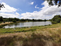
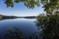
The Reilhac pond.
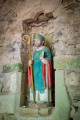
The church at Neuvic-Entier.

Reviews and comments

3.7 / 5
Based on 5 reviews

Reliability of the description
3.4 / 5
Ease of following the route
3.6 / 5
Route interest
4 / 5
User 6735938

Overall rating : 5 / 5

Date of your route : Jun 30, 2025
Reliability of the description : ★★★★★ Very good
Ease of following the route : ★★★★★ Very good
Route interest : ★★★★★ Very good
Very busy route : No

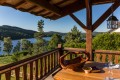
A nice little hike between meadows and forests. I was the object of curiosity for the cows. About halfway through, you come across a campsite where you can rest and eat a bite at the tables (Etang de Riffataire). I did this in early June, just before the heatwave of 2025, and there wasn't a single hiker on the trail. There is a small car park in the centre of Neuvic where you can park.

Thanks for the tip!

Machine-translated

balou17
balou17

Overall rating : 4.3 / 5

Date of your route : Mar 26, 2022
Reliability of the description : ★★★★☆ Good
Ease of following the route : ★★★★☆ Good
Route interest : ★★★★★ Very good
Very busy route : No

A bit of a slow start; ptD and 1 aren’t straightforward.
A magnificent walk, with a succession of forests (deciduous and coniferous) and meadows. A truly sweeping 270° panorama.
At point 10, I joined point 6, then headed towards S/E via the GRP. (3.5 km shorter)

Machine-translated

Leleu Denis
Leleu Denis
• Edited:

Overall rating : 1 / 5

Date of your route : Jun 22, 2020
Reliability of the description : ★☆☆☆☆ Very disappointing
Ease of following the route : ★☆☆☆☆ Very disappointing
Route interest : ★☆☆☆☆ Very disappointing
Very busy route : No

Starting from the church, the street names are incorrect: Rue Jean Jaurès and Allée des Garennes do not connect. We set off along Rue Jean Jaurès and had to turn back
Then, there were no further signposts along the route; everything had been removed… though new routes are, in fact, well signposted… is that a coincidence?
As a result, we got a bit lost. Fortunately, my phone and the sat-nav helped us find our way back to the village
In short, a walk to cross off your lists

Machine-translated

Mimiro66
Mimiro66

Overall rating : 4 / 5

Date of your route : Jul 26, 2019
Reliability of the description : ★★★★☆ Good
Ease of following the route : ★★★★☆ Good
Route interest : ★★★★☆ Good

I had no trouble following the route. At point 3, the path that should branch off to the right is now impassable. You need to carry on straight ahead until you reach a road, then turn right onto it, and you’ll find yourself in the hamlet of La Ribière, where you can rejoin the route.
A very pleasant walk through hamlets full of flowers.
A bit too much road for my liking, but nothing’s perfect...
Thanks for the walk

Machine-translated

les2pieds
les2pieds

Overall rating : 4 / 5

Date of your route : Mar 11, 2018
Reliability of the description : ★★★☆☆ Average
Ease of following the route : ★★★★☆ Good
Route interest : ★★★★★ Very good

The description is a bit vague
No indication of whether the path goes uphill or downhill
We couldn’t find a junction and ended up going slightly off course
Apart from that, a lovely walk – we’re going to take some friends there, hoping the weather will be just as good
Thanks
I can’t seem to ‘post’ my photo

Machine-translated

Other walks in the area

For more walks, use our search engine .

The GPS track and description are the property of this route's author. Please do not copy them without permission.