Route des Deux Digues (Saint-Martin route)

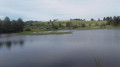
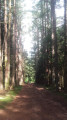
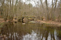
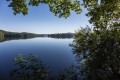
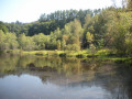
The embankments and the beautiful view of the lake, the sweeping landscapes beyond Le Chataignoux, the lovely rows of trees, the walk around Peu de Vaux, and the arrival at Auchaise are all delightful surprises on this walk near Lake Vassivière.

Details

954698
Creation:
Last update:
Last review:
  • Walking
    Activity: Walking
  • ↔
    Distance: 5.88 mi
  • ◔
    Average duration: 3h 05 
  • ▲
    Difficulty: Moderate

  • ⚐
    Back to start: Yes
  • ↗
    Ascent: + 459 ft
  • ↘
    Descent: - 446 ft

  • ▲
    Highest point: 2,192 ft
  • ▼
    Lowest point: 1,991 ft

Photos

Description of the walk

(S/E) Carefully follow the D3A2 road heading south-west and cross the Auchaise embankment.

(1) Immediately afterwards, turn left onto a path running alongside the lake. Join a path leading to a leisure centre at a place called Le Plianchier. Continue straight on until you reach the D3A2 road. Turn left, follow the road with care and cross the Vassivière Dam (Auphèle embankment).

(2) Take a track on the left which quickly rejoins the D3A2 road. Follow this road to the left.

(3) Turn immediately right onto a track. At the Fork in the road that appears straight away, take the track on the right (north-west). Cross the River Maulde via the Pont du Châtaignoux. Continue straight on (north) towards the hamlet of the same name.

(4) Just before the hamlet, take the track on the left. At the T-junction, turn right towards the hamlet of Châtaignoux. In the hamlet, turn left onto a track. Continue straight on (north-east) until you reach the D7. Follow the road to the right (take care) and walk alongside a pond on your right.

(5) Almost at the end of the pond, turn left onto a small road towards Auzoux. Pass through the village and, at the exit (T-junction), turn right onto the D51 (take care). At the junction with the D7, turn right at a sharp angle.

(6) Take the first track on the left and head for the hamlet of Vaux. Go round the buildings on the left, ignoring the turn-offs to the left, and make your way to the bank of the Masgrangeas stream. Continue along the track after crossing the Masgrangeas stream.

(7) At the junction, carry straight on.

(8) Just before a Y-junction, turn right onto a path that initially heads north. After bending westwards, the path leads to a T-junction with a larger track: turn right here.

(9) Just before the Route d’Auchaise, turn left onto a track that runs alongside the road at some distance. At the next junction, turn left to continue the tour of Le Puy-au-Tais. At the next junction, turn right onto a track.

(10) Shortly afterwards, turn right again towards the village of Aucaise. Turn left onto the road that runs through the village. Before the last building on the left-hand side of the road, turn left onto a track. Follow the road at a slight distance, at the foot of the Peu de l’Aiguille. When you reach the D3A2, turn left to reach the car park on the right-hand side of the road (S/E).

Waypoints

  1. S/E : mi 0 - alt. 2,142 ft - Car park to the east of the Digue d’Auchaise
  2. 1 : mi 0.2 - alt. 2,136 ft - Junction of the D3A2 road and the track
  3. 2 : mi 0.69 - alt. 2,146 ft - Junction of the D3A2 road and the track
  4. 3 : mi 0.77 - alt. 2,165 ft - Junction of the D3A2 road and the track
  5. 4 : mi 1.53 - alt. 2,106 ft - Crossroads
  6. 5 : mi 2.66 - alt. 2,001 ft - Junction of the D7 road and the small road towards Auzoux
  7. 6 : mi 3.45 - alt. 2,060 ft - Junction of the D7 road and the track
  8. 7 : mi 4.02 - alt. 2,080 ft - Crossroads
  9. 8 : mi 4.41 - alt. 2,113 ft - T-junction
  10. 9 : mi 4.96 - alt. 2,060 ft - Crossroads
  11. 10 : mi 5.37 - alt. 2,182 ft - Crossroads
  12. S/E : mi 5.88 - alt. 2,142 ft - Car park to the east of the Digue d’Auchaise

Notes

The car park is situated at the side of the D3A2 road on the lake side, north-east of the Digue d’Auchaise (a large, compacted earth car park).

This walk across varied terrain requires suitable footwear.

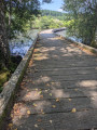
A few short sections on minor roads require great caution, particularly on the D3A2 and the D7, the road that circles the lake. On both dykes there is a narrow footpath (where walkers must pass in single file), which you are strongly advised to use so as not to obstruct any passing traffic.

This route is unmarked in certain sections, even though it follows aPR® trail (yellow markings) in places. Consequently, it is advisable to follow the directions in the description and on the map, whilst also paying attention to the landscape.

Walk completed by the author on 28 May 2018

Alternative route
It is possible to shorten this route slightly by going directly from point (8) to point (10). The walk is then approximately 8 km long. Immediately after point (8), the path reaches a ‘Y’-shaped junction of ascending stony tracks. Take the one on the right.

Worth a visit

Lake Vassivière
Lake Vassivière (Vaciviéra in Occitan) is a French artificial lake covering 9.76 km², created by the construction of a dam on the River Maulde at the mouth of its valley, flanked by two hills – the ideal spot for building a dam. The largest body of water in the Limousin region and one of the largest artificial lakes in France, it is situated to the north-west of the Millevaches Plateau, within a dense forest, in the departments of Creuse and Haute-Vienne, and close to Corrèze.

The dam was built of reinforced concrete between 1947 and 1950 to close off several valleys or thalwegs converging at a single point, through which streams flowed, including the Maulde, which has since then flowed into the port of Vauveix near the Broussat peninsula. The reservoir was filled on Christmas Eve 1950. The lake’s capacity is 106 million cubic metres at its highest water level, at elevation 651 NGF. Every year in late September or early October, the lake’s water level is deliberately lowered (as observed on 28/09/11) in order to collect and store water from autumn rainfall and winter snowmelt, which are very abundant in this region. The lake is fed by the Maulde, a tributary of the Vienne, and several streams around its perimeter, including the Gane du Réau, the Haute-Faye stream, the Lavaud-Gelade Lake aqueduct, and water from the Arfeuille pond channelled via an underground pipeline. The lake lies partly in the Haute-Vienne and partly in the Creuse. Furthermore, Lake Lavaud-Gelade, situated nearby and covering an area of 285 hectares, was also created by Électricité de France. Since 1950, it has served as a water reservoir, supplying Lake Vassivière via an underground pipeline according to the latter’s water requirements.
Downstream, at the foot of the dam on its left-hand side, a vaulted valve chamber – built beneath the hill near the foundation reinforcement piles – is connected to a small open-air spillway. This maintains a constant water flow of around 1 m³/s to preserve the ecosystem of the Maulde stream, which continues its course through its valley.
The site’s distinctive features are as follows:
- the dam is situated in Auchaise (in the municipality of Royère-de-Vassivière);
- the water intake is at Port Crozat (in the municipality of Peyrat-le-Château);
- the Mazet power station is situated in the municipality of Peyrat-le-Château;
- a 2,585-metre underground tunnel and a 610-metre penstock connect the latter two.
When the lake was filled, eight hamlets and abandoned villages were submerged by the rising water, including the former village of Vassivière, from which the lake takes its name. In Old Occitan, this name means ‘all the lambs in a sheepfold’.
The lake is bordered by numerous localities, including:
in Creuse: Faux-la-Montagne, Royère-de-Vassivière;
in Haute-Vienne: Beaumont-du-Lac, Peyrat-le-Château.
It is the 23rd largest lake in France by surface area, if coastal ponds and natural lakes are included. However, it ranks 14th if only artificial lakes and ponds are considered. It is the sixth largest body of water in the Massif Central.

Where necessary, two areas are designated for water-bombing seaplanes to skim water over a distance of more than 1,500 metres, under the control and authority of the National Gendarmerie. Information boards have been placed at strategic locations to inform the public about the regulations governing the lake – in particular regarding prohibited equipment, speed limits, and specific areas reserved for certain activities such as water skiing and motorboating. These boards were produced by the Lake Management Association and EDF, which owns the lake. All the organisations concerned have signed partnership agreements with the surrounding local authorities to preserve this exceptional site.

In the 1960s and 1970s, Dr Pierre Ferrand, a local and regional elected representative, was a great visionary who came up with the idea of developing the lake’s shores into a tourist destination. He received support from various quarters, including the President of the Creuse General Council, Senator Pauly. Beaches, harbours, holiday villages, restaurants, hotels and campsites sprang up and flourished, attracting holidaymakers, boaters, tourists, walkers and hikers from spring to autumn…

A road circling the entire lake was built to serve the villages and hamlets newly created following the filling of the lake.

Always be cautious and plan ahead when you're outdoors. Visorando and the author of this route cannot be held responsible for any accidents occurring on this route.

The GR® and PR® markings are the intellectual property of the Fédération Française de Randonnée Pédestre.

Reviews and comments

4.2 / 5
Based on 3 reviews

Reliability of the description
4.3 / 5
Ease of following the route
4.7 / 5
Route interest
3.7 / 5
Bananette75
Bananette75
• Edited:

Overall rating : 4 / 5

Date of your route : May 11, 2024
Reliability of the description : ★★★★☆ Good
Ease of following the route : ★★★★☆ Good
Route interest : ★★★★☆ Good
Very busy route : No

A lovely route, but one which, unfortunately, begins with a clear-cut (apparently recent) section through the forest.
However, the rest of the route is pleasant and varied.
There are no particular difficulties apart from the section through the peat bogs, which is very muddy in places, but nothing insurmountable if you’re wearing the right footwear.

Machine-translated

C.Claude
C.Claude

Overall rating : 4 / 5

Date of your route : May 25, 2020
Reliability of the description : ★★★★☆ Good
Ease of following the route : ★★★★★ Very good
Route interest : ★★★☆☆ Average
Very busy route : No

It’s fine, but a bit too far to drive for my liking.

Machine-translated

BCA
BCA

Overall rating : 4.7 / 5

Date of your route : Sep 03, 2018
Reliability of the description : ★★★★★ Very good
Ease of following the route : ★★★★★ Very good
Route interest : ★★★★☆ Good

A very pleasant walk with lovely views and a lovely woodland setting. The path is well-maintained and clearly signposted.

Machine-translated

Other walks in the area

For more walks, use our search engine .

The GPS track and description are the property of this route's author. Please do not copy them without permission.