Country:

 City:
City:


Hikers’ car park on the D3a1 near a mobile phone mast, approximately 2.5 km west of the D3a1 x D3 roundabout.
(S/E) At the far end of the car park, take the path leading down to the left, marked in yellow (ignore the other path). Follow these yellow markings until otherwise indicated. The path joins a road at the entrance to the hamlet of Masgrangeas, near a pond. Follow the road to the left to cross the hamlet (well-preserved old houses).
(1) Opposite No. 20, turn left onto Rue de la Fontaine, pass the drinking fountain, then turn left again onto Rue d’Orladeix and pass a wash house.
(2) Leave the road and take a path leading down to the left. Follow this path until you reach a T-junction.
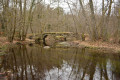
(3) Take the path on the right (the one on the left is not shown on the IGN map). Further on, cross a stream via a stone bridge (a small bridge made of simple flat stones), then reach a T-junction.
(4) Turn left. When you reach a house (unoccupied in 2026), take the path to its left.
(5) At the junction with a recent forest track (in use in 2026), turn left. Ignore a track on the left further on. You’ll come to a four-way junction.
(6) Leave the yellow markings, which head off to the right, and continue straight ahead, following the blue markings. These are the markings for the Sentier de Rive, which you should follow until otherwise indicated. Ignore a path on the left, then you’ll reach the D3a1.
(7) Cross the road carefully, then follow it to the left for about 500 metres along a wide verge. Then take the path on the right, signposted with a sign.
(8) At the junction of the paths, turn left. At the next junction, follow the path leading down to the right, through a cleared area, and join a track.
(9) Cross it and take the Blue-marked path opposite. You’ll come to a track; follow it to the right.
(10) At the T-junction, turn left. At the next junction, leave the blue-marked trail, which heads left, and continue straight on following the yellow markings – which you will follow until otherwise indicated – along the Chassagnas Peninsula Tour trail. At the junction with a track, turn right.
(11) At the next junction, turn left. Ignore a path on the right, then you’ll come to some gates leading into pastureland.
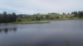
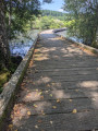
(12) Carry on straight ahead towards Île de Vauveix, along a lovely path through a fern-covered heath. Pass through another set of gates, then cross a footbridge (over sand now that the lake level has dropped) to reach the island.
(13) Follow the path round the island; take the left-hand route for the suggested itinerary.
(13) Back at the footbridge, follow the route in the opposite direction to the way out, heading back up through the fern-covered heathland and back through the gate.
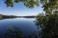
(12) Go straight through the gate on the left. At the fork in the road, keep to the right as you head uphill. The view opens out onto the lake.
(14) As you leave the grazing area, go through another gate and continue climbing through the woodland. Pass through yet another gate and you’ll arrive at a beautiful rocky outcrop at the top of the headland (737 m).
(15) Here again, enjoy a beautiful panoramic view of the lake. Then go through one final gate and head straight down the slope. At the junction with a path, keep to the right and descend a little further to reach the lakeshore.
(16) Carry on to the right along a path. Further on, the path widens into a track.
(17) Carry on straight ahead along this track, ignoring a path on the right; you’ll notice a beautiful house on the left, and you’ll reach the few houses of Chassagnat, near an ancient stone cross.
(18) Carry on straight ahead along the track. To save yourself a section of the track, at the sign for the Tour de la Presqu’île de Chassagnas, turn right, leaving the yellow markings. You’ll climb up to a junction you passed on the way there. (You can also continue along the track.)
(10) Turn left and follow the blue markings again, taking the reverse route of the outward journey. Don’t miss the path on the left. You’ll rejoin the track.
(9) Follow it to the right to reach the D3a1; cross carefully to get back to the car park (S/E).
 Tourist office

 Easy
Easy  Visorando Member