


Refine your search for walks in Fontan
Fontan walks


 The Céva Plateau via the Cime de Coss, starting from Fontan
 Visorando Member

 11.32 mi
 +4,715 ft
 -4,715 ft
 8 hrs
 Very difficult
 Departure from Fontan (Alpes-Maritimes)
A major centre for pastoralism, the Céva plateau remains little known and rarely visited by walkers. This pleasant walk takes you there via a secondary peak of the Mercantour, the Cime de Coss, whilst still offering interesting views, particularly of the Authion massif.
An ideal walk for those seeking tranquillity and a sense of solitude. Spring is probably the best time to explore this plateau perched high above the Roya valley.
Malmort Castle
 3.64 mi
+2,060 ft
-2,073 ft
3h 30
 Moderate
Departure from Saorge (Alpes-Maritimes)
A former 14th-century stronghold on the right bank of the Roya, Malmort Castle formed part of a defensive system controlling the Roya Valley under the rule of the House of Savoy.
Saorge – Breil-sur-Roya
 5.75 mi
+2,343 ft
-3,009 ft
4h 40
Moderate
Departure from Saorge (Alpes-Maritimes)
This is the Valléen trail, an easy route along the Roya.
Both towns are served by the ‘Train des Merveilles’. From Breil to Sospel: one stop (15 mins).
Malmort Castle as seen from Saorge, via the Paspus Chapel
 6.39 mi
+3,094 ft
-3,087 ft
5h 40
 Difficult
Departure from Saorge (Alpes-Maritimes)
This village, clinging to the mountainside like an amphitheatre above the Gorges de la Roya, will reveal its many facets throughout the day. The scents of broom, lavender and thyme will accompany you. At the end of the walk, a stop at the Bains du Sémite will allow you to experience a form of ‘cryotherapy’ in a magnificent setting, which will help your body recover more quickly.
From Saint-Dalmas de Tende to La Brigue
 5.48 mi
+896 ft
-922 ft
3h 20
 Easy
Departure from Tende (Alpes-Maritimes)
A beautiful walk through the Levensa Valley. Breathtaking views of these two towns. Prestigious sites steeped in history, including a magnificent House of Brigasque Heritage and Traditions to visit – everything you need for a pleasant day combining physical activity with fun and cultural visits.
The Saint-Dalmas de Tende, La Brigue, Tende triangle
 9.79 mi
+2,972 ft
-2,966 ft
7h 05
Difficult
Departure from Tende (Alpes-Maritimes)
Three villages,names and prestigious locations steeped in history on the natural border of the Mercantour National Park and the Vallée des Merveilles. Numerous sweeping views over these two valleys and the Alpine massif. A magnificent hike that lives up to our expectations.
Tête de la Nava, Cime and Balcon de Marta
 10.86 mi
+3,993 ft
-3,993 ft
8h 30
Difficult
Departure from La Brigue (Alpes-Maritimes)
Three peaks near the Italian border, with old military installations.
The walk is long but takes place largely through woodland.
Ascent to the Merveilles refuge from Lac des Mesches
 4.74 mi
+2,487 ft
-46 ft
4h 20
Moderate
Departure from Tende (Alpes-Maritimes)
The Refuge des Merveilles can be a destination in itself or the starting point for a guided tour of the petroglyphs or other hikes. The climb to the refuge via Lac des Mesches takes 3 hours and 15 minutes (excluding breaks) and has the advantage of being accessible by car or public transport (see "Practical Information").
Breil-sur-Roya – Libre and back via La Colette
 9.29 mi
+2,828 ft
-2,844 ft
6h 45
Difficult
Departure from Breil-sur-Roya (Alpes-Maritimes)
Libre, like Piène-Haute, was part of Italy until February 1947, when it was incorporated into the municipality of Breil-sur-Roya. The hamlet of Libre consists of several scattered neighbourhoods, including Cotté, Aubé and Borgoni, which you will pass through before the climb up to La Colette. On the way there, the route offers several views of the Roya. The return journey takes you via La Colette and Gardiola back to the Carleva Valley.
Breil – Sospel via La Baisse de Levens
 9.50 mi
+3,100 ft
-2,930 ft
7h 05
Difficult
Departure from Breil-sur-Roya (Alpes-Maritimes)
A lovely route linking the Bévéra Valley with the Roya Valley. Along the way, the Col de Brouis marks the boundary between these two valleys. If you set off early enough, you can have lunch on the terrace of one of the restaurants in this pretty village, where life flows as peacefully as the River Bévéra. The return journey is then by the Train des Merveilles, which connects the two stations in 15 minutes.
Cime des Lacs
 11.53 mi
+3,753 ft
-3,737 ft
8h 35
Difficult
Departure from Tende (Alpes-Maritimes)
This summit, which rises just opposite the Refuge des Merveilles, lives up to its name. 360° panoramic view of a dozen lakes and the main peaks of the Vallée des Merveilles: Mont Bégo, Grand Capelet, Cime du Diable.
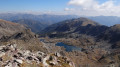
La Cime du Diable from Lac des Mesches
 13.98 mi
+4,469 ft
-4,452 ft
8 hrs
Very difficult
Departure from Tende (Alpes-Maritimes)
Long, fairly strenuous hike. The summit offers a 360° panorama from the sea to the highest peaks of the Mercantour and Argentera. You will look out over the many lakes you will have passed along the way.
 Lac des Mesches - Refuge des Merveilles - Lac des Mesches
 9.09 mi
+2,484 ft
-2,454 ft
7 hrs
Difficult
Departure from Tende (Alpes-Maritimes)
This hike takes you through the Vallon de la Minière and then the exceptional site of the Vallée des Merveilles.
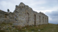
La Minière de Vallauria - Col de Turini
 12.49 mi
+4,009 ft
-3,635 ft
8 hrs
Very difficult
Departure from Tende (Alpes-Maritimes)
Thissecond stage is the most alpine of the three. At the Refuge des Merveilles, you’ll admire the beauty of the landscapes, from the Cime du Diable to the Vallon des Merveilles. You’ll pass several lakes before descending into a more Mediterranean-style valley at the Pas du Diable. With the Redoute des Trois Communes in sight for much of the way, you’ll walk along the old border ridge, dotted with defensive structures. Near the Authion, numerous ruins will remind you of the end of the last war.
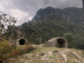
The Cruella tower circular via Les Crottés and the Breil-sur-Roya forest.
 4.92 mi
+2,280 ft
-2,297 ft
4h 15
Moderate
Departure from Breil-sur-Roya (Alpes-Maritimes)
A very beautiful hike, starting with a walk through Breil-sur-Roya, whose narrow streets with vaulted porches are steeped in history. Then, after discovering a dozen crottés (small vaulted shelters), a real local curiosity, as well as the old Cruella watchtower overlooking the village, our route crosses the main areas of biological diversity located on the left bank of the Roya, overlooking the town.
Towards Notre-Dame-des-Fontaines and the Pont du Coq
5.41 mi
+817 ft
-814 ft
3h 10
Moderate
Departure from La Brigue (Alpes-Maritimes)
This circular route, starting from La Brigue, allows you to explore the Lévensa Valley via a varied trail combining woodland, footbridges and ancient ruins. The route leads to the Notre-Dame-des-Fontaines Chapel, notable for its frescoes, before a gentler return via the road. Combining nature and heritage, this route offers a gradual immersion in a peaceful environment typical of the hinterland.
L'Arpette from Breil-sur-Roya 15 April 2016
 7.66 mi
+5,335 ft
-5,312 ft
7 hrs
Very difficult
Departure from Breil-sur-Roya (Alpes-Maritimes)
A lovely, challenging hike with no particular difficulties apart from the steep gradient.
The Baisses de Géréon and Peluna from La Brigue
 10.52 mi
+2,680 ft
-2,667 ft
7h 10
Moderate
Departure from La Brigue (Alpes-Maritimes)
A pleasant, easy forest hike, ideal for getting back into walking in the spring. The descent offers beautiful views of La Brigue, the Chaberta massif and the terraces built over the centuries, evidence of an agricultural past.
Cruella Tower
 1.27 mi
+738 ft
-735 ft
1h 15
Easy
Departure from Breil-sur-Roya (Alpes-Maritimes)
A pleasant short walk above Breil-sur-Roya. Once you reach the Cruella Tower, you’ll enjoy a superb panorama of the Roya Valley, the peaks around the Col de Brouïs (Mangiabo, Cime de Bosc...) and a bird’s-eye view of the village of Breil.
The Carleva valley
 7.15 mi
+3,031 ft
-3,018 ft
5h 55
Difficult
Departure from Breil-sur-Roya (Alpes-Maritimes)
The Carleva is a small tributary of the Roya. This stream owes its reputation to its long, wild canyon. The route follows the Carleva to the start of the canyon. The trail continues under the ridge on the border with Italy. Crossing several streams adds a touch of coolness to this hike. The trail continues along the left bank of the Carleva to a magnificent bridge that spans it. The final stretch overlooks the Roya to the entrance of the village of Breil-sur-Roya.
User comment on 22 February 2025: Trail currently closed between markers 105 and 107.See https://randoxygene.departement06.fr/liste-des-sentiers-fermes-pedestre
Therefore closed on the return from marker 107 (9) to marker 105 (3).
The route from (S) to point (6): crossing the Carléva remains a beautiful route. In this case, the return journey is via the same route as the outward journey.
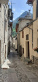
Chapel of Saint-Sauveur in Tende
 2.24 mi
+922 ft
-922 ft
1h 50
Moderate
Departure from Tende (Alpes-Maritimes)
Discover one of the highest points in the village of Tende by climbing up to the Saint-Sauveur Chapel.
This chapel, listed as a historic monument since 26 May 2000, was built on the orders of the first Count of Tende for his wife, who was Orthodox. It features 14th-century murals.
The route is short but the climb is steep (250m elevation gain over less than 1km).
Caution: tricky passage at the end.
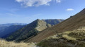
From the Refuge des Merveilles to L'Authion via the Pas du Diable
 6.11 mi
+1,850 ft
-2,159 ft
4h 25
Moderate
Departure from Tende (Alpes-Maritimes)
A beautiful classic route on theGR®®52. As you progress along this three-part itinerary, you will appreciate the beauty of the lakes up to the Pas du Diable, then the very chaotic landscape at the foot of the Cime du Diable and Mont Capelet Supérieur. Finally, after the Baisse Cavaline, you will enter a more Mediterranean setting to discover the Authion massif, a historic site during the end of the Second World War.
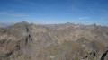
Refuge des Merveilles – Castérino
 8.31 mi
+2,703 ft
-4,058 ft
8 hrs
Very difficult
Departure from Tende (Alpes-Maritimes)
This final stage will take you back to Castérino via the ascent of Mont Bégo. From the summit, you’ll look out over the Vallée des Merveilles. You’ll catch sight of the neighbouring peak opposite, the Grand Capelet. You’ll enjoy a 360° panorama stretching from the Argentera to the Mediterranean.
You’ll need to be careful on the first part of the descent towards the Baisse de Valmasque (rated T3).
From the Baisse de Valmasque, the return journey follows the classic route that runs alongside the Lacs du Basto, Noir and Vert.
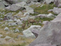
Refuge des Merveilles - Baisse de Camp
 8.26 mi
+1,946 ft
-3,150 ft
5h 30
Difficult
Departure from Tende (Alpes-Maritimes)
The fifth stage ofthe GR®52, where southern landscapes give way to mountain scenery. Challenging due to its elevation gain, this stage follows the old Italian border, where you’ll discover numerous military remains. Notably at Authion, where one of the last battles in France took place, resulting in the deaths of 273 French soldiers just a few weeks before the armistice of 8 May 1945. The views here are fabulous.
From the Refuge Merveilles to the Refuge Nice via the Baisses de Valmasque and the Basto
5.79 mi
+2,464 ft
-2,129 ft
4h 50
Difficult
Departure from Tende (Alpes-Maritimes)
Third stage of the five-day Vievola–Saint-Martin-Vesubie hike.
On the itinerary: a crossing of the Vallée des Merveilles and several lovely high-altitude lakes.
Refuge des Merveilles - Refuge de Nice
 5.43 mi
+2,543 ft
-2,201 ft
4h 45
Difficult
Departure from Tende (Alpes-Maritimes)
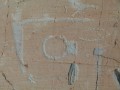
This itinerary allows you to discover the wonders of this valley. In particular, the famous engravings such as Christ, the Tribal Chief and the Altar Rock. But be careful, these areas are monitored!
Mont Saccarel, Mont Tanarel and Cime Ventose
 11.65 mi
+5,016 ft
-5,013 ft
10 hrs
Very difficult
Departure from La Brigue (Alpes-Maritimes)
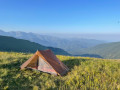
The three easternmost peaks in France.
This hike presents no technical difficulties; the paths are well-marked and there are plenty of signposts.
I classify it as very difficult given its length and elevation gain.
A similar hike was already described in 2019, but I am not including the description of the descent today.
From Casterino to the Refuge des Merveilles via Mont Bégo
7.66 mi
+3,917 ft
-2,034 ft
6h 55
Very difficult
Departure from Tende (Alpes-Maritimes)
Second stage of the five-day Vievola–Saint-Martin Vesubie hike.
⚠️ 18/08/2026: Route amended at point 4.
The summit of Chanvrairée and the return off-trail via Plan Tendasque
 7.96 mi
+3,002 ft
-2,986 ft
6h 15
Difficult
Departure from Tende (Alpes-Maritimes)
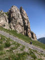
The ridges and summit of Chanvrairée offer stunning 360° panoramic views, including the Mercantour. After passing the fortified structures dating from the 1930s, which form part of the Italian defence line known as the 8th caposaldo Pian Tendasco, the little-used return route passes through an area frequented by chamois. Keep an eye out!
The Baisse d'Ourne de Castérino
 6.09 mi
+1,841 ft
-1,854 ft
4h 25
Moderate
Departure from Tende (Alpes-Maritimes)
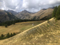
A very pretty hike, offering beautiful views of the Alps, including Monts Bégo, Clapier and Grand Capelet, in the upper part. The return journey is along a very pleasant, unmarked, little-used wooded path. In total, there is a small elevation gain of 490 m, which will help you get back into shape.
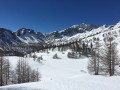
Lac des Grenouilles and Vallon de Fontanalba from Casterino
 6.13 mi
+1,624 ft
-1,627 ft
5 hrs
Moderate
Departure from Tende (Alpes-Maritimes)
In the Roya Valley, above Saint-Dalmas-de-Tende, enjoy a beautiful snowshoe hike in the setting of Mont Bégo in the middle of the Vallée des Merveilles.
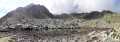
Lake Sainte-Marie
 8.30 mi
+2,779 ft
-2,772 ft
6h 15
Moderate
Departure from Tende (Alpes-Maritimes)
Lac Sainte-Marie, situated 350 metres higher than the famous and much-visited Lac des Grenouilles, is well worth the slight extra effort. At the foot of Mont Sainte-Marie, peace and tranquillity await you.
Not to be confused with Lac de Sainte-Marie, situated to the south-west of Mont Sainte-Marie.
Castérino – Saint-Dalmas-de-Tende
 6.97 mi
+633 ft
-3,451 ft
3h 45
Moderate
Departure from Tende (Alpes-Maritimes)
After two days in the high mountains, this route will take you back into the Roya Valley. You’ll look out over the Vallon de Castérino and Lac des Mesches, before descending rapidly to Saint-Dalmas-de-Tende via the Chemin des Bois.
Mont Gros (Monte Grosso) fortifications
 4.48 mi
+1,427 ft
-1,453 ft
3h 20
Moderate
Departure from Breil-sur-Roya (Alpes-Maritimes)
Mont Gros (Monte Grosso) is a small peak above the Col de Brouis. It occupies a strategic position on the line separating the Bévéra and Roya valleys. The Monte Grosso fortification was built between 1931 and 1935 and forms part of the Maginot Line, the fortified sector of the Alpes-Maritimes. Beyond its historical significance, this route offers magnificent panoramic views of the Mercantour peaks and the ridges bordering Italy.
Le Mangiabo
 7.35 mi
+3,235 ft
-3,235 ft
6h 10
Difficult
Departure from Breil-sur-Roya (Alpes-Maritimes)
Mont Mangiabo, clearly visible from Breil sur Roya, entices hikers to conquer it. This climb, which is not technically difficult, offers a unique 360° panorama.
To the south, the Mediterranean stretches from San Remo to Cannes, passing through Nice and the Var estuary.
To the north, the peaks of the Mercantour will catch your eye.
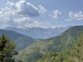
Circular Vallon de Stroup starting from Morignole
 6.10 mi
+2,395 ft
-2,375 ft
4h 55
Moderate
Departure from La Brigue (Alpes-Maritimes)
Here is a very pleasant walk offering superb panoramic views of the hills above the village of Morignole, passing by the Stroup Waterfall and ending at the Chambeuil Sheepfold.
Morignole – Rifugio Don Barbera
 7.22 mi
+4,774 ft
-1,043 ft
7h 30
Difficult
Departure from La Brigue (Alpes-Maritimes)
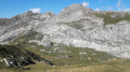
This first stage will take you into the Marguareis Nature Park from France.As soon as you enter the park, the karstic panoramas are enchanting and completely different from the crystalline landscapes of the nearby Mercantour. During the ascent, you’ll be far enough back to admire the Mercantour massif from the Authion to the Argentera.
Route through the Marguareis Nature Park
35.86 mi
+15,581 ft
-15,538 ft
5 days
Difficult
Departure from La Brigue (Alpes-Maritimes)
The two main access points to the Marguareis Nature Park are quite a distance from our French Alpes-Maritimes. The northern entrance is at Chiusa di Pesio (a 2-hour drive), the southern entrance is at Carnino (a 3-hour drive). Choosing Morignole is an alternative way to enter this magnificent park, which is rarely visited by French people despite being on the border. Pointe Marguareis lies on the French-Italian border.Five days to climb Pointe Marguareis and circumnavigate it.
Pigna - Apricale
 14.45 mi
+4,147 ft
-4,213 ft
10h 15
Very difficult
Departure from Pigna (Imperia)
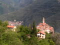
This second stage will take you from Pigna to Apricale. You will pass through the charming villages of Castel Vittorio, Bajardo and Perinaldo. Like Triora, Perinaldo and Apricale are listed among the most beautiful villages in Italy (I Borghi più belli d'Italia).
Mont Bertrand, starting from the Baisse d’Ugail
 7.64 mi
+3,576 ft
-3,576 ft
6h 40
Difficult
Departure from Tende (Alpes-Maritimes)
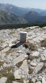
This walk is situated above the hamlet of Morignole, starting from the Baisse d’Ugail car park.
This route is in the commune of La Brigue, in the upper Roya Valley in the Alpes-Maritimes.
It begins in the woodland and ends at the Italian border in the mountain pastures.