Mont Bertrand, starting from the Baisse d’Ugail

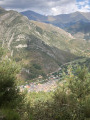
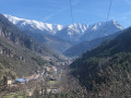
This walk is situated above the hamlet of Morignole, starting from the Baisse d’Ugail car park.
This route is in the commune of La Brigue, in the upper Roya Valley in the Alpes-Maritimes.
It begins in the woodland and ends at the Italian border in the mountain pastures.

Details

n°13075915
Creation:
Last update:
Last review:
  • Walking
    Activity: Walking
  • ↔
    Distance: 7.64 mi
  • ◔
    Average duration: 6h 40 
  • ▲
    Difficulty: Difficult

  • ⚐
    Back to start: Yes
  • ↗
    Ascent: + 3,576 ft
  • ↘
    Descent: - 3,576 ft

  • ▲
    Highest point: 8,127 ft
  • ▼
    Lowest point: 4,551 ft

Photos

Description of the walk

Park at the Baisse d’Ugail by taking the forest track from Morigole.

(S/E) Take the path through the woodland, heading towards Mont Bertrand. Join a forest track.

(1) Follow it straight ahead to reach marker 312 at Baisse de la Crouseta.

(2) Turn left to reach a clearing at marker 327c.

(3) Turn right onto the yellow-marked path. Continue along it to reach the edge of the woodland.

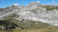
(4) Leave the woodland to begin the final ascent and emerge at the summit of Mont Bertrand.

(5) Continue left along the border ridge, then veer off it to reach marker 327b.

(6) Turn left to begin the descent and return to marker 327c in the clearing you passed on the way out.

(3) Follow the route back in the opposite direction to the outward journey, then veer slightly to the left to reach Fort de la Crouseta.

(7) Return to the path and continue to the left, following the route in the opposite direction to the outward journey, to return to the Baisse d’Ugail car park (S/E).

Waypoints

  1. S/E : mi 0 - alt. 4,551 ft - Baisse d’Ugail car park
  2. 1 : mi 0.72 - alt. 5,171 ft - Junction with the forest track
  3. 2 : mi 1.09 - alt. 5,479 ft - Marker 312
  4. 3 : mi 2.15 - alt. 6,542 ft - Marker 327c
  5. 4 : mi 2.53 - alt. 7,119 ft - Forest edge
  6. 5 : mi 3.1 - alt. 8,127 ft - Summit of Mont Bertrand
  7. 6 : mi 4.27 - alt. 7,418 ft - Marker 327b
  8. 7 : mi 6.16 - alt. 5,942 ft - Fort de la Crouseta
  9. S/E : mi 7.64 - alt. 4,551 ft - Baisse d’Ugail car park

Worth a visit

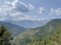
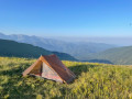
(5) Mont Bertrand: enjoy the panoramic views, with:
- the Mercantour to the west,
- Mont Viso far to the north in Italy,
- the Margareis Massif to the north-east,
- the Italian valleys to the east and south-east.

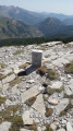
Between (5) and (6), the border is the one that was redefined in 1947.

Reviews and comments

5 / 5
Based on 1 review

Reliability of the description
5 / 5
Ease of following the route
5 / 5
Route interest
5 / 5
titirex
titirex

Overall rating : 5 / 5

Date of your route : Nov 11, 2024
Reliability of the description : ★★★★★ Very good
Ease of following the route : ★★★★★ Very good
Route interest : ★★★★★ Very good
Very busy route : No

A magnificent summit with a 360-degree view. It’s a steep climb to the top, but there are no technical difficulties.
Well worth a visit.

Machine-translated

Other walks in the area

For more walks, use our search engine .

The GPS track and description are the property of this route's author. Please do not copy them without permission.