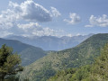
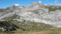
Tête de la Nava, Cime and Balcon de Marta

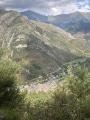
Three peaks near the Italian border, with old military installations.
The walk is long but takes place largely through woodland.

Details

n°22035684
Creation:
Last update:
Last review:
  • Walking
    Activity: Walking
  • ↔
    Distance: 10.86 mi
  • ◔
    Average duration: 8h 30 
  • ▲
    Difficulty: Difficult

  • ⚐
    Back to start: Yes
  • ↗
    Ascent: + 3,993 ft
  • ↘
    Descent: - 3,993 ft

  • ▲
    Highest point: 6,998 ft
  • ▼
    Lowest point: 3,661 ft

Photos

Description of the walk

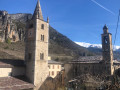
At La Brigue, go round the village and take the road to Rio Secco, which is unmarked but recognised by GPS, until you reach a three-way junction (marker 249) from where the Pelluna track branches off to the right; it is advisable to use a 4x4 here, as the tarmac is badly damaged or even non-existent on some stony hairpin bends and the vehicle tends to spin its wheels; follow it for 1.5 km and 232 m of elevation gain to a junction.

(S/E) Marker 246 points to the right towards the Baisse de Pelluna and straight ahead towards the Baisse de Géréon, which is accessible by car.
Follow the track to the Baisse de Géréon, marker 251.

(1) Take the wide path that climbs towards Cime Marta. The gradient is steep at the start but the path runs through woodland. Follow it to marker 252.

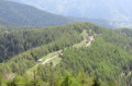
(2) Turn left towards the Col de l’Afel; for 6 km the path climbs gradually, winding from valley to valley, through fir and larch wood; the path is sometimes narrow and slopes across grassy ground, which can be slippery in wet weather. From km 4.6 to km 5.2 (marker 257), the gradient is steep with fairly high steps. Continue to the Col de l’Afel (marker 256).

(3) Turn right towards Cime Marta. Enter the pastureland and you’ll soon reach the Italian border, marker 255.

(4) Turn left (for a return trip) and take the grassy path on the left above the track leading to the Baisse de Sanson; it winds its way up to the summit of the Tête de la Nava (elevation 1,939).

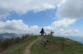
(5) There is an unobstructed view towards Italy, and below lie the remains of old barracks. Head straight back down off the path.

(4) Follow the border track for 200 m to marker 255a.

(6) Take the marked path to the right to reach the Cime de Marta or Mont Vaquier (elevation 2,135), marker 254.

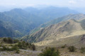
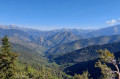
(7) 360° view of the Mercantour and Italy; to the south, the alpine pasture plateau where old barracks serve as shelters for summer grazing herds; and to the south-west, the Balcon de Marta.
Descend through the meadow, where the flora is abundant, to marker 253.

(8) The ascent (and return) to the Balcon de Marta is not signposted, but it can be reached via the track or, more directly, via the path on its right – although the markings here are virtually non-existent – simply head straight on between the sparse trees in the meadow. Reach the Balcon de Marta (elevation 2,122).

(9) A small plateau with, to the west, an old bunker and an adjoining Samu 06 antenna. A bird’s-eye view over the Vallon de Groa and, separated by the Crête de Rionard, the succession of valleys leading towards the Roya.
Head back down to the previous junction.

(8) Turn left onto the well-marked and signposted path towards the Baisse de Géréon; the descent is sometimes steep, with numerous hairpin bends beneath centuries-old larch trees. Return to the start of the circular path.

(2) Return to the path taken on the way out, which you simply follow in the opposite direction until you reach marker 246 (S/E), where your car will have remained in the shade if you left it on the upstream side of the track.

Waypoints

  1. S/E : mi 0 - alt. 3,661 ft - La Brigue to Pelluna track, marker 246
  2. 1 : mi 0.8 - alt. 4,108 ft - Descent from Géréon
  3. 2 : mi 1.45 - alt. 4,567 ft - Marker 252 (junction of the circular route)
  4. 3 : mi 4.7 - alt. 5,906 ft - Col de l’Afel, marker 256
  5. 4 : mi 5.12 - alt. 6,227 ft - Border marker 255. Turn-off (there and back) towards Tête de la Nava
  6. 5 : mi 5.36 - alt. 6,345 ft - Tête de la Nava
  7. 6 : mi 5.58 - alt. 6,270 ft - Marker 255a
  8. 7 : mi 6.34 - alt. 6,998 ft - Cime de Marta or Mont Vaquier
  9. 8 : mi 7 - alt. 6,552 ft - Marker 253. Fork in the path (out and back) towards the Balcon de Marta
  10. 9 : mi 7.54 - alt. 6,952 ft - Balcon de Marta
  11. S/E : mi 10.86 - alt. 3,661 ft - La Brigue to Pelluna track, marker 246

Notes

A few narrow, sloping sections may prove slippery if the ground is wet on the way to the Col de l’Afel.
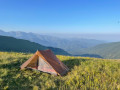
From the Col de l’Afel to the Balcon de Marta, a vast summer pasture area where there may be livestock guard dogs.
There is no water source at the hamlet of Fontaine de Vaquet where you can refill your water supply.

Worth a visit

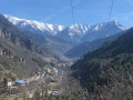
Views of the Mercantour peaks.
Near old military barracks.
Abundant flora.

Reviews and comments

4.3 / 5
Based on 2 reviews

Reliability of the description
4.5 / 5
Ease of following the route
4 / 5
Route interest
4.5 / 5
mimibm
mimibm

Overall rating : 4 / 5

Date of your route : Jul 10, 2023
Reliability of the description : ★★★★☆ Good
Ease of following the route : ★★★★☆ Good
Route interest : ★★★★☆ Good
Very busy route : No

We completed this walk on a hot summer’s day, but in the opposite direction to that described. The section between the Col de l’Afel (marker 256) and marker 252 appears to be in a state of neglect. The path, which is often on a slope, disappears beneath the grass, which is frequently slippery; you can’t see where you’re putting your feet, so watch out for falls! Remember to take plenty of water! The view from the summit of Cime de Marta is magnificent. Bonus: there’s a bunker to explore, above the path, beneath the Rionard ridge (make sure you bring a torch).

Machine-translated

MARTIN THIERRY
MARTIN THIERRY

Overall rating : 4.7 / 5

Date of your route : Jun 27, 2022
Reliability of the description : ★★★★★ Very good
Ease of following the route : ★★★★☆ Good
Route interest : ★★★★★ Very good
Very busy route : Yes

Please note: to be fully familiar with this area, you should avoid venturing into the enormous Balcon de Marte fort if you are not familiar with the structure (443 steps at a 75° angle and 17 combat blocks)
A magnificent hike with spectacular scenery, best enjoyed in fine weather

Machine-translated

Other walks in the area

For more walks, use our search engine .

The GPS track and description are the property of this route's author. Please do not copy them without permission.