Date of your route : Jun 30, 2026
Reliability of the description : ★★★★☆ Good
Ease of following the route : ★★★★☆ Good
Route interest : ★★★★★ Very good
Very busy route : No
I set off from the Pont du Countet on my own.
The route is varied. It allows you to discover beautiful, unspoilt landscapes.
Please note: there’s no mobile signal!
I’d advise you to download the GPX file and the directions for the different stages.
The route is technically challenging. You’ll need solid mountaineering experience: map and terrain reading, climbing difficulty level 3, and good physical fitness.
Day 1: Relais des Merveilles – Refuge des Merveilles.
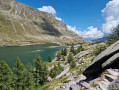
The path is marked by cairns. The valley is magnificent at the start of summer: water, flowers…
You need to be careful on the scree with a heavy rucksack.
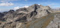
At the ‘Pas de Trem’, I set my rucksack down to complete the ascent to the summit of the Diable. The view is magnificent. The descent to the Refuge des Merveilles runs alongside the lakes.
I took a walk through the Vallée des Merveilles to look at some Neolithic rock carvings. If you’re on your own, you’re not allowed to leave the GR 52 trail, and it’s hard to know where to go or what to look for.
From the refuge, you can join a park guide to benefit from their valuable information whilst venturing off the GR trail.
Day 2: Le BÉGO – 800m over 3km (3 hours; the rucksack was heavy)... it’s a steep climb.
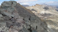
Be careful near the summit – follow the cairns closely, otherwise it can turn into a ridge walk. You’ll need to use your hands. The descent involves some downclimbing. Be sure to follow the path closely all the way to the Baisse de Valmasque. The GPS track is misleading.
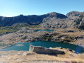
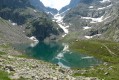
The descent past Lac de Basto, Lac Noir and Lac Vert is magnificent. Ibex and chamois can be seen right by the path.
Then, below the Valmasque refuge, a magnificent waterfall and a larch forest come into view.
Given the weather, I decided not to climb up to Lac Agnel.
Day 3: Valmasque to the Nice refuge via the Baisse de Basto. 4 hours
At this time of year, there are snowfields.
The descent from the Baisse de Basto to the Refuge de Nice is technical and slippery in wet weather.
After the storm: I reached Lac Long in 1h15. Well… it’s getting quite rocky! Not ideal for pitching a tent 
Day 4: Lac Long – Madone de Fenestre refuge: 5 hours
I looked for the cairns, hesitating on both the ascent and the descent. ‘My Location’ on the app was a great help. I was on my own.
The climb is steep: 400m over 1,500m…
Watch out for the scree on the descent. It’s technical all the way down. You end up hopping from rock to rock… it’s rocky.
Day 5: Madone de Fenestre mountain hut to the Countet Bridge. 4h15
A 700m climb after leaving the cow pastures, and you come to the famous scree slope.
There are snowfields. Personally, I prefer walking on snowfields; I find it quicker and more comfortable than scree slopes. The final section is steep. After the Pas de Collomb, the descent involves high steps. It’s a steep drop with no room to run out your stride. You need to be careful.
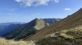
Then the descent along the Gordolasque is magical.
I absolutely loved these five days!
Machine-translated



 Country:

 City:
City:




 Visorando Member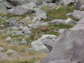
 Difficult
 Moderate