Country:

 City:
City:



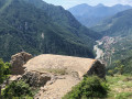
Park in the car park on Avenue Pasteur.
(S/E) Head to the start of the route, located by the recycling bins, just a stone’s throw away, below the “Le temps des cerises” care home. Follow the concrete path down to the left, leaving the village on your right
(1) At the first junction, turn left: the concrete path ends on this section of the Saorge discovery trail and the Salt Route trades trail. A few steel figurines dot the descent towards the Roya, through olive groves and woodland.
(2) Turn right onto the main road leading downhill: watch out for traffic.
(3) Turn 180° to the right. The map shows a footpath here: there isn’t one; this is the old A-road. Cross the bridge and carry on to the next bend (marker 18).
(4) Leave the old road, which has no traffic. Turn left towards Breil-sur-Roya, onto the old Route du Sel used in the 17th century. Only the start is paved slanting street. Follow the yellow markings.
(5) At the junction, keep to the right and follow the yellow markings to reach the hamlet and the chapel at Paspus (water point).
(6) Continue along the ascending path and follow the yellow markings. You will reach a junction near a cistern.
(7) Ignore the track and take the path opposite, which runs parallel to it, and follow it until you reach the edge of the woodland.
(8) The path continues to the left and joins the Panigeore track. Turn right at marker 173.
(9) At this Y-junction, turn right and follow the track downhill until you can see the farm below. Please note that the sheep farm is private property.
(10) At the bend, head down to the left over the scree (which is safe) to reach the hamlet of Campé and marker 180. Continue straight on towards Château de Malmort – La Roya on the yellow-marked trail. You’ll reach the junction marked 181.
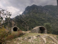
(11) An excellent spot for viewing Château de Malmort. Those feeling adventurous can make a round trip to the ruins (45 mins). Otherwise, continue towards La Roya, pass marker 182 and carry on to the right. You’ll reach marker 427, next to which stands an old building.
(12) Head straight ahead through the vegetation that has overgrown the path for about 10 metres. After that, the path is clearly marked. Please note that the end of the path consists of a series of stone steps leading onto the D6204, a busy road.
(13) Turn left towards the bridge with the blue arches; cross the bridge, keeping well to the left-hand side. After the bridge, cross carefully to walk along the right-hand verge, heading uphill.
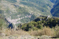
(14) An old military road, winding its way uphill with straight stretches and numerous bends, raises a few questions.
However, climb up the embankment on the right to reach the second section, then take the steps to cut across the bends. What seemed tedious and uninteresting is actually climbed very quickly. The path eventually emerges at a tunnel: take care.
(15) Turn right onto the Ciapagne Sovran road. Given the terrain, traffic moves slowly but still poses a danger, so stay alert.
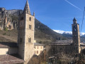
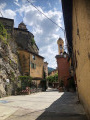
(16) Enter the village of Saorge, which is a pedestrian zone. The fire brigade reminds us that in Saorge, it’s an emergency! Walk past the town hall and follow the signs to the monastery. At the end of the tarmac road, turn left onto Rue Virgile Barel, which passes the village post office further on. Immediately afterwards, carry on straight ahead, then follow the narrow lane which further on becomes Rue Louis Périssol. Walk past the Chapelle des Pénitents Blancs, which has been converted into an information point, and continue until you reach Avenue Pasteur. Follow this road, passing the care home, to return to the car park (S/E).




 Visorando Member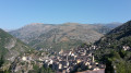
 Moderate
 Very difficult
 Easy
Easy