From the Refuge Merveilles to the Refuge Nice via the Baisses de Valmasque and the Basto

Third stage of the five-day Vievola–Saint-Martin-Vesubie hike.
On the itinerary: a crossing of the Vallée des Merveilles and several lovely high-altitude lakes.

This walk is part of a multi-day hike: Circuit Vievola - Saint Martin Vésubie

Details

n°106174
Creation:
Last update:
Last review:
  • Walking
    Activity: Walking
  • ↔
    Distance: 5.79 mi
  • ◔
    Average duration: 4h 50 
  • ▲
    Difficulty: Difficult

  • ⚐
    Back to start: No
  • ↗
    Ascent: + 2,464 ft
  • ↘
    Descent: - 2,129 ft

  • ▲
    Highest point: 8,825 ft
  • ▼
    Lowest point: 6,959 ft

Description of the walk

A day in the Vallée des Merveilles
This stage is shorter and easier than the previous day’s.

(S) Set off from the Refuge des Merveilles on the shores of Lac Long Supérieur.

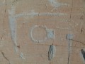
(1) Walk up the lake and turn right, heading due north towards the Baisse de la Valmasque. Cross the famous valley amidst the archaeological wonders, which are within easy reach but where access is restricted. Without a guide, it is not permitted to approach the rock carvings.

(2) Carry on due north, passing Lac des Merveilles.

(3) Walk leisurely between the two giants – the Grand Capelet on the left and the Bégo on the right – before reaching the foot of the Baisse de la Valmasque, a steeper ascent that you’ll tackle via a series of beautiful hairpin bends.

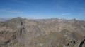
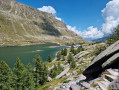
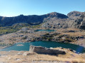
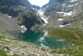
(4) At the pass, the view is sublime: the succession of the three lakes – Basto, Noir and Vert – is unique, with the Vallée des Merveilles behind us. A short descent leads to the junction with the Baisse du Basto (marker 95).

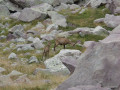
(5). Take the path branching off to the left towards the north-west. Climb up the valley fairly easily along a lovely path where you may often spot ibex, before ascending the Baisse du Basto via a steeper, winding path.

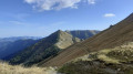
(6) On the other side of the pass, the descent is steep at first and, as you head west, turns into gentle slopes amongst small lakes.

(7) Pass by Lac Niré, where it’s a more pleasant spot to have a bite to eat than at the summit of either of the two Baisses, which are often windy. Shortly afterwards, you reach the Refuge de Nice, which overlooks the magnificent Lac de la Fous (E).

Waypoints

  1. S : mi 0 - alt. 6,959 ft - Refuge des Merveilles
  2. 1 : mi 0.09 - alt. 6,991 ft - Lac Long Supérieur
  3. 2 : mi 0.88 - alt. 7,257 ft - Entrance to the rock engravings site
  4. 3 : mi 1.3 - alt. 7,520 ft - Lac des Merveilles - Lac des Merveilles
  5. 4 : mi 2.56 - alt. 8,356 ft - Baisse de Valmasque
  6. 5 : mi 2.91 - alt. 7,904 ft - Junction leading to the Baisse du Basto
  7. 6 : mi 4.04 - alt. 8,825 ft - Baisse du Basto
  8. 7 : mi 5.12 - alt. 7,740 ft - Lac Niré
  9. E : mi 5.79 - alt. 7,293 ft - Refuge de Nice

This route passes through a protected area, which may be subject to special regulations:

Worth a visit

Reviews and comments

4.3 / 5
Based on 2 reviews

Reliability of the description
4.5 / 5
Ease of following the route
4 / 5
Route interest
4.5 / 5
Luco7
Luco7

Overall rating : 4.3 / 5

Date of your route : Oct 14, 2024
Reliability of the description : ★★★★☆ Good
Ease of following the route : ★★★★☆ Good
Route interest : ★★★★★ Very good
Very busy route : No

A lovely hike that ended in the snow on 15 September… please note that the markings in the scree slopes of La Baisse can be difficult to make out, especially when there’s snow.
A very cosy refuge with superb views… when the weather’s fine

Machine-translated

Joseph S.
Joseph S.

Overall rating : 4.3 / 5

Date of your route : Sep 13, 2017
Reliability of the description : ★★★★★ Very good
Ease of following the route : ★★★★☆ Good
Route interest : ★★★★☆ Good

A magnificent route with stunning scenery

Machine-translated

Other walks in the area

For more walks, use our search engine .

The GPS track and description are the property of this route's author. Please do not copy them without permission.