Country:

 City:
City:


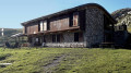
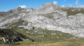
From Saint-Dalmas de Tende (06), take the D43 road towards La Brigue. Continue along the D43 to the hamlet of Morignole. Park in the car park or on the road leading into the Morignole valley.
(S) Walk through the hamlet heading north to reach marker 305 (in the centre of the hamlet).
(1) Continue along the path to marker 304, heading north-east.
(2) Turn 90° to the left and climb gently due west to reach marker 303.
(3) Cross the ridge and start a long northward stretch to the right, passing the Oratoire Saint-Dominique, then continue until you reach marker 302 further up.
(4) Continue left along the fairly steeply ascending path to reach the Baisse de Crouseta at the junction of several paths.
(5) Follow the path to the right towards Mont Bertrand until you emerge from the woods. You will reach a junction of several paths at marker 327c.
Note: at the crossroads of paths before the marker, you can take the shortcut opposite to join the path crossing the Cioto de Bertrand.
(6) Leave the Mont Bertrand path on your right and take the path on the left which leads into the Cioto de Bertrand. Begin the long walk due north which takes you to marker 327b.
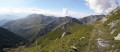
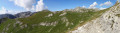
(7) Continue along the path beneath the Mont Bertrand ridge to reach a small pass between the peaks of L’Évêque and Vélègue. Take in the panoramic views.
Head down to the right, then climb back up towards the Col de l’Évêque. Descend again towards the Col de la Celle Vieille, which you’ll reach at marker 327a.
(8) Take the path on the left towards the Col des Seigneurs. To do this, leave the old military track on your right. Do not go down. You’ll reach this pass at marker 327.
(9) Head down to the right towards the Rifugio Don Barbera, which is clearly visible from the Col dei Signori. Join the old military track to reach the Rifugio Don Barbera (E).

 Visorando Member
 Moderate
 Very difficult