Country:

 City:


The walk starts at Breil-sur-Roya station. It finishes at Sospel station.
(S) On leaving Breil station, take the D6204 on the right until you reach the Promenade Georges Clémenceau, just before the bridge over the Roya.
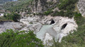
(1) Turn right and follow the Roya river to the Pont Charabot (currently under reconstruction following damage caused by Storm Alex).
Follow theGR®52Asignposts to the Col de Brouis
(2) Turn right, go under the railway line, and arrive at a junction (marker 7). Turn left onto the Première Division Française Libre trail, and you’ll soon reach marker 7A.
(3) Continue along the PDFI track (signpost: Col de Brouis).
(4) Follow this small road to marker 120. Stay on this road and head back to the Chapel of Our Lady of Graces.
(5) Just twenty metres or so past the chapel, the path splits in two (marker 126). Follow the path on the left towards the Col de Brouis. Continue along this pleasant path to the Col de Brouis (marker 123).
Yellow markings to the Col de l’Agaisen
(6) Turn right and walk past the inn at the pass, cross the D2204 with care and take the first track on the right.
(7) Follow this stony track for about 1 km, pass an old barracks converted into a farm, and reach marker 125.
Continue along the Route de l’Armée des Alpes until the first bend. Leave it on your right, take the Baisse de Levens path and arrive at a stream.
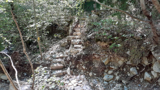
(8) Although this stream is dry, the floods caused by Storm Alex destroyed the crossing point. You’ll need to climb down a few metres to find a makeshift crossing. Rejoin the path via this makeshift access. Return to the Baisse de Levens by following this well-marked path.
(9) Begin the fairly steep, winding descent through the woods and emerge onto a track. (Please note: this section is incorrectly shown on the IGN map but is correct on OpenStreetMap Randonnée Monde)
(10) Cross the track, rejoin the path and continue the descent into the Vallon de la Baisse de Levens. You’ll come to a stream.
(11) Ford the stream and rejoin the path, which climbs slightly. Keep heading south and return to a junction at marker 84.
(12) At marker 84, turn left, following the sign for the Col de l’Agaisen, and reach it fairly quickly.
FollowtheGR® 52A markings until you reach the entrance to Sospel (marker 81)
(13) At the pass (marker 83), head east and look for two paths; take the one furthest to the left, which descends slightly. 20 metres further on, you’ll come to a second marker 83, signposted ‘Sospel’ and‘GR®52A’. Follow this path to the right, which skirts Mont Agaisen and makes two 90-degree bends. Cross the track and continue until you reach the Route de l’Agaisen. Follow this road to the right for about 150 m and look out for aGR® sign indicating you should turn left.
(14) Leave the road and take the path on the left down to marker 81, at the junction with the Chemin du Vier. Leave the GR®.
Unmarked section
(15) Head south along the Chemin du Vier for a few metres and take a short cut towards the village (marked with a Red Cross and White Cross). Join the Boulevard du Général de Gaulle. Turn right and head towards a car park. Turn left and follow the narrow streets to the Pont Vieux. Cross the bridge. Turn right to walk alongside the Bévéra on Avenue Jean Médecin, until you reach Place de la Cabraïa (restaurants and bars). Take Rue Saint-Michel to reach the Church of Saint-Michel, which houses a bishop’s cathedral.
(16) Turn round, leaving the Pont Vieux on your left. Continue and cross diagonally across the Esplanade Antonin Gianotti opposite the town hall. Cross the Chemin de Suez and take the steps leading to the station, passing through a garden (E).

 Visorando Member
 Moderate
 Very difficult
 Easy