Country:

 City:


The start and finish of this walk are at Breil-sur-Roya railway station
(S/E) From the station, heading south, take Boulevard Jean Jaurès as far as the traffic lights. Turn left onto Avenue des Combattants de l’AFN and rejoin Avenue Jean Jaurès at the restaurant ‘Le Flavie’. Cross the bridge over the Roya.
(1) Follow Boulevard Rouvier alongside the Roya until you reach Place Biancheri.
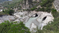
(2) Continue along the lake to Rue Marius Cauvin, near the dam on the Roya. Carry on to a wash house and turn right onto the Chemin des Remparts, then take the path known as the Valléen. Walk along, admiring the Chapelle Saint-Antoine l’Hermite as you go, then the Porte de Gênes. After a bend that follows the circular section of the Roya, you’ll reach a junction.
(3) Leave the Cruella path on your left and continue southwards to marker 105.
(4) Take the path on the right towards Libre – Fanghetto. Follow this path, which overlooks the Roya. The coastal river bends before the Carleva joins it on its left bank. Enter the Carleva valley and descend slightly to a small bridge. Cross the Carleva and begin a winding ascent until you reach a track at a place called Rougna (marker 104).
(5) Take the track that descends to the right. Heading south, follow the Chemin de Praghiou to marker 106.
(6) Leave the track and take the narrow path that branches off to the left, following the bends of the Roya, 200 m higher up. Enjoy a few views of the river. After a bend, you’ll reach a section that has been repaired following a rockslide caused by Storm Alex.
(7) Take the steps carved into the rock and easily make your way back to marker 416, at the junction with the D90 near Borgogni.
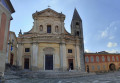
(8) Follow the D90 as it gradually leads into Libre, continuing to Saint-Michel Church.
(9) To the right of the church, walk past the playgrounds and follow the ‘Sentier de la Madone’ to reach the statue of Mary.
(10) Retrace your steps back to the church, then continue along the D90 until you reach the junction on the right leading to the cemetery and the hamlets of Aubé and Cotté. Take this small road, pass Aubé and continue until you reach the first houses in Cotté (marker 422).
(11) Turn left into the first narrow lane and follow the signs for La Colette and Breil via Gardiola. After the last house, the path heads first north, then west. After a bend, head north again, winding your way up the hairpin bends to La Colette (marker 421).
(12) From La Colette, which is in fact a small pass, take the left-hand path towards Gardiola and the Carleva valley. Heading north-east, make your way to marker 107.
(13) Turn left onto the path leading down towards Breil via Praghiou and Rougna. Walk through a beautiful forest, then arrive at a farm. Pass below the farm and descend to the Praghiou track, at the hamlet of Rougna.
(14) Continue along the track until the first bend, where you’ll find marker 104.
(5) Follow the route in reverse to return to Breil-sur-Roya station (S/E).
 Visorando Member

 Moderate
 Very difficult
 Easy