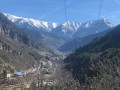
Saorge – Breil-sur-Roya

This is the Valléen trail, an easy route along the Roya.
Both towns are served by the ‘Train des Merveilles’. From Breil to Sospel: one stop (15 mins).

This walk is part of a multi-day hike: Variante de la GTA Briançon - Menton

Details

n°2316320
Creation:
Last update:
Last review:
  • Walking
    Activity: Walking
  • ↔
    Distance: 5.75 mi
  • ◔
    Average duration: 4h 40 
  • ▲
    Difficulty: Moderate

  • ⚐
    Back to start: No
  • ↗
    Ascent: + 2,343 ft
  • ↘
    Descent: - 3,009 ft

  • ▲
    Highest point: 2,156 ft
  • ▼
    Lowest point: 925 ft
  • ⚐ Country: France
  • ⚐
    Areas: Alps, Mercantour
  • ⚐ City: Saorge (06540)
  • ⚑
    Start: N 43.98733° / E 7.55241°
  • ⚑
    End: N 43.940679° / E 7.513777°
  • ❏
    IGN map(s): Ref. 3741ET, 3841OT
  • Hour-by-hour weather

Photos

Description of the walk

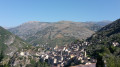
(S) From the village of Saorge. Walk down to the bottom of the village until you reach Rue Doumergue. Follow it to the washhouse. The street continues as a footpath. Stay on this path, keeping to the right at the junction. Follow the route to marker 16.

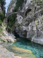
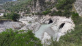
(1) Cross the D138 before joining it on the banks of the Roya. Take the road to the left. Before the bridge, turn left towards a crystal-clear pool. This is the ‘Bain du Sémite’, fed by the waters of the Bendola. Cross the stream and continue due south. Reach the banks of the Roya at marker 156.

(2) Immediately head uphill to the left, ignoring the path on the right leading to a house.
After a bend to the right, a short climb leads back onto theGR® 52A.
Note: a new section has been created with steps and safety handrails.

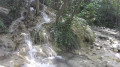
(3) Take this to the right. Cross the refreshing Caïne stream and continue along the GR®. You’ll reach the junction at marker 153.

(4) Here, there are two possible routes:
- continue along theGR® by keeping to the left to reach Breil-sur-Roya (E),
- head down to the right, as shown on the map. Pass through the hamlet of Ornéglia, then take the track to reach the junction marked with signpost 9.

(5) Stay on the path on the right, follow the Roya river, cross it and turn right onto the D6204 road. At the station, turn left to reach the centre of Breil-sur-Roya (E).

Waypoints

  1. S : mi 0 - alt. 1,663 ft - Saorge
  2. 1 : mi 0.62 - alt. 1,165 ft - Bain du Sémite - Roya (fleuve)
  3. 2 : mi 1.4 - alt. 1,119 ft - Waymark 156
  4. 3 : mi 2.28 - alt. 1,719 ft - GR 52A
  5. 4 : mi 3.62 - alt. 2,051 ft - Waymark 153. Alternative route
  6. 5 : mi 4.77 - alt. 1,033 ft - Waymark 9
  7. E : mi 5.75 - alt. 1,004 ft - Breil-sur-Roya

Notes

Make sure you bring water. There are no water supplies along the route.
You can easily reach Sospel by train.

Worth a visit

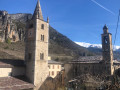
(S) Visit to the village of Saorge.
(1) Bain du Sémite
(E) Take the train to Sospel for the final stage.

Always be cautious and plan ahead when you're outdoors. Visorando and the author of this route cannot be held responsible for any accidents occurring on this route.

The GR® and PR® markings are the intellectual property of the Fédération Française de Randonnée Pédestre.

Reviews and comments

3.5 / 5
Based on 4 reviews

Reliability of the description
3.3 / 5
Ease of following the route
3.3 / 5
Route interest
4 / 5
Peanut
Peanut

Overall rating : 4 / 5

Date of your route : Aug 12, 2024
Reliability of the description : ★★★★☆ Good
Ease of following the route : ★★★★☆ Good
Route interest : ★★★★☆ Good
Very busy route : No

Following Storm Alex, the footpath was re-graded.
A new section has been created between points 2 and 3, featuring safe steps and handrails.
It is no longer necessary to rejoin the GR, and the walk can be completed as described in the current guide.

Machine-translated

batur
batur

Overall rating : 2 / 5

Date of your route : Oct 02, 2023
Reliability of the description : ★☆☆☆☆ Very disappointing
Ease of following the route : ★☆☆☆☆ Very disappointing
Route interest : ★★★★☆ Good
Very busy route : No

Shortcut between points 2 and 3, as shown on the map; new route heading uphill to join the GR,
After point 3, a leisurely walk, in fine weather like on that day when it was 28°

Machine-translated

jmper1
jmper1

Overall rating : 3.5 / 5

Date of your route : Nov 28, 2021
Reliability of the description : Not used / Not applicable
Ease of following the route : ★★★☆☆ Average
Route interest : ★★★★☆ Good
Very busy route : No

The path is still closed between 2 and 3, although it is still scheduled to reopen in September 2021.
An alternative route via the Croix du Mont Agu is possible, but the elevation gain is no longer the same. Furthermore, you may need to leave your car in Bréil and travel to Saorge by train or bus, but please note that from Saorge station there is still a distance of nearly 2 km and a slight climb to reach the starting point at the Madone de Poggio.

Machine-translated

kerwin
kerwin

Overall rating : 4.7 / 5

Date of your route : Jun 06, 2021
Reliability of the description : ★★★★★ Very good
Ease of following the route : ★★★★★ Very good
Route interest : ★★★★☆ Good
Very busy route : No

The hiking trail was destroyed by Storm Alex, particularly between point 2 and point 3 – it’s impossible to get through. What a shame.

Machine-translated

Other walks in the area

For more walks, use our search engine .

The GPS track and description are the property of this route's author. Please do not copy them without permission.