From Casterino to the Refuge des Merveilles via Mont Bégo

Second stage of the five-day Vievola–Saint-Martin Vesubie hike.

⚠️ 20/07/2026: Do not undertake this hike. It is currently very dangerous from point 5 to the Refuge des Merveilles. Read the warnings. Currently being updated.

This walk is part of a multi-day hike: Circuit Vievola - Saint Martin Vésubie

Details

106092
Creation:
Last update:
Last review:
  • Walking
    Activity: Walking
  • ↔
    Distance: 7.36 mi
  • ◔
    Average duration: 7h 40 
  • ▲
    Difficulty: Very difficult

  • ⚐
    Back to start: No
  • ↗
    Ascent: + 4,951 ft
  • ↘
    Descent: - 3,051 ft

  • ▲
    Highest point: 9,367 ft
  • ▼
    Lowest point: 5,049 ft
  • ⚐ Country: France
  • ⚐
    Areas: Alps, Mercantour
  • ⚐ City: Tende (06430)
  • ⚑
    Start: N 44.096203° / E 7.508111°
  • ⚑
    End: N 44.057337° / E 7.451715°
  • ❏
    IGN map(s): Ref. 3741OT, 3841OT
  • Hour-by-hour weather

Description of the walk

Start at marker 391 on the edge of the Casterino road.
With your back to the car park, turn right and head up the Vallon de Fontanalba to the junction at marker 390.

(1) Leave the path leading up to Lac des Grenouilles on your right and continue towards the Fontanalba mountain hut.

(2) Pass the refuge and continue along the path to another junction, marker 387

(3) Ignore the path on the right leading to Lac Vert de Fontanalba and the rock carvings, and take the track climbing to the left, below the Baisse de Vallaurette. You’ll reach the junction with the track descending from the Baisse.

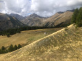
(4) Continue straight on towards the Baisse de Fontanalba. As you approach the Baisse, the slope levels out and you reach a large, flat area.

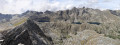
(5) Leave the Baisse de Fontanalba path and tackle a steep slope off-trail, heading west, to join a ridge path coming from the Baisse de la Valmasque

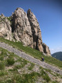
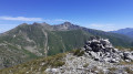
(6) Take this path to the left, heading south then south-east. There are tricky sections, first downhill and then a steep climb, to reach the summit of the Bégo. If the weather is on your side, enjoy the exceptional 360° view from this summit.

(7) Continue due south to reach the secondary summit of Bégo. Keep an eye out for the path leading down to the Refuge des Merveilles, immediately on the right at the end of the plateau.

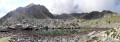
(8) Follow this path as it descends gently to Lac Long Supérieur.

(9). Cross the dam and arrive at the refuge (E).

Waypoints

  1. S : mi 0 - alt. 5,056 ft - Starting point: Casterino road
  2. 1 : mi 1.92 - alt. 6,342 ft - Lac des Grenouilles junction
  3. 2 : mi 2.32 - alt. 6,588 ft - Refuge de Fontanalba
  4. 3 : mi 2.87 - alt. 6,962 ft - Junction at Lac Vert de Fontanalbe
  5. 4 : mi 3.09 - alt. 7,277 ft - Junction with the Baisse de Vallaurette path
  6. 5 : mi 4.55 - alt. 8,274 ft - Leave the Baisse de Fontanalbe path
  7. 6 : mi 4.9 - alt. 8,911 ft - The Baisse de Valmasque path is on the left.
  8. 7 : mi 5.55 - alt. 9,364 ft - Mont Bego
  9. 8 : mi 5.78 - alt. 9,285 ft - Keep to the right to descend to the refuge
  10. 9 : mi 7.28 - alt. 6,926 ft - Lac Long Supérieur
  11. E : mi 7.36 - alt. 6,962 ft - Refuge des Merveilles

This route passes through a protected area, which may be subject to special regulations:

Reviews and comments

2.5 / 5
Based on 2 reviews

Reliability of the description
1.5 / 5
Ease of following the route
2.5 / 5
Route interest
3.5 / 5
Nicolas Planchenault

Overall rating : 2 / 5

Date of your route : Aug 22, 2024
Reliability of the description : ★★☆☆☆ Disappointing
Ease of following the route : ★☆☆☆☆ Very disappointing
Route interest : ★★★☆☆ Average
Very busy route : No

/!\ DO NOT GO ON THIS HIKE.
At any rate, not the off-trail section!
- It takes you off-trail through the ‘Merveilles’ restricted area, which is prohibited
- the route description does not make it clear exactly where to go off-trail without putting yourself in danger
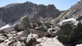
- It’s rated as ‘difficult’, which is completely inappropriate. ‘Difficult’ hikes on Visorando are generally quite long with significant elevation gain, possibly requiring you to use your hands. Here, however, we’re talking about having to use your hands continuously – effectively climbing – where we were. High-mountain kit would have been essential.

=> Take the route via the pass; it’s longer on the map, but doesn’t take any longer in terms of time.
Even so, there’s still a section where you have to use your hands quite a bit to reach the summit.

We set off for a day trip, so we were travelling light compared to those doing a multi-day trek.
We reached the Refuge des Merveilles in about 6 hours, and then it took us 2 hours to walk back down to Lac des Mesches to catch the bus.

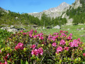
This hike offers magnificent scenery and views!

Machine-translated

funky83
funky83

Hello
Having walked the GR20 in September, from Calenzana to Vizzavone, I don’t think I’m the sort of person who’s keen on ‘a little Sunday stroll’.
But I’ll say it again, as a warning to anyone thinking of venturing there: this section is dangerous.
Kind regards

Machine-translated

henri57
henri57 ★

Hello,

Thank you for your comment.

This is a dangerous hike if you take the steep, unmarked slope!

Indeed, this walk is not suitable for beginners but is intended for experienced walkers.

You’d have to be reckless to recommend such a route!

On the Visorando website, you’ll find everything from ‘a gentle Sunday stroll’ to very challenging hikes. That way, every Visorando user can find something to suit them.

Kind regards

Machine-translated

funky83
funky83

Overall rating : 3 / 5

Date of your route : Oct 13, 2018
Reliability of the description : ★☆☆☆☆ Very disappointing
Ease of following the route : ★★★★☆ Good
Route interest : ★★★★☆ Good

I’ll come back to the difficult part of this hike.
It is completely inappropriate!
It’s a dangerous walk if you take the steep, unmarked slope!
You’d have to be reckless to recommend such a route!

Machine-translated

Other walks in the area

For more walks, use our search engine .

The GPS track and description are the property of this route's author. Please do not copy them without permission.