Country:

 City:


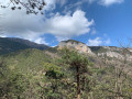
The route starts at the lower entrance to the village of Fontan. There are two options for parking:
- in the small car park next to the recycling bins, situated just before the traffic lights regulating traffic into the village,
- if there are no spaces in this car park, head up the concrete track on the left (still before the traffic lights) to reach a car park a little further up.
(S/E) Cross the road, then take the steps leading up to the car park mentioned above. At the foot of the steps, there is a commemorative plaque honouring the soldiers who liberated the valley, as well as a signpost indicating that La Céva is 3 hours’ walk away. From the upper car park, continue straight ahead along the road/track, which quickly turns into a footpath.
Please note that IGN maps show two waymarks numbered 25 and 26, but these are not actually present on the ground. Carry on until you actually reach waymark 26, directly beneath the power line.
(1) Pass it, heading towards Campeï and Pratolin. Continue along a well-defined but unmarked path. Reach marker 197 (also incorrectly positioned on the IGN map).
(2) Continue heading towards Campeï and Pratolin. The path remains clearly visible, though it is less well marked, with the occasional yellow marker—but you’ll need a keen eye. It is nevertheless easy to follow the route. Reach Campeï and marker 196, which, although present on the ground, is in very poor condition and lying on the ground; the directional inscriptions are almost illegible.
(3) Continue along the path which heads straight west-south-west; you’ll quickly pass above a sheepfold, although the path is poorly marked. Join the track leading up from the Caïros valley.
(4) Cross itonce to reach, on the other side, an area bearing the marks of a recent small fire. As you pass through this area, look out for the yellow markers, which are much more prominent. Cross the track asecond time, continuing to follow the yellow markers and heading towards a wooden cross: there is no real path here, but it is easy to find your way. Reach the hamlet known as Le Pous.
(5) There is no longer a path here as it has completely disappeared and the yellow markers are absent. Continue due west, heading towards a DFCI water reservoir visible a little further up, and reach it.
(6) Go round it, keeping it on your right (this means continuing straight on). You will very quickly come across a well-marked path that presents no difficulty. Carry on to reach Pratolin and marker 199.
(7) Now proceed off the marked path to the Ceva plateau. Continue straight on towards the west, taking care to pass slightly to the left and below the ridge marking the entrance to a private property. You will see two successive cairns and a faint track that winds now through the bushes, now across a slope (but without any particular danger). A few cairns mark the route, but it is advisable to look into the distance to identify the easiest route. Reach the entrance to the Mercantour National Park, marked by green hexagons.
(8) Continue westwards, following a faint path that becomes increasingly hard to make out. There are a few very rare cairns. To find your way, you can also use the wooden posts as a guide; these probably mark a former boundary of a grazing area. In any case, you should stay as close as possible to the edge of the pine forest and not enter it. Reach the end of the path.
(9) Important note: from this point onwards, there are no further paths or cairns. Head north-west, venturing slightly into the pine forest whilst continuing to climb; you must never descend and should maintain a north-north-westerly course as much as possible. When the pines become sparser, begin to head slightly westwards again until you reach the ridge. This is the most gruelling part of the walk, over a very steep slope and through thick tufts of alpine grass. You will reach the summit of the Cime de Coss.
(10) To descend to the Plateau de la Céva, there are two options:
- directly down the western slope,
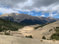
- or heading south-west along the ridge: this option, which follows the marked route, allows you to walk around the top of the plateau and climb up to a spur (altitude 1612) offering a lovely view of the plateau and the Caïros valley. Then head down to the Plateau de la Céva.
(11) Cross it by following a faint track northwards. At the end of the plateau, the track enters the forest; you must continue to follow it and not start descending. Upon emerging from the woods, you will reach a crossroads of tracks in a clearing.
(12) Here too, there are two options:
- turn right and head straight down towards the altitude of 1550,
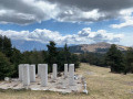
- continue along the track – this is the route shown on the map – which climbs up to the left to reach the Céva sheepfold, the Liberator monument and marker 230.
(13) Head towards Fontan and reach the junction at an altitude of 1550 metres.
(14) Leave the track and take the path opposite. Cross the Torrent de la Céva before continuing along a well-marked path to reach the junction at marker 229.
(15) Continue along the Piste des Celles for a few hundred metres, before taking the path leading down to the left into the forest at marker 226. The route is very easy to follow; the path is very well marked and dotted with a few yellow markers. Continue in this way until you reach marker 227.
(16) Carry on towards Fontan and you’ll soon reach marker 193.
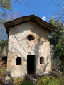
(17) Stay on the path on the left. Directly beneath the power line, pass the Saint-Maurice Chapel. Then continue due south until you come out onto the D620 at marker 192.
(18) Turn right onto the road and proceed with caution through Fontan to return to the car park you chose at the start (S/E).
 Visorando Member
 Moderate

 Difficult
 Easy