


Refine your search for walks in Foncegrive
Foncegrive walks

 The Gency to Selongey Trail
 Association / Club / Walk leader
 4.96 mi
 +377 ft
 -394 ft
 2h 35
2h 35
 Easy
Easy
 Departure from Selongey (Côte-d'Or)
The area around Selongey, the birthplace of the Seb pressure cooker, invites you to explore its Gency walking trail. Its name is taken from one of the three hills overlooking the village. This easy, signposted trail will take you through the forest that covers much of this hill.You’ll cross the Venelle before reaching the hill. You’ll finish this walk by passing near the pressure cooker factory.
Between Vernois-lès-Vesvres and Chalancey
 Visorando Member
 9.07 mi
+659 ft
-636 ft
4h 45
9.07 mi
+659 ft
-636 ft
4h 45
 Moderate
Departure from Vernois-lès-Vesvres (Côte-d'Or)
Moderate
Departure from Vernois-lès-Vesvres (Côte-d'Or)
A walk between Vernois-lès-Vesvres and Chalancey, setting off via the Champberceau Forest and returning via the plateau, including a visit to Chalancey Castle.
The valley on either side of the Venelle between Selongey and Foncegrive
 7.36 mi
+755 ft
-738 ft
4h 00
Moderate
Departure from Selongey (Côte-d'Or)
7.36 mi
+755 ft
-738 ft
4h 00
Moderate
Departure from Selongey (Côte-d'Or)
This signposted route is one of four trails starting from the Courvelles Sports Complex in Selongey. It will take you from the home of the pressure cooker to Foncegrive, a small village nestled at the bottom of its valley. You’ll return to Selongey via the beautiful Gency Forest. This route is not particularly difficult. Only a short, steep 100-metre stretch will set your heart racing a little faster.
The Tertre Trail in Selongey
 Local authority
 6.98 mi
+591 ft
-577 ft
3h 45
Moderate
Departure from Selongey (Côte-d'Or)
6.98 mi
+591 ft
-577 ft
3h 45
Moderate
Departure from Selongey (Côte-d'Or)
The Selongey area, home to the SEB pressure cooker, invites you to explore its Tertre hiking trail. Its name comes from the woodland you will pass through during this hike, which reaches a highest point of 415 m.
You will pass by the statue of the Virgin Mary, along the Tille and Venelle wind farm, before descending into the village. You will continue the walk along Rue du Mont and pass by the Church of Saint-Rémy de Foncegrive on your return to Selongey.
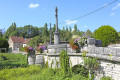
Short version of the Tertre hike from Selongey
 4.93 mi
+449 ft
-436 ft
2h 40
Easy
Departure from Selongey (Côte-d'Or)
4.93 mi
+449 ft
-436 ft
2h 40
Easy
Departure from Selongey (Côte-d'Or)
The Selongey area, home to the SEB pressure cooker, invites you to explore its Tertre hiking trail. Its name comes from the woodland you will pass through during this hike, which reaches a highest point of 415 m.You’ll pass by the statue of the Virgin Mary, along the Tille and Venelle wind farm, before descending a beautiful path to join the track that will take you back to Selongey. You’ll finish this hike by passing near the pressure cooker factory.
The Valley at Selongey
 7.32 mi
+696 ft
-715 ft
4h 00
Moderate
Departure from Selongey (Côte-d'Or)
7.32 mi
+696 ft
-715 ft
4h 00
Moderate
Departure from Selongey (Côte-d'Or)
Gradually leave Selongey behind as you climb higher to discover the Venelle valley from a different perspective.
This circular route links Selongey to Foncegrive, alternating between country lanes, woodland paths and village crossings. After an initial section through the woods, the route reaches the heights of Foncegrive and its viewpoint. The walk then passes through the village before gaining altitude again via the paths and woods of Gency.
The return journey to Selongey offers one final change of scenery. The natural landscapes gradually give way to the urban and industrial heritage of a town closely linked to the history of SEB and the famous Cocotte-Minute.
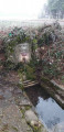
A tour of Selongey’s chapels
 5.39 mi
+404 ft
-384 ft
2h 50
Easy
Departure from Selongey (Côte-d'Or)
5.39 mi
+404 ft
-384 ft
2h 50
Easy
Departure from Selongey (Côte-d'Or)
Selongey takes its name from a Roman estate once situated at the ‘Champ de Mars’. Centuries of history have left it with some remarkable monuments: a 13th-century church housing a carillon of 48 bells, listed as a historic monument, and a 19th-century organ, the Chapel of Saint Gertrude (1530) and the Chapel of Saint Anne (1637). There are also a few old houses dating from the 15th and 16th centuries.
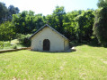
Foncegrive and Selongey as seen from Boussenois
 10.98 mi
+869 ft
-866 ft
5h 50
Moderate
Departure from Boussenois (Côte-d'Or)
10.98 mi
+869 ft
-866 ft
5h 50
Moderate
Departure from Boussenois (Côte-d'Or)
From Boussenois, head towards Foncegrive, partly through the woods; pass through Foncegrive and continue to Selongey, also via a small woodland path; pass through Selongey and head back up via the Sainte-Anne Chapel to return to Boussenois.
La Combe Henri and Montchevreuil, starting from Villey-sur-Tille
12.43 mi
+663 ft
-656 ft
6h 20
 Difficult
Departure from Villey-sur-Tille (Côte-d'Or)
Difficult
Departure from Villey-sur-Tille (Côte-d'Or)
A walk through plains and wooded areas in the north-western communes of Is-sur-Tille. Passing through little-known villages with a few points of interest (wash houses, fountains, churches).
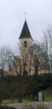
In the forest of Crécey-sur-Tille via the Vornay valley
 4.41 mi
+417 ft
-410 ft
2h 25
Easy
Departure from Crécey-sur-Tille (Côte-d'Or)
4.41 mi
+417 ft
-410 ft
2h 25
Easy
Departure from Crécey-sur-Tille (Côte-d'Or)
This route will take you to Crécey-sur-Tille Castle and its dovecote, wash houses, wayside crosses and the Church of Notre-Dame de la Nativité. This walk will also take you through the forest via the Combe Vornay to the north-east of the village.
In the footsteps of Gargantua around Marcilly-sur-Tille
4.73 mi
+174 ft
-180 ft
2h 20
Easy
Departure from Marcilly-sur-Tille (Côte-d'Or)
A short, easy walk around the village of Marcilly-sur-Tille, which is situated on the River Ignon and not on the River Tille as its name suggests, passing by the Étang de Venarde where you can see many birds (depending on the season). You’ll walk along the River Ignon, with its wash house and old mill, and reach Mont de Marcilly, where you’ll enjoy a magnificent view over the Tille Valley.
The Meuley Circuit in Is-sur-Tille
 Tourist office
 4.46 mi
+325 ft
-328 ft
2h 20
Easy
Departure from Is-sur-Tille (Côte-d'Or)
4.46 mi
+325 ft
-328 ft
2h 20
Easy
Departure from Is-sur-Tille (Côte-d'Or)
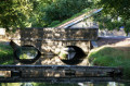
This route, partly through woodland, will allow you to discover the leat des Courtines, the market halls, the medieval defensive ditch and a viewpoint overlooking Mont de Marcilly
Hunting days: Sundays and public holidays. Côte-d’Or PDIPR route.
La Combe Marey, starting from Is-sur-Tille
 5.24 mi
+486 ft
-472 ft
2h 50
Easy
Departure from Is-sur-Tille (Côte-d'Or)
5.24 mi
+486 ft
-472 ft
2h 50
Easy
Departure from Is-sur-Tille (Côte-d'Or)
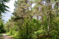
As you walk along the Combe Marey trail, some of Is-sur-Tille’s natural treasures are revealed to you. They lie hidden in the woods… This route will allow you to discover the limestone plateau overlooking Is-sur-Tille, the old Montchevreuil house and the small bell tower. Route recommended by the Tille and Ignon Valleys Tourist Office. Official route listed in the Côte-d’Or PDIPR.
Hunting days: Sundays and public holidays.
Les Mauritaines, departing from Is-sur-Tille
 6.71 mi
+574 ft
-571 ft
3h 35
Moderate
Departure from Is-sur-Tille (Côte-d'Or)
6.71 mi
+574 ft
-571 ft
3h 35
Moderate
Departure from Is-sur-Tille (Côte-d'Or)
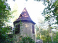
This forest route will allow you to discover the limestone plateau overlooking Is-sur-Tille, a wayside cross, a spring: the Marcevau fountain, and the small bell tower. The route, proposed by the Tille and Ignon Valleys Tourist Office, is listed in the Côte-d’Or PDIPR.
PDIPR: Departmental Plan for Walking and Hiking Routes.
Hunting days: Sundays and public holidays.