


Refine your search for walks in Domalain
Domalain walks

 La Vigne route
 Local authority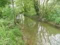
 8.96 mi
 +269 ft
 -262 ft
 4h 20
4h 20
 Moderate
 Departure from Bais (Ille-et-Vilaine)
Unfortunately, they have since disappeared, but in the 17th century, the region’s vineyards produced a wine of some renown. Madame de Sévigné, in fact, mentions it in several of her letters. Today, the only traces that remain are the names of local hamlets: Les Bourgeons, La Vigne, etc.
Over the final few kilometres, the route runs alongside the Quincampoix, a small river teeming with wildlife.
Vineyard Route No. 57 on the RANDO’ maps of the Vitré Community
Circuit de la Voie Romaine à Torcé
6.96 mi
+138 ft
-167 ft
3h 20
Moderate
Departure from Torcé (Ille-et-Vilaine)
Discover Torcé and its surroundings with this 11.4 km circular, which can be shortened to an 8 km route without the northern circular at Haut Montigné.
Circuit de Vassé-Pierre Galate, Torcé
 4.26 mi
+30 ft
-30 ft
2h 00
4.26 mi
+30 ft
-30 ft
2h 00
 Easy
Departure from Torcé (Ille-et-Vilaine)
Easy
Departure from Torcé (Ille-et-Vilaine)
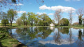
The Vassé Pond was created as ecological compensation for the construction of the Paris-Rennes high-speed rail line. There are educational panels on biodiversity and an old manor house. Many animals have found a home here, including sheep, Scottish cows, donkeys and ducks. Picnic tables, dry toilets, a shelter and a barbecue area are available.
Route des Onze Villages from Rannée
 6.95 mi
+138 ft
-135 ft
3h 20
Moderate
Departure from Rannée (Ille-et-Vilaine)
6.95 mi
+138 ft
-135 ft
3h 20
Moderate
Departure from Rannée (Ille-et-Vilaine)
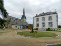
This route consists mainly of dirt tracks that were preserved during land consolidation, allowing you to discover the richness of the built heritage, particularly in the hamlets of La Perrière (17th-century manor house) and La Rinjardière. The southern section also follows the Roman road that linked Angers to Rennes. Magnificent stone bridges bear witness to this rich past.
This route has been awarded the FFRandonnée label.
Route Robert d’Arbrissel, Moussé
 6.42 mi
+135 ft
-135 ft
3h 05
Moderate
Departure from Moussé (Ille-et-Vilaine)
6.42 mi
+135 ft
-135 ft
3h 05
Moderate
Departure from Moussé (Ille-et-Vilaine)
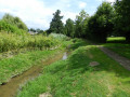
The name of the village comes from the Breton word ‘mouës’, meaning ‘wet place’. The southern part of the village is crossed by the Ruisseau de Drouges, whilst the Ardennes form a natural boundary to the north between Arbrissel and Moussé.
Don’t miss the Romanesque church of Arbrissel (12th century), the altarpiece and the life-size wooden statue of Robert d’Arbrissel, both dating from the 16th century.
Robert d’Arbrissel founded the Abbey of La Roë in 1096 and the Abbey of Fontevrault in 1101; his relics are on display at the monastery of Martigné-Briand in Maine-et-Loire.
This route is certified by the FFRandonnée.
Suitable for both walking and cycling.
The Chestnut Tree Route in Moulins
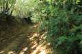 8.38 mi
+213 ft
-210 ft
4h 00
Moderate
Departure from Moulins (Ille-et-Vilaine) (Ille-et-Vilaine)
8.38 mi
+213 ft
-210 ft
4h 00
Moderate
Departure from Moulins (Ille-et-Vilaine) (Ille-et-Vilaine)
Enjoy the charm of the church square in Moulins, unspoilt by any overhead cables or aerials. This square served as the setting for the television series directed by Hervé Baslé in 2002: *Le Champ Dolent*.
Can be enjoyed on foot or by mountain bike.
Moulin Neuf, Grotte de la Vierge and Jardin du Hill in Argentré-du-Plessis
 Visorando Member4.30 mi
+171 ft
-177 ft
2h 10
Easy
Departure from Argentré-du-Plessis (Ille-et-Vilaine)
Visorando Member4.30 mi
+171 ft
-177 ft
2h 10
Easy
Departure from Argentré-du-Plessis (Ille-et-Vilaine)
A short, refreshing walk in lush green surroundings – a little time for yourself or with the family, combining nature with a touch of history. Whatever the season, you’ll be treated to magnificent colours.
The Heron Trail in Argentré-du-Plessis
3.84 mi
+102 ft
-102 ft
1h 50
Easy
Departure from Argentré-du-Plessis (Ille-et-Vilaine)
This idyllic route (No. 79 in the Vitré Communauté walking guide), set in the heart of the Argentré-du-Plessis bocage, south of Vitré, connects the town’s two old mills (Neuf aux Moines) and their ponds over a distance of just over six kilometres.
Route de Plessis-Sévigné, Argentré-du-Plessis
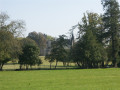 9.92 mi
+292 ft
-269 ft
4h 50
Moderate
Departure from Argentré-du-Plessis (Ille-et-Vilaine)
9.92 mi
+292 ft
-269 ft
4h 50
Moderate
Departure from Argentré-du-Plessis (Ille-et-Vilaine)
The village of Argentré-du-Plessis lived for five centuries in the shadow of the Château du Plessis. This family remained the owners of almost the entire village until the early 20th century, and Alain d’Argentré was mayor until 1983. You will pass close to the Château du Plessis during this walk.
Route certified by FFRandonnée.
Suitable for both walking and cycling.
The Chemin des Loups in Argentré-du-Plessis
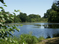 8.93 mi
+282 ft
-279 ft
4h 20
Moderate
Departure from Argentré-du-Plessis (Ille-et-Vilaine)
8.93 mi
+282 ft
-279 ft
4h 20
Moderate
Departure from Argentré-du-Plessis (Ille-et-Vilaine)
Wolves were very common in Brittany until the 19th century. The Argentré-du-Plessis region was no exception. Although its refuge was the Pertre forest, which we will cross in its western part, its hunting ground extended over the entire municipality, as evidenced by the names of certain localities such as Louveaudière, Cul de Loup and even the Bois de Noirloup, which we will pass by. But you can hike in complete safety, as the wolf has been extinct in the region for over a century.
Route of the Bichetière Stream Valleys in Cornillé
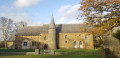 4.26 mi
+184 ft
-184 ft
2h 05
Easy
Departure from Cornillé (Ille-et-Vilaine) (Ille-et-Vilaine)
4.26 mi
+184 ft
-184 ft
2h 05
Easy
Departure from Cornillé (Ille-et-Vilaine) (Ille-et-Vilaine)
Cornillé is a small village with just under 1,000 inhabitants, first mentioned as early as 1049 in the cartulary of Saint-Melaine. Around 1500, the village boasted numerous manor houses, including the Château de la Bichetière and the Manoir de la Recoulais, which you can see on this route.
Suitable for both walking and mountain biking.
Route des Poachers, Drouges
 7.30 mi
+200 ft
-174 ft
3h 30
Moderate
Departure from Drouges (Ille-et-Vilaine)
7.30 mi
+200 ft
-174 ft
3h 30
Moderate
Departure from Drouges (Ille-et-Vilaine)
The Guerche Forest is ever-present on this route, whether you follow its southern edge or it closes off the horizon to the north. Beautiful architecture typical of the Pays Guerchais in Drouges and its many villages.
The Salé to Brielles route
7.11 mi
+131 ft
-105 ft
3h 25
Moderate
Departure from Brielles (Ille-et-Vilaine)
Centred around its church and the square surrounding it, the village of Brielles has largely retained the layout it had in 1810, the year the so-called ‘Napoleonic’ land register was drawn up.
Also worth mentioning in the commune is the breeding of Kobe cattle (a Japanese breed), whose meat is highly prized by gourmets.
This route can be tackled on foot or by mountain bike.
La route de la Crossonière in Brielles
 10.18 mi
+331 ft
-308 ft
5h 00
Moderate
Departure from Brielles (Ille-et-Vilaine)
10.18 mi
+331 ft
-308 ft
5h 00
Moderate
Departure from Brielles (Ille-et-Vilaine)
Although the high-speed rail line (LGV) runs through Brielles from east to west, the town, together with the neighbouring commune of Le Pertre, offers a network of beautiful trails.Suitable for both walking and mountain biking.
Route de la Valière, Vitré
 5.64 mi
+39 ft
-39 ft
2h 40
Easy
Departure from Vitré (Ille-et-Vilaine)
5.64 mi
+39 ft
-39 ft
2h 40
Easy
Departure from Vitré (Ille-et-Vilaine)
This reservoir, which has supplied drinking water since 1978, is also used to control flood peaks and maintain low water levels as required.
This route is FFRandonnée-certified. It can be enjoyed on foot or by bike.
The Cinq Chemins route in Argentré-du-Plessis
3.57 mi
+164 ft
-164 ft
1h 45
Easy
Departure from Argentré-du-Plessis (Ille-et-Vilaine)
A short circular route through the countryside between Argentré-du-Plessis and Le Pertre.
The Theil and La Rigaudière forest route
 Association / Club / Walk leader12.39 mi
+371 ft
-364 ft
6h 00
Moderate
Departure from Essé (Ille-et-Vilaine) (Ille-et-Vilaine)
Association / Club / Walk leader12.39 mi
+371 ft
-364 ft
6h 00
Moderate
Departure from Essé (Ille-et-Vilaine) (Ille-et-Vilaine)
The route starts at the Roche aux Fées dolmen, the best-preserved iconic monument in Europe. The walk takes you through meadows and fields, perfect for relaxation. The crossing of Theil-de-Bretagne is fairly short, so you can take the opportunity to stop at the wash house park. The route continues through the hamlet of La Rigaudiére and the pond of the same name.
Route de la Rigaudière via La Roche aux Fées
8.12 mi
+246 ft
-243 ft
3h 55
Moderate
Departure from Essé (Ille-et-Vilaine) (Ille-et-Vilaine)
This is a short circular variation on the walk known as the ‘Boucle dans la campagne du Theil-de-Bretagne’ starting from La Roche aux Fées (no.88594830)
The circular route starts at the Allée couverte de la Roche aux Fées, an iconic monument that is extremely well preserved. Le Theil de Bretagne is a predominantly rural commune, rich in architectural, religious and natural heritage. The Résidence Bon Abri, the Notre-Dame de Beauvais Chapel (listed as a Historic Monument), the Château de La Rigaudière, and the Church, with its patriotic stained-glass windows, are just a few examples. This countryside walk crosses the commune of Le Theil-de-Bretagne.
A stroll through Vitré
 4.81 mi
+194 ft
-194 ft
2h 25
Easy
Departure from Vitré (Ille-et-Vilaine)
4.81 mi
+194 ft
-194 ft
2h 25
Easy
Departure from Vitré (Ille-et-Vilaine)
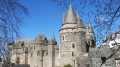
Whether you’re exploring this ‘City of Art and History’ or simply taking a stroll, here’s a short route that takes you through the historic quarter, past the castle, along narrow streets and through the Jardin du Parc.
Sightseeing tour of Vitré
 5.34 mi
+243 ft
-217 ft
2h 40
Easy
Departure from Vitré (Ille-et-Vilaine)
5.34 mi
+243 ft
-217 ft
2h 40
Easy
Departure from Vitré (Ille-et-Vilaine)
Explore the historic heart of Vitré, a town of art and history, with its streets and alleyways dating back to medieval times.Stroll and wander in search of hidden gems with this route taking in all the must-see sights.A real getaway into the heart of history and the Vitré way of life! Finish the walk with a visit to the medieval castle.Follow the step-by-step guide rather than the GPX track for ease of use.
Sightseeing tour of Vitré
 5.33 mi
+177 ft
-157 ft
2h 35
Easy
Departure from Vitré (Ille-et-Vilaine)
5.33 mi
+177 ft
-157 ft
2h 35
Easy
Departure from Vitré (Ille-et-Vilaine)
Stroll through the historical heart of Vitré, city of art and history, with its medieval streets and alleys.
Wander in quest of the heritage wonders with this trail.
A true escape through history and the vitréen "art de vivre".
End the walk by a visit of the medieval castle and its museum before going back to the starting point.
Follow the description rather than the GPX tracks.
The historic railway route between Argentré-du-Plessis and Vitré
 6.58 mi
+308 ft
-308 ft
3h 20
6.58 mi
+308 ft
-308 ft
3h 20
 Difficult
Departure from Vitré (Ille-et-Vilaine)
Difficult
Departure from Vitré (Ille-et-Vilaine)
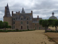
As its name suggests, it is clear that this route follows the greenway for a considerable distance, along which the railway line to Argentré-du-Plessis and then La Guerche-de-Bretagne once ran. It is now reserved for walkers, hikers and cycle tourists.
The route continues with a brief glimpse of Madame de Sévigné’s residence before returning towards Vitré via small, shaded roads and paths.
From Vitré to Argentré-du-Plessis via the Valière lake
 13.51 mi
+377 ft
-390 ft
6h 35
Difficult
Departure from Vitré (Ille-et-Vilaine)
13.51 mi
+377 ft
-390 ft
6h 35
Difficult
Departure from Vitré (Ille-et-Vilaine)
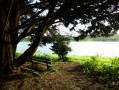
This route is the first stage of a 96 km circular through the Vitré countryside. Consisting mainly of sunken lanes, this route will take you, among other places, to the Château des Rochers-Sévigné and the Valière lake.
The Pré des Lavandières route in Vitré
 2.84 mi
+174 ft
-148 ft
1h 30
Easy
Departure from Vitré (Ille-et-Vilaine)
2.84 mi
+174 ft
-148 ft
1h 30
Easy
Departure from Vitré (Ille-et-Vilaine)
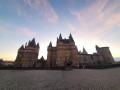
This route will take you on a timeless stroll through the medieval alleyways of old Vitré. You’ll also have the chance to explore the Pré des Lavandières and the Promenade du Val.
Signposted in a clockwise direction.
FFRP-certified route.
The Green World circular in Mondevert
 6.32 mi
+102 ft
-102 ft
3h 00
Moderate
Departure from Mondevert (Ille-et-Vilaine)
6.32 mi
+102 ft
-102 ft
3h 00
Moderate
Departure from Mondevert (Ille-et-Vilaine)
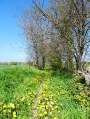
A circular route through the Mondevert countryside which also passes close to the Pertre Forest.
Route de la Vilaine, Saint-Didier
8.18 mi
+361 ft
-371 ft
4h 05
Moderate
Departure from Saint-Didier (Ille-et-Vilaine) (Ille-et-Vilaine)
Take a stroll through the countryside around Saint-Didier on this route which runs alongside a stretch of the River Vilaine. You’ll pass close to the Peinière Chapel, a place of pilgrimage which, every 15 August and on the Sunday closest to the Feast of the Nativity in early September, attracts thousands of Catholics from across the department (and even beyond) to celebrate the Virgin Mary. Stop for a moment to admire the mosaics created by the Odorico brothers that adorn the altars.
Menhir Trail (Champeaux)
 3.03 mi
+138 ft
-138 ft
1h 30
Easy
Departure from Champeaux (Ille-et-Vilaine)
3.03 mi
+138 ft
-138 ft
1h 30
Easy
Departure from Champeaux (Ille-et-Vilaine)
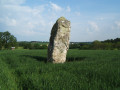
Take a stroll along the Plan d’Eau de la Cantache, a leisure area much loved by locals: fishing, birdwatching, walking… You’ll pass close to the Haute Pierre menhir.
FFR-certified route, marked with yellowPR® signs, supplemented by green arrows bearing the number 15 (anti-clockwise). Suitable for both walking and mountain biking.
In the Corbière Forest, starting from Saint-Jean-sur-Vilaine
 8.25 mi
+361 ft
-361 ft
4h 05
Moderate
Departure from Saint-Jean-sur-Vilaine (Ille-et-Vilaine)
8.25 mi
+361 ft
-361 ft
4h 05
Moderate
Departure from Saint-Jean-sur-Vilaine (Ille-et-Vilaine)
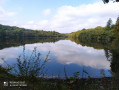
Wide forest lanes, a walk through the woods where only birdsong can be heard, plus a pond where large waterbirds reign supreme and fish provide their meal – this is the ultimate aim of this walk, which will end as it began: on sunken paths through the bocage, with very little tarmac.
The Gaudinais route on the RANDO’ maps of the Vitré Community
Châteaubourg circular route via Pont Riou
 3.64 mi
+98 ft
-79 ft
1h 45
Easy
Departure from Châteaubourg (Ille-et-Vilaine) (Ille-et-Vilaine)
3.64 mi
+98 ft
-79 ft
1h 45
Easy
Departure from Châteaubourg (Ille-et-Vilaine) (Ille-et-Vilaine)
A short, easy walk to get some fresh air.
Route des deux Vallons in Châteaubourg
 6.22 mi
+331 ft
-331 ft
3h 10
Easy
Departure from Châteaubourg (Ille-et-Vilaine) (Ille-et-Vilaine)
6.22 mi
+331 ft
-331 ft
3h 10
Easy
Departure from Châteaubourg (Ille-et-Vilaine) (Ille-et-Vilaine)
This route will take you through the rolling countryside of Châteaubourg. You will also pass close to the Vilaine river, which winds its way through the entire department. This hike can be done on foot or by mountain bike.
FFRP-certified route.
Route des étangs, Châteaubourg
 9.24 mi
+315 ft
-315 ft
4h 30
Moderate
Departure from Châteaubourg (Ille-et-Vilaine) (Ille-et-Vilaine)
9.24 mi
+315 ft
-315 ft
4h 30
Moderate
Departure from Châteaubourg (Ille-et-Vilaine) (Ille-et-Vilaine)
This route will take you through the Châteaubourg countryside where, as its name suggests, there are several ponds: Pont de Pierre Pond, Roches Bises Pond and Grand Fayelle Pond. You will also walk along a small section of the Corbière Forest.
This route is FFRandonnée certified. It can be done on foot or by bike.
Route of the Lisière Trail in Marpiré
 10.81 mi
+236 ft
-236 ft
5h 10
Moderate
Departure from Marpiré (Ille-et-Vilaine)
10.81 mi
+236 ft
-236 ft
5h 10
Moderate
Departure from Marpiré (Ille-et-Vilaine)
After walking through the undergrowth of the Chevré Forest, you will discover this vast plateau via wide paths and small country lanes, where fields of grain blend with green meadows, ending as you began with a walk through the Bois de Briérue and the Orée du Bois lake near La Lisière.
 Tourist office