The Heron Trail in Argentré-du-Plessis

This idyllic route (No. 79 in the Vitré Communauté walking guide), set in the heart of the Argentré-du-Plessis bocage, south of Vitré, connects the town’s two old mills (Neuf aux Moines) and their ponds over a distance of just over six kilometres.

Details

35309694
Creation:
Last update:
Last review:
  • Walking
    Activity: Walking
  • ↔
    Distance: 3.84 mi
  • ◔
    Average duration: 1h 50 
  • ▲
    Difficulty: Easy

  • ⚐
    Back to start: Yes
  • ↗
    Ascent: + 102 ft
  • ↘
    Descent: - 102 ft

  • ▲
    Highest point: 335 ft
  • ▼
    Lowest point: 259 ft

Description of the walk

The route starts from the Moulin Neuf car park (17th century) in Argentré-du-Plessis (accessible by bike via the greenway from Vitré and by car), where there is free parking.

Blue PR® signposting supplemented by green arrows marked with the number 79. The route is signposted in a clockwise direction.

(S/E) From the car park, head east and walk along the Étang du Moulin Neuf on your right. At the far end of the pond, continue straight ahead on the path. At a Fork in the road, turn right. Cross a footbridge over a stream and you’ll immediately reach a junction.

(1) Turn left and follow the stream on your left.

(2) At the next junction, carry on straight ahead along the stream.

(3) At the next junction, turn right. A short circular loop takes you to the waterfall beneath the Moulin aux Moines weir. Follow the stream for 30 metres so that you can cross it, then take the steps to reach the road on the weir. Follow this road to the left.

(4) When the road turns sharply to the left, take a path on the right and walk alongside the Étang du Moulin aux Moines on your right. At the far end of the pond, go straight on until you reach a road. Continue along the north bank of the pond until you reach the road.

(5) Take the road on the right, passing the turn-off for the hamlet of l’Épine on your right.

(6) Just before a three-way junction, leave the road and take a dirt track on the right. Continue along a slope.

(7) At a junction, turn right towards the Ruisseau des Cinq Fontaines. Shortly afterwards, cross the stream via a wooden footbridge. Immediately after, at a junction, turn right. The path gradually leads to the far end of the Étang du Moulin aux Moines. Walk along the right-hand side of the pond until you reach its dam.

(8) Then follow the road to the left as far as La Péraudière.

(9) At the junction, turn right, passing houses on your left. Follow a dirt track leading towards the woods. At the entrance to the woods, turn right to reach a junction you passed on the way there.

(2) Turn left and walk alongside the stream on your right.

(1) At the next junction, turn left and keep some distance from the stream, which remains on your right. Ignore all the paths branching off to the left and head for the southern shore of the Étang du Moulin Neuf.

(10) Follow the pond on your right, rejoin its embankment and you’ll soon reach the starting point (S/E).


Waypoints

  1. S/E : mi 0 - alt. 262 ft - North bank of the - Étang du Moulin Neuf (Argentré-du-Plessis)
  2. 1 : mi 0.47 - alt. 266 ft - Junction with the Western Circular Loop
  3. 2 : mi 0.53 - alt. 269 ft - Junction with the eastern circular loop
  4. 3 : mi 0.67 - alt. 266 ft - Junction – Access to a waterfall
  5. 4 : mi 0.87 - alt. 289 ft - Étang du Moulin aux Moines
  6. 5 : mi 1.44 - alt. 302 ft - Road junction
  7. 6 : mi 1.81 - alt. 335 ft - Start of the dirt track
  8. 7 : mi 2.17 - alt. 292 ft - Junction
  9. 8 : mi 2.83 - alt. 292 ft - Dike of the - Étang du Moulin aux Moines
  10. 9 : mi 2.92 - alt. 315 ft - La Péraudière – Dirt track
  11. 10 : mi 3.62 - alt. 259 ft - South bank of the - Étang du Moulin Neuf (Argentré-du-Plessis)
  12. S/E : mi 3.84 - alt. 262 ft - North bank of the - Étang du Moulin Neuf (Argentré-du-Plessis)

Notes

At the start, you’ll find a drinking fountain, toilets and free car park.

Worth a visit

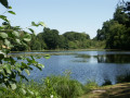
Discover the flora and fauna of the Moulins Neuf and Aux Moines ponds in Argentré-du-Plessis, including some fine specimens of herons. These ponds are well-known and popular with anglers.
You can admire a waterfall at the start of the trail, which has a particularly strong flow during the off-season.

Always be cautious and plan ahead when you're outdoors. Visorando and the author of this route cannot be held responsible for any accidents occurring on this route.

The GR® and PR® markings are the intellectual property of the Fédération Française de Randonnée Pédestre.

Reviews and comments

3.9 / 5
Based on 3 reviews

Reliability of the description
4 / 5
Ease of following the route
3.3 / 5
Route interest
4.3 / 5
Squirrel33
Squirrel33

Overall rating : 4.7 / 5

Date of your route : Sep 01, 2025
Reliability of the description : ★★★★★ Very good
Ease of following the route : ★★★★☆ Good
Route interest : ★★★★★ Very good
Very busy route : No

Very pretty route

Quite easy to follow, just along the second lake, take the path a little higher up along the trees and not along the shore

otherwise, no problems

Squirrell33

Machine-translated

Vitré Communauté
Vitré Communauté

Hello

Thank you
this route is featured in the new hiking guide available at the tourist office since the beginning of the year.

Kind regards

Machine-translated

User 26682308

Overall rating : 4.3 / 5

Date of your route : Aug 07, 2025
Reliability of the description : ★★★★☆ Good
Ease of following the route : ★★★★☆ Good
Route interest : ★★★★★ Very good
Very busy route : Yes

Alternates between sunny fields, small shaded paths and two ponds, with little road traffic and easy to follow. This is very welcome, especially as it is very well signposted, even though it does not appear on the maps sold at the tourist office.

Machine-translated

Thierry Auger
Thierry Auger

Overall rating : 2.7 / 5

Date of your route : Jul 28, 2024
Reliability of the description : ★★★☆☆ Average
Ease of following the route : ★★☆☆☆ Disappointing
Route interest : ★★★☆☆ Average
Very busy route : Yes

At point 5, the signpost pointing towards the hamlet of L’Epine is damaged and the sign is not visible
It would be better to walk along the southern shore of the pond towards La Péraudière
Thank you very much

Machine-translated

Other walks in the area

For more walks, use our search engine .

The GPS track and description are the property of this route's author. Please do not copy them without permission.