The Salé to Brielles route

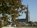
Centred around its church and the square surrounding it, the village of Brielles has largely retained the layout it had in 1810, the year the so-called ‘Napoleonic’ land register was drawn up.
Also worth mentioning in the commune is the breeding of Kobe cattle (a Japanese breed), whose meat is highly prized by gourmets.
This route can be tackled on foot or by mountain bike.

Details

n°31476068
Creation:
Last update:
Last review:
  • Walking
    Activity: Walking
  • ↔
    Distance: 7.11 mi
  • ◔
    Average duration: 3h 25 
  • ▲
    Difficulty: Moderate

  • ⚐
    Back to start: Yes
  • ↗
    Ascent: + 131 ft
  • ↘
    Descent: - 105 ft

  • ▲
    Highest point: 358 ft
  • ▼
    Lowest point: 240 ft
  • ⚐ Country: France
  • ⚐ City: Brielles (35370)
  • ⚑
    Start/End: N 48.007078° / W 1.09243°
  • ❏
    IGN map(s): Ref. 1319SB, 1419SB
  • Hour-by-hour weather

Description of the walk

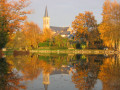
Start at the Étang du Val Fleuri.
Route signposted in a clockwise direction.
YellowPR® signposting supplemented by green arrows marked with the number 50.

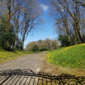
(S/E) Set off in the opposite direction to the village. Follow the road for 250 m, then, at the bend, turn left onto a country lane which becomes a dirt track; cross the Ruisseau de Salé and continue to a T-junction.

(1) Turn left, then take the first road on the right 100 metres further on. Cross the farmyard, then turn right immediately afterwards. Follow the track. At the T-junction, turn right and continue to Haut Brinbeau. Turn left to join the D37.

(2) Turn right, then immediately left onto a small track. Follow it, turn right to follow the edge of the field and continue to a T-junction. Turn right, then immediately left, and continue to a road. Turn left to cross over the railway line.

(3) Once on the other side, take the first road on the right and follow it. Then leave it to take a track on the left which leads to Haut Charil.

(4) Pass the farm on your left and carry on to the right, following the road.

(5) Cross the multi-way junction and carry on straight ahead to the hamlet of Les Communs.

(6) Turn right just before the houses and follow the track. Walk alongside a field, then turn left at the end of it and walk to a T-junction.

(7) Turn right and join the road. At the end of the road, turn right to go under the railway line. Once on the other side, take the D43 to the left, then turn right. Follow the road to the first junction.

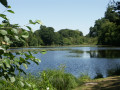
(8) Keep to the left and continue until you reach a pond. Then veer right and walk until you reach a road at a place called La Rubinière de la Marche.

(9) Turn right, pass L’Écachoire, La Selle and La Poulardière, then turn onto a path on the left. Follow this path alongside the fields until you reach another road leading to La Mare.

(10) Turn right and continue to the Croix Chemin.

(11) Turn left towards La Chopardière, then follow the path on the right which winds its way before emerging onto Allée des Portes opposite Brielles Town Hall. Turn left, continue straight on through the bend to follow the path which bends to the right and further on joins Allée des Portes and then Rue d’Anjou (D43).

Cross the road carefully and head straight ahead to quickly reach the Étang du Val Fleuri (S/E).

Waypoints

  1. S/E : mi 0 - alt. 256 ft - Étang du Val Fleuri
  2. 1 : mi 0.85 - alt. 295 ft - T-junction
  3. 2 : mi 1.55 - alt. 289 ft - D37
  4. 3 : mi 2.3 - alt. 272 ft - La Pavière
  5. 4 : mi 2.77 - alt. 335 ft - Haut Charil Farm
  6. 5 : mi 3.29 - alt. 338 ft - Multiple junctions
  7. 6 : mi 3.68 - alt. 351 ft - Les Communs
  8. 7 : mi 3.96 - alt. 338 ft - T-junction
  9. 8 : mi 4.43 - alt. 322 ft - Junction
  10. 9 : mi 5.06 - alt. 295 ft - Road, La Rubinière de la Marche
  11. 10 : mi 5.94 - alt. 292 ft - Access to the Mare
  12. 11 : mi 6.38 - alt. 302 ft - La Croix Chemin
  13. S/E : mi 7.11 - alt. 256 ft - Étang du Val Fleuri

Notes

Car park, picnic area and toilets near the starting point.

Worth a visit

Étang du Val Dleuri.

Always be cautious and plan ahead when you're outdoors. Visorando and the author of this route cannot be held responsible for any accidents occurring on this route.

The GR® and PR® markings are the intellectual property of the Fédération Française de Randonnée Pédestre.

Reviews and comments

4 / 5
Based on 2 reviews

Reliability of the description
4.5 / 5
Ease of following the route
4 / 5
Route interest
3.5 / 5
User 15265167

Overall rating : 4 / 5

Date of your route : Apr 13, 2026
Reliability of the description : ★★★★★ Very good
Ease of following the route : ★★★★☆ Good
Route interest : ★★★☆☆ Average
Very busy route : Yes

A route popular with hikers, motocross riders (who cause a lot of damage to the dirt tracks in wet weather) and mountain bikers. Some sections are impassable.

Machine-translated

bonchampois
bonchampois
• Edited:

Overall rating : 4 / 5

Date of your route : Mar 20, 2023
Reliability of the description : ★★★★☆ Good
Ease of following the route : ★★★★☆ Good
Route interest : ★★★★☆ Good
Very busy route : Yes

A route popular with walkers, mountain bikers and quad bikers in places, which isn’t ideal

Machine-translated

Other walks in the area

For more walks, use our search engine .

The GPS track and description are the property of this route's author. Please do not copy them without permission.