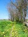
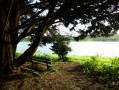
Route de la Valière, Vitré

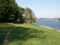
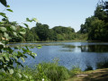
This reservoir, which has supplied drinking water since 1978, is also used to control flood peaks and maintain low water levels as required.

This route is FFRandonnée-certified. It can be enjoyed on foot or by bike.

Details

30548739
Creation:
Last update:
Last review:
  • Walking
    Activity: Walking
  • ↔
    Distance: 5.64 mi
  • ◔
    Average duration: 2h 40 
  • ▲
    Difficulty: Easy

  • ⚐
    Back to start: Yes
  • ↗
    Ascent: + 39 ft
  • ↘
    Descent: - 39 ft

  • ▲
    Highest point: 344 ft
  • ▼
    Lowest point: 279 ft
  • ⚐ Country: France
  • ⚐ City: Vitré (35500)
  • ⚑
    Start/End: N 48.08471° / W 1.165018°
  • ❏
    IGN map(s): Ref. 1318SB
  • Hour-by-hour weather

Photos

Description of the walk

YellowPR® signposting supplemented by green arrows marked with the number 71. Signposted in a clockwise direction, this route circles Lake de la Valière.

There are several starting points around the lake, all with car parks. This route starts from the car park near the Equestrian Centre to the south-west of the lake.

(S/E) From the car park, set off to walk round the lake in a clockwise direction. Always follow the yellow markings and the green arrows marked 71.

(1) You can take a shortcut to the right; the small 2km circular loop to the north should be avoided in wet weather.

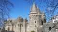
(2) From the embankment, take a moment to admire the roof of the Château des Rochers Sévignés (S/E).

Waypoints

  1. S/E : mi 0 - alt. 305 ft - Car park - Plan d'Eau de la Valière
  2. 1 : mi 1.69 - alt. 295 ft - Shortcut
  3. 2 : mi 5.32 - alt. 295 ft - Dike
  4. S/E : mi 5.64 - alt. 305 ft - Car park - Plan d'Eau de la Valière

Notes

Worth a visit

Sévigné Castle and Les Rochers Woods
Les Rochers Golf Course
Town of Vitré
Option to link up with the Plessis Sévigné route, which heads towards Argentré-du-Plessis (No. 47)

Always be cautious and plan ahead when you're outdoors. Visorando and the author of this route cannot be held responsible for any accidents occurring on this route.

The GR® and PR® markings are the intellectual property of the Fédération Française de Randonnée Pédestre.

Reviews and comments

4.8 / 5
Based on 2 reviews

Reliability of the description
5 / 5
Ease of following the route
5 / 5
Route interest
4.5 / 5
lagire
lagire
• Edited:

Overall rating : 5 / 5

Date of your route : Jul 04, 2019
Reliability of the description : ★★★★★ Very good
Ease of following the route : ★★★★★ Very good
Route interest : ★★★★★ Very good
Very busy route : No

A lovely, pleasant walk near the lake and the castle.

Machine-translated

lou17lou17
lou17lou17

Overall rating : 4.7 / 5

Date of your route : Jun 03, 2025
Reliability of the description : ★★★★★ Very good
Ease of following the route : ★★★★★ Very good
Route interest : ★★★★☆ Good
Very busy route : No

Easy and pleasant walk, the only negative point is the car park. It's very difficult to find where to park.

Machine-translated

Other walks in the area

For more walks, use our search engine .

The GPS track and description are the property of this route's author. Please do not copy them without permission.