Country:
 City:
City:


Park in the car park near the town hall.
YellowPR® signposting supplemented by green arrows marked with the number 77. The route is signposted in an anti-clockwise direction.
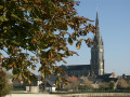
(S/E) Leave the car park and head right towards the church.
(1) Cross the road at the pedestrian crossing and continue straight ahead until you leave the village. Go round the roundabout on the right, cross over the dual carriageway and carry on to the next roundabout.
(2) Take the second exit on the left, walk for about 150 metres, then turn left again onto the small road leading to La Fromandière.
(3) Turn left, go under the dual carriageway and carry on straight ahead until you reach a Y-junction at Poncéard. Head left, then take the first path on the right and follow it until you reach a T-junction.
(4) Turn right and carry on straight ahead until you reach the D111.
(5) Cross it carefully and turn left towards the hamlet known as Le Chemin. Pass it and carry on straight ahead until you reach Petite Boulais.
(6) Pass the first field on the left and, at the corner of this field, turn left at a 90° angle onto the path running alongside it. Follow this path to the road, then turn right and follow it until you arrive opposite Le Houx Vert.
(7) Cross the road carefully and carry on straight ahead. A little further on, turn left at the edge of the woodland; this leads onto a small road which you follow straight on until you reach the Chêne Matignon.
(8) Turn right, then take the first road on the left. After just under 600 m, turn left into Rue des Étangs. At the end of the street, turn right once, then right again. Then turn left onto a small path leading to a lake.
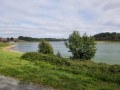
(9) Continue straight ahead along the left bank of the lake and follow the path back to the starting point at the car park (S/E).

 Local authority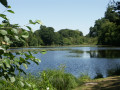

 Easy
Easy 
 Visorando Member