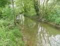
Route of the Bichetière Stream Valleys in Cornillé

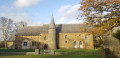
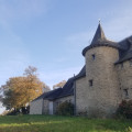
Cornillé is a small village with just under 1,000 inhabitants, first mentioned as early as 1049 in the cartulary of Saint-Melaine. Around 1500, the village boasted numerous manor houses, including the Château de la Bichetière and the Manoir de la Recoulais, which you can see on this route.
Suitable for both walking and mountain biking.

Details

31223453
Creation:
Last update:
Last review:
  • Walking
    Activity: Walking
  • ↔
    Distance: 4.26 mi
  • ◔
    Average duration: 2h 05 
  • ▲
    Difficulty: Easy

  • ⚐
    Back to start: Yes
  • ↗
    Ascent: + 184 ft
  • ↘
    Descent: - 184 ft

  • ▲
    Highest point: 335 ft
  • ▼
    Lowest point: 213 ft

Photos

Description of the walk

Start at Cornillé Town Hall.
The route is signposted in an anti-clockwise direction.
YellowPR®signposting supplemented by green arrows marked with the number 76.

(S/E) From the starting point, head towards the church. Follow the street that runs past it and leave the village. Continue to the hamlet of La Bichetière.

(1) Turn left, follow the road, then turn right at Bas Passay. Follow the signposting and walk along the fields until you reach Les Masures.

(2) Turn left and follow the road to Saint-Aubin-des-Landes.

(3) At the roundabout, turn left, then take the first right and follow the track to La Bouchardière.

(4) Turn left onto the road.

(4) Carry on straight ahead until you return to the village of Cornillé. Continue along the main street – first Rue du Presbytère, then Rue Jean Guillet – to return to the starting point (S/E).


Waypoints

  1. S/E : mi 0 - alt. 325 ft - Cornillé Town Hall
  2. 1 : mi 0.53 - alt. 276 ft - La Bichetière
  3. 2 : mi 1.96 - alt. 305 ft - Les Masures
  4. 3 : mi 2.72 - alt. 223 ft - Saint-Aubin-des-Landes, roundabout
  5. 4 : mi 3.24 - alt. 262 ft - La Bouchardière
  6. S/E : mi 4.26 - alt. 325 ft - Cornillé Town Hall

Notes

Car park and toilets near the starting point.

Always be cautious and plan ahead when you're outdoors. Visorando and the author of this route cannot be held responsible for any accidents occurring on this route.

The GR® and PR® markings are the intellectual property of the Fédération Française de Randonnée Pédestre.

Reviews and comments

4.3 / 5
Based on 2 reviews

Reliability of the description
4.5 / 5
Ease of following the route
4.5 / 5
Route interest
4 / 5
pa2pa2
pa2pa2

Overall rating : 4.7 / 5

Date of your route : Sep 06, 2026
Reliability of the description : ★★★★★ Very good
Ease of following the route : ★★★★★ Very good
Route interest : ★★★★☆ Good
Very busy route : No

Well, I haven't seen many manor houses, though.

Machine-translated

domivasseur2935
domivasseur2935

Overall rating : 4 / 5

Date of your route : Nov 20, 2023
Reliability of the description : ★★★★☆ Good
Ease of following the route : ★★★★☆ Good
Route interest : ★★★★☆ Good
Very busy route : No

The route is quite nice, taking you past two very beautiful manor houses/castles. There are two minor drawbacks: there are a lot of tarmac roads, and the rather unpleasant hum of cars on the motorway throughout the first half of the ride.

Machine-translated

Other walks in the area

For more walks, use our search engine .

The GPS track and description are the property of this route's author. Please do not copy them without permission.