Route Robert d’Arbrissel, Moussé

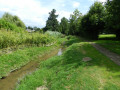
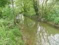
The name of the village comes from the Breton word ‘mouës’, meaning ‘wet place’. The southern part of the village is crossed by the Ruisseau de Drouges, whilst the Ardennes form a natural boundary to the north between Arbrissel and Moussé.
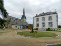
Don’t miss the Romanesque church of Arbrissel (12th century), the altarpiece and the life-size wooden statue of Robert d’Arbrissel, both dating from the 16th century.
Robert d’Arbrissel founded the Abbey of La Roë in 1096 and the Abbey of Fontevrault in 1101; his relics are on display at the monastery of Martigné-Briand in Maine-et-Loire.
This route is certified by the FFRandonnée.
Suitable for both walking and cycling.

Details

n°30517026
Creation:
Last update:
Last review:
  • Walking
    Activity: Walking
  • ↔
    Distance: 6.42 mi
  • ◔
    Average duration: 3h 05 
  • ▲
    Difficulty: Moderate

  • ⚐
    Back to start: Yes
  • ↗
    Ascent: + 135 ft
  • ↘
    Descent: - 135 ft

  • ▲
    Highest point: 256 ft
  • ▼
    Lowest point: 177 ft
  • ⚐ Country: France
  • ⚐ City: Moussé (35130)
  • ⚑
    Start/End: N 47.92256° / W 1.269953°
  • ❏
    IGN map(s): Ref. 1319SB
  • Hour-by-hour weather

Photos

Description of the walk

Starts at the Parc de l’Ardenne.
Signposted in a clockwise direction.
YellowPR®signposting supplemented by green arrows marked with thenumber 64.

(S/E) From the starting point, head towards Rue de Drouges. Turn left onto this road and follow it for about a hundred metres until you reach a dirt track on the right.

(1) Follow this track until you reach a Fork in the road, then take the left-hand fork until you reach a road at a place called Le Plessis.

(2) Turn right and continue to La Bretonnière. Take the first street on the left, in the bend, and follow the path.

(3) Cross the Ruisseau de Drouges, ignore aPR® sign on the left and arrive at a T-junction.

(4) Turn right, then take the second left and follow the track that runs alongside the field to the hamlet of Brault.

(5) Just after the bend, take the dirt track on the left which joins a road. Pass the sewage treatment plant and follow this road. Cross the D47 with care to reach the village of Arbrissel.

(6) Turn right onto the Route de la Chapelle and carry on straight ahead until you reach the hamlet of Garmont.

(7) At the end of the village, turn left onto a path heading due north. Follow the yellowPR® markings and the green 64 arrows until you come out behind a housing estate.

(8) Turn left once, then left again, to go round the housing estate, then carry on straight ahead. Cross the D47 carefully once more to return to the starting point (S/E).

Waypoints

  1. S/E : mi 0 - alt. 190 ft - Ardenne Park
  2. 1 : mi 0.09 - alt. 190 ft - Dirt track junction - Aedenne (rivière)
  3. 2 : mi 0.57 - alt. 226 ft - Le Plessis
  4. 3 : mi 1.23 - alt. 194 ft - Drouges stream
  5. 4 : mi 2.12 - alt. 249 ft - T-junction
  6. 5 : mi 2.86 - alt. 187 ft - Brault
  7. 6 : mi 3.63 - alt. 223 ft - Arbrissel village
  8. 7 : mi 4.72 - alt. 256 ft - Exit at the hamlet of Garmont
  9. 8 : mi 6.11 - alt. 207 ft - Housing estate
  10. S/E : mi 6.42 - alt. 190 ft - Ardenne Park

Notes

Car park and picnic area near the starting point.

Worth a visit

Always be cautious and plan ahead when you're outdoors. Visorando and the author of this route cannot be held responsible for any accidents occurring on this route.

The GR® and PR® markings are the intellectual property of the Fédération Française de Randonnée Pédestre.

Reviews and comments

4.2 / 5
Based on 2 reviews

Reliability of the description
4 / 5
Ease of following the route
4.5 / 5
Route interest
4 / 5
CASEON35
CASEON35

Overall rating : 4 / 5

Date of your route : Apr 29, 2026
Reliability of the description : ★★★★☆ Good
Ease of following the route : ★★★★★ Very good
Route interest : ★★★☆☆ Average
Very busy route : No

A gentle, flat walk with no difficulty
1/3 tarmac (very quiet roads) and 2/3 tracks.
Pleasant but not particularly interesting

Machine-translated

bonchampois
bonchampois

Overall rating : 4.3 / 5

Date of your route : Feb 24, 2023
Reliability of the description : ★★★★☆ Good
Ease of following the route : ★★★★☆ Good
Route interest : ★★★★★ Very good
Very busy route : Yes

visited, yes, but not all of it

Machine-translated

Other walks in the area

For more walks, use our search engine .

The GPS track and description are the property of this route's author. Please do not copy them without permission.