Route des Onze Villages from Rannée

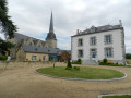
This route consists mainly of dirt tracks that were preserved during land consolidation, allowing you to discover the richness of the built heritage, particularly in the hamlets of La Perrière (17th-century manor house) and La Rinjardière. The southern section also follows the Roman road that linked Angers to Rennes. Magnificent stone bridges bear witness to this rich past.
This route has been awarded the FFRandonnée label.

Details

30547233
Creation:
Last update:
Last review:
  • Walking
    Activity: Walking
  • ↔
    Distance: 6.95 mi
  • ◔
    Average duration: 3h 20 
  • ▲
    Difficulty: Moderate

  • ⚐
    Back to start: Yes
  • ↗
    Ascent: + 138 ft
  • ↘
    Descent: - 135 ft

  • ▲
    Highest point: 295 ft
  • ▼
    Lowest point: 200 ft
  • ⚐ Country: France
  • ⚐ City: Rannée (35130)
  • ⚑
    Start/End: N 47.923877° / W 1.24542°
  • ❏
    IGN map(s): Ref. 1319SB, 1320SB
  • Hour-by-hour weather

Photos

Description of the walk

YellowPR® signposting supplemented by green arrows marked with the number 67, following a clockwise route.
Suitable for both walking and cycling.

Start from the Étang du Noyer car park

(S/E) Leave the car park to the right towards the D47 and turn immediately right onto Avenue de l’Étang. Follow this road, then turn left just after the second pedestrian crossing. Continue straight ahead, then take the first street on the right after the bend. Once on Avenue de l’Ardenne, cross it and go round the back of the church.

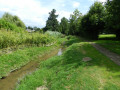
(1) Turn left onto Rue du Pont Gaultier, which then becomes a dirt track. At the end, turn right and follow the track alongside the River Ardenne until you reach the D47.

(2) Turn right onto the D47 and follow it for about 1 km, then turn right onto a track until you reach the D463.

(3) Turn right and follow the road along the grass verge. Pass the hamlet of Les Grées and take the first track on the right, heading due south.

(4) Cross a road at the hamlet of Le Breil, continue along the track to the hamlet of Tirehar, go round it and then join a road.

(5) Follow it to the right, then take the first road on the left. Continue straight on until you reach a T-junction.

(6) Turn right and carry on straight ahead. Pass Le Creux Chemin and carry on until you reach a road.

(7) Turn left onto this road, then cross the D95 with care. Follow the path opposite for 200 m until you reach the D178. Follow it to the right for 200 m.

(8) Cross it carefully, then turn right onto a path heading due north, running alongside the road on your left. Join a small road and turn right onto it, following it for about 250 m.

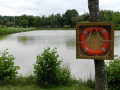
(9) Turn left and continue straight on. Walk alongside the ponds on your left until you reach the Étang du Noyer car park (S/E).

Waypoints

  1. S/E : mi 0 - alt. 207 ft - Étang du Noyer car park
  2. 1 : mi 0.37 - alt. 233 ft - Rue du Pont Gaultier. Towards the - Aedenne (rivière)
  3. 2 : mi 0.82 - alt. 226 ft - D47
  4. 3 : mi 1.98 - alt. 272 ft - D463
  5. 4 : mi 2.86 - alt. 256 ft - Le Breil
  6. 5 : mi 3.76 - alt. 266 ft - Junction after Le Tirehar
  7. 6 : mi 4.26 - alt. 269 ft - T-junction
  8. 7 : mi 5.42 - alt. 249 ft - Road after the Creux Chemin
  9. 8 : mi 5.91 - alt. 259 ft - D178. Left / Right
  10. 9 : mi 6.61 - alt. 220 ft - Fork
  11. S/E : mi 6.95 - alt. 207 ft - Étang du Noyer car park

Notes

Car park, picnic area, drinking fountain and toilets near the starting point.

Always be cautious and plan ahead when you're outdoors. Visorando and the author of this route cannot be held responsible for any accidents occurring on this route.

The GR® and PR® markings are the intellectual property of the Fédération Française de Randonnée Pédestre.

Reviews and comments

4.1 / 5
Based on 3 reviews

Reliability of the description
4.5 / 5
Ease of following the route
3.7 / 5
Route interest
4 / 5
Bernard 10
Bernard 10

Overall rating : 3 / 5

Date of your route : Dec 25, 2023
Reliability of the description : Not used / Not applicable
Ease of following the route : ★★★☆☆ Average
Route interest : ★★★☆☆ Average
Very busy route : No

This route features some very pleasant sections. It takes in some lovely paths. However, the yellow markings could do with being redone and supplemented at junctions. The green arrows are few and far between and are of only limited use for finding your way.
Between points 7 and 8, it would appear that the route shown on the map is no longer up to date.
In fact, you need to cross the D178 straight ahead. Look out for a yellow marker on a stop sign (opposite), then a few metres further on, take a path on the right. This path ends at point 8.
You need to head uphill to leave it and join a tarmac road which leads to a path heading towards the hamlet known as ‘La Chaussée’. From there, take the tarmac road on the right and turn off at point 9 to reach the pond. (There are no signposts at this point.)
The pond is a very pleasant spot with plenty of picnic tables. Car park.
Overall, this route isn’t particularly interesting (in my view). There are few, if any, heritage sites to visit.
Except for the church at La Rannée (which was closed).

Machine-translated

guiarp
guiarp

Overall rating : 4.3 / 5

Date of your route : Aug 18, 2023
Reliability of the description : ★★★★★ Very good
Ease of following the route : ★★★★☆ Good
Route interest : ★★★★☆ Good
Very busy route : No

A lovely route that gives you a glimpse of the traditional architecture of the Vitré region. There are some beautiful stone houses, and the section along the D178 is perfectly safe.
Thank you and well done, Visorando.

Machine-translated

bonchampois
bonchampois

Overall rating : 4.3 / 5

Date of your route : Feb 20, 2023
Reliability of the description : ★★★★☆ Good
Ease of following the route : ★★★★☆ Good
Route interest : ★★★★★ Very good
Very busy route : Yes

A lovely, popular route, well-frequented by walkers and cycle tourists, set in the heart of the countryside

Machine-translated

Other walks in the area

For more walks, use our search engine .

The GPS track and description are the property of this route's author. Please do not copy them without permission.