


Refine your search for walks in Comunero de Ansó y Hecho
Comunero de Ansó y Hecho walks


 From the Barranco del Barcal to the Barranco de la Rueda
 Association / Club / Walk leader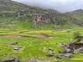
 6.25 mi
 +1,191 ft
 -1,194 ft
 3h 55
3h 55
 Easy
Easy
 Departure from Comunero de Ansó y Hecho (Huesca)
A round trip following the Pyrenean trail through the municipality of Ansó, which is listed as one of Spain’s most beautiful villages.
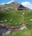
The refuge and Lac d’Arlet as seen from Lhers
 Visorando Member
 11.47 mi
+3,445 ft
-3,425 ft
8h 15
11.47 mi
+3,445 ft
-3,425 ft
8h 15
 Difficult
Departure from Accous (Pyrénées-Atlantiques)
Difficult
Departure from Accous (Pyrénées-Atlantiques)
The Refuge d’Arlet is accessible from several locations. This hike, which is a little long and involves a significant elevation gain, is one of the most beautiful, alongside the Aubise route. The lake, dominated by the Pic d’Aillary and the Pic d’Arlet, is absolutely stunning. The herds grazing all around add a bucolic touch to the landscape. In 20 minutes, you can climb up to the Col d’Arlet.
Lac du Puits d'Arious
5.58 mi
+2,365 ft
-2,365 ft
4h 40
 Moderate
Departure from Accous (Pyrénées-Atlantiques)
Moderate
Departure from Accous (Pyrénées-Atlantiques)
A lovely walk offering magnificent views of the Pic d’Anie, the Orgues de Camplong and many other peaks throughout the ascent. Towards the end of the hike, the route isn’t always obvious but is straightforward in clear weather.
The lake comes into view at the very last moment. Small but beautiful, it makes you want to take a dip in the summer and stay there for a while to rest.
Pic Labigouer from Lhers
 9.84 mi
+3,973 ft
-3,983 ft
8h 00
Difficult
Departure from Accous (Pyrénées-Atlantiques)
9.84 mi
+3,973 ft
-3,983 ft
8h 00
Difficult
Departure from Accous (Pyrénées-Atlantiques)
The main attraction of this hike is the easy ridge walk, when there is no snow, from the Col de Souperet to the Col de la Nabe. The 360° view stretches from Bedous to the Cirque de Lescun, Ossau, Balaïtous and beyond.
In summer, there are numerous herds of sheep, and shepherds make the famous sheep's cheese in their huts. Keep your eyes peeled, as chamois are not uncommon.
Set off early to enjoy the shade on the way up.
See practical information.
Lake Ansabère
 5.72 mi
+2,251 ft
-2,251 ft
4h 35
Moderate
Departure from Lescun (Pyrénées-Atlantiques)
5.72 mi
+2,251 ft
-2,251 ft
4h 35
Moderate
Departure from Lescun (Pyrénées-Atlantiques)
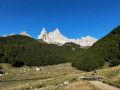
A beautiful little lake that is easily accessible. This hike is truly bucolic and the arrival at the lake is a wonder. You can stay there for a while to admire the scenery...
Col de Pau and Col de Burcq
8.50 mi
+3,294 ft
-3,294 ft
6h 45
Difficult
Departure from Lescun (Pyrénées-Atlantiques)
A magnificent hike from Lescun, yet relatively unknown. There are magnificent views all along the way. Herds of chamois are frequently seen between the Col de Pau and the Col de Burg.Although this hike is challenging due to the elevation gain, it is not overly difficult. You can stop at the Cabane de Bonaris or the Col de Pau if you start to feel tired. If you are very fit, you can extend the hike by climbing the surrounding peaks or even reaching the Refuge d'Arlet.
Ibón de Acherito from the Lamareich bridge car park
 10.42 mi
+3,556 ft
-3,556 ft
7h 55
Difficult
Departure from Lescun (Pyrénées-Atlantiques)
10.42 mi
+3,556 ft
-3,556 ft
7h 55
Difficult
Departure from Lescun (Pyrénées-Atlantiques)
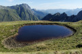
This is a long hike with a steady climb, taking you to some beautiful huts, with a water source, a lake in France and a lake in Spain. The elevation gain is significant, exceeding 1,200 metres.
The hike starts at the Lamareich car park next to La Borde de Trésarricq.
This is a difficult hike due to its length and the sense of direction required.
From Ansabère to Acherito
 8.98 mi
+3,629 ft
-3,625 ft
7h 15
Difficult
Departure from Lescun (Pyrénées-Atlantiques)
8.98 mi
+3,629 ft
-3,625 ft
7h 15
Difficult
Departure from Lescun (Pyrénées-Atlantiques)
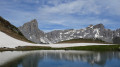
A cross-border circular to discover a little-known area (Ibón de Acherito) from a very popular location (Cabanes d'Ansabère from Lescun). Magnificent landscapes, a varied route.
Hike published in Pyrénées Magazine in 1995 (without a map and with little detail on the descent).
Update: According to several hikers' reviews (see the associated forum), it would be preferable to do this route in reverse.
The Cabanes d'Ansabère
 6.45 mi
+1,998 ft
-1,998 ft
4h 40
Moderate
Departure from Lescun (Pyrénées-Atlantiques)
6.45 mi
+1,998 ft
-1,998 ft
4h 40
Moderate
Departure from Lescun (Pyrénées-Atlantiques)
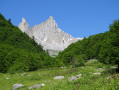
From Lescun, discover the Aiguilles d'Ansabère and the superb landscape of the Aspe Valley!
Towards the Cabane d’Atsout in the Aspe Valley
 4.46 mi
+1,250 ft
-1,230 ft
3h 10
Moderate
Departure from Borce (Pyrénées-Atlantiques)
4.46 mi
+1,250 ft
-1,230 ft
3h 10
Moderate
Departure from Borce (Pyrénées-Atlantiques)
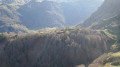
A fairly short circular walk offering easy access to a breathtaking viewpoint over the Col du Somport and the surrounding area.
The Pic de Gabedaille
 6.03 mi
+2,989 ft
-2,986 ft
6 hrs
6.03 mi
+2,989 ft
-2,986 ft
6 hrs
 Very difficult
Departure from Borce (Pyrénées-Atlantiques)
Very difficult
Departure from Borce (Pyrénées-Atlantiques)
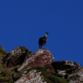
A modest but extremely well-situated summit, on the France-Spain border, on the watershed (Gave d’Aspe and Río Aragón Subordán), in an exceptional geological area and with unobstructed views of the Western Pyrenees.
A hike suitable for anyone accustomed to walking in the mountains and navigating with a map (off-trail descent).
Arlet Refuge and Lake Arlet from the Espélunguère car park
10.26 mi
+2,697 ft
-2,671 ft
7h 05
Moderate
Departure from Borce (Pyrénées-Atlantiques)
There are several routes to Lac d’Arlet and the Arlet Refuge. This is one of the most beautiful: varied scenery with a magnificent viewpoint at an elevation of 1909 metres on the map, followed by the arrival at Col de Lapachouaou. The first half of the hike is steady but fairly strenuous. The rest of the way to the lake follows the contour lines more or less. You’ll have plenty of time to admire the stunning scenery unfolding before you from the slopes of Montagne de Banasse.
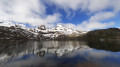
Lake Estaens as seen from Les Forges d’Abel
 5.93 mi
+1,998 ft
-1,978 ft
4h 30
Moderate
Departure from Borce (Pyrénées-Atlantiques)
5.93 mi
+1,998 ft
-1,978 ft
4h 30
Moderate
Departure from Borce (Pyrénées-Atlantiques)
This circular route takes you to Lake Estaens from Les Forges d’Abel.
It is also possible to do this hike as a return trip from Sansanet; this route is described on the Lac d’Estaens information sheet
The route suggested here is a circular route offering a variety of scenery.
Please note that this walk is slightly more vertiginous than the other one, in that reaching the lake requires using a small ladder attached to the rock face and a few handrails – though it is completely safe. Alternatively, it can be done as an ascent, which is less vertiginous than a descent.
Although the route is not signposted, it is very well maintained and it is impossible to get lost. However, it is advisable to follow the route on the app to ensure you don’t get lost.
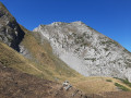
Pic Baqué from Salanoube
 5.87 mi
+3,320 ft
-3,301 ft
5h 35
Very difficult
Departure from Lescun (Pyrénées-Atlantiques)
5.87 mi
+3,320 ft
-3,301 ft
5h 35
Very difficult
Departure from Lescun (Pyrénées-Atlantiques)
A lovely circular walk, with a tricky climb off the beaten track, reserved for experienced walkers who have a good sense of direction and the ability to assess difficulties, to avoid finding themselves in a dead end.
Col de Lagréou circular starting from Terrailh
 3.19 mi
+958 ft
-955 ft
2h 20
Moderate
Departure from Borce (Pyrénées-Atlantiques)
3.19 mi
+958 ft
-955 ft
2h 20
Moderate
Departure from Borce (Pyrénées-Atlantiques)
A short, family-friendly half-day walk. The ascent is in the shade and the descent in the sun amongst the ferns. There is the option (not described here) to extend the walk with a route involving an elevation gain through the Belonce Valley to the huts at Hortassy or Lapassa.
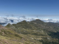
Pic d'Aillary via Lac and Col d'Arlet
 11.65 mi
+4,242 ft
-4,229 ft
9h 05
Difficult
Departure from Borce (Pyrénées-Atlantiques)
11.65 mi
+4,242 ft
-4,229 ft
9h 05
Difficult
Departure from Borce (Pyrénées-Atlantiques)
A pleasant hike through the undergrowth to discover a small valley and then the Montagne de Bannasse. Arrival at the mountain pastures with a few waterfalls on the high plains and a few huts where you can buy cheese. Discover the Lac d'Arlet then climb to the pass to finish at the Pic d'Aillary with a 360° view.
Col, Lac and Refuge d'Arlet from Aubise
 10.56 mi
+3,291 ft
-3,287 ft
7h 45
Difficult
Departure from Borce (Pyrénées-Atlantiques)
10.56 mi
+3,291 ft
-3,287 ft
7h 45
Difficult
Departure from Borce (Pyrénées-Atlantiques)
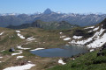
This hike will take you to a wild area where you can discover Lac d'Arlet and Refuge d'Arlet, then to the border pass, which offers a splendid 360° view of both sides.
On the French side, you can admire a magnificent panorama, including the Pic du Midi d'Ossau.
On the Spanish side, there is a view of Aragon with the easily recognisable Castillo de Acher, the Pic de Bisaurin, and the magnificent green valley of Aguas Tuertas.
Picq de Burcq and Col de Pau via the Col du Saoubathou
 14.25 mi
+3,747 ft
-3,760 ft
9h 50
Difficult
Departure from Accous (Pyrénées-Atlantiques)
14.25 mi
+3,747 ft
-3,760 ft
9h 50
Difficult
Departure from Accous (Pyrénées-Atlantiques)
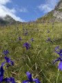
Climb up, crossing the valley, and arrive at the pasture plateaus to fully enjoy the mountains and the landscape. Hike done in early July, wild irises are present and form magnificent blue fields. You may encounter chamois or marmots and, of course, herds of horses, sheep and cows.
Cabane d'Estarou
4.43 mi
+1,900 ft
-1,877 ft
3h 40
Moderate
Departure from Borce (Pyrénées-Atlantiques)
A lovely climb in the shade of the woods, highly recommended on hot days. On arrival, a beautiful view of the Cirque d’Aspe and a lovely picnic spot. Magnificent houses at the start, others currently being restored.
Sanchèse Plateau
 3.43 mi
+410 ft
-384 ft
1h 55
Easy
Departure from Lescun (Pyrénées-Atlantiques)
3.43 mi
+410 ft
-384 ft
1h 55
Easy
Departure from Lescun (Pyrénées-Atlantiques)
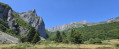
An easy hike that can be done at any time of day with the family
Cabanes and Lac de Lhurs from La Borde d'Anapia
 7.20 mi
+2,621 ft
-2,595 ft
5h 35
Difficult
Departure from Lescun (Pyrénées-Atlantiques)
7.20 mi
+2,621 ft
-2,595 ft
5h 35
Difficult
Departure from Lescun (Pyrénées-Atlantiques)
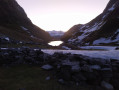
This hike allows you to discover Lake Lhurs and its huts, nestled in a mineral cirque with the jagged Ansabère area in the background.
The Pène d'Udapet circuit
 7.62 mi
+3,045 ft
-3,041 ft
6h 10
Difficult
Departure from Borce (Pyrénées-Atlantiques)
7.62 mi
+3,045 ft
-3,041 ft
6h 10
Difficult
Departure from Borce (Pyrénées-Atlantiques)
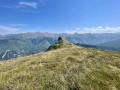
The Pène d’Udapet is that curious rocky peak ‘perched’ above the village of Borce, guarding the entrance to the Belonce Valley. Isn’t the best way to appreciate it to walk around it, rather than climb it (which is perilous)? That is what we offer with this highly varied route featuring picturesque views.
The Bérat circular route in Urdos
 2.56 mi
+554 ft
-561 ft
1h 40
Easy
Departure from Urdos (Pyrénées-Atlantiques)
2.56 mi
+554 ft
-561 ft
1h 40
Easy
Departure from Urdos (Pyrénées-Atlantiques)
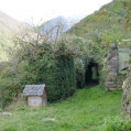
A fairly short circular route to explore the village and the surroundings of Urdos, in the upper Aspe Valley, offering a fine view of the enormous walls built over the centuries using stones extracted during the arduous ploughing of the fields.
The route is varied, signposted (yellow markings) and described in several guidebooks.
Suitable for all seasons (shaded), but avoid midday in the height of summer!
The Mâture and the Col d'Arras Path
 5.66 mi
+2,710 ft
-2,694 ft
5h 00
Moderate
Departure from Borce (Pyrénées-Atlantiques)
5.66 mi
+2,710 ft
-2,694 ft
5h 00
Moderate
Departure from Borce (Pyrénées-Atlantiques)
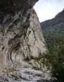
One of the best-known paths in the Pyrenees, carved into the steep rock above the Gorges d'Enfer. The Chemin de la Mâture still echoes with the blows of the pickaxes of the convicts who dug it. An unforgettable page of history!
From Lescun to Lhers via the Chemin de Petraube
 4.92 mi
+1,145 ft
-1,152 ft
3h 15
Moderate
Departure from Lescun (Pyrénées-Atlantiques)
4.92 mi
+1,145 ft
-1,152 ft
3h 15
Moderate
Departure from Lescun (Pyrénées-Atlantiques)
A circular walk to explore the old Lescun to Lhers path. These ancient paths are part of the valley’s history. By walking them, you are helping to preserve our heritage. A route mainly through woodland on the northern slope of the valley: ideal in hot weather.
Pic d’Ourtasse circular walk
 3.70 mi
+1,699 ft
-1,696 ft
3h 10
Difficult
Departure from Lescun (Pyrénées-Atlantiques)
3.70 mi
+1,699 ft
-1,696 ft
3h 10
Difficult
Departure from Lescun (Pyrénées-Atlantiques)
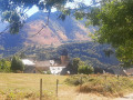
A stunning viewpoint over the Cirque de Lescun, easily accessible apart from the final gully. Suitable for paragliding take-off. Ideal for families as a round trip via the descent route. You can even stop at the plateau below the summit if the final thirty metres daunt you.
Circular loop via Lac d’Estaëns or Ibon de Astanès
 6.71 mi
+2,218 ft
-2,221 ft
5h 00
Moderate
Departure from Urdos (Pyrénées-Atlantiques)
6.71 mi
+2,218 ft
-2,221 ft
5h 00
Moderate
Departure from Urdos (Pyrénées-Atlantiques)
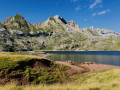
It is a peaceful valley where a thin stream flows, where large herds of horses and cows graze in the calm air, indifferent to this geological feature, this reddish earth, on the border between Spain and France and Lac d'Estaëns (Ibon de Astanès).
Lac d'Estaens loop via the Chemin des Échelles
 6.65 mi
+2,162 ft
-2,165 ft
4h 55
Moderate
Departure from Urdos (Pyrénées-Atlantiques)
6.65 mi
+2,162 ft
-2,165 ft
4h 55
Moderate
Departure from Urdos (Pyrénées-Atlantiques)
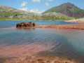
The aim here is to make a loop. You will need to climb down a small chimney and follow a path that runs along the cliff and takes you down a ladder. Magnificent view of the peaks and the valley below.
Lake Estaens
 5.26 mi
+1,745 ft
-1,749 ft
3h 55
Moderate
Departure from Urdos (Pyrénées-Atlantiques)
5.26 mi
+1,745 ft
-1,749 ft
3h 55
Moderate
Departure from Urdos (Pyrénées-Atlantiques)
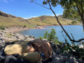
This round trip hike is mostly in Spain and is suitable for all walkers. It is a very easy family walk. The green surroundings are home to marmots and chamois, if you know where to look. From the end of June onwards, numerous flocks of sheep, cows and horses graze here. The lake is splendid and is surrounded by white rock mountains on the left with the Aspe peak and the Visaurin and on the right by red rocks with the Gabedaille peak.
Col d'Anaye, Marmitou springs, starting from Sanchèse
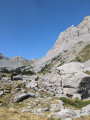 6.69 mi
+3,264 ft
-3,255 ft
5h 55
Difficult
Departure from Lescun (Pyrénées-Atlantiques)
6.69 mi
+3,264 ft
-3,255 ft
5h 55
Difficult
Departure from Lescun (Pyrénées-Atlantiques)
An interesting discovery: the source of the Marmitou, calm and peaceful before it disappears underground. A lovely hike that also takes you to the Anaye border pass.
The Bois d'Arce loop in Lescun
 2.59 mi
+906 ft
-899 ft
2h 00
Easy
Departure from Lescun (Pyrénées-Atlantiques)
2.59 mi
+906 ft
-899 ft
2h 00
Easy
Departure from Lescun (Pyrénées-Atlantiques)
A fairly short loop above Lescun, ideal for warming up, for children or people who are a little tired. A short climb and a gentle descent: what more could you ask for?
On the Way of St James, between Etsaut and Urdos
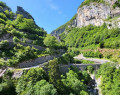 2.90 mi
+807 ft
-413 ft
2h 00
Easy
Departure from Etsaut (Pyrénées-Atlantiques)
2.90 mi
+807 ft
-413 ft
2h 00
Easy
Departure from Etsaut (Pyrénées-Atlantiques)
The work carried out by the Pyrénées-Atlantiques department and the Haut-Béarn community of municipalities to facilitate access to the Fort du Portalet, as well as the route through the upper Aspe valley for hikers and pilgrims (GR®65), has been completed and now allows visitors to discover this exceptional site in the best conditions of visibility and safety. Let's make the most of it!
The Tour du Busteigts (revised version)
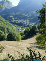 2.48 mi
+1,043 ft
-1,033 ft
2h 05
Moderate
Departure from Etsaut (Pyrénées-Atlantiques)
2.48 mi
+1,043 ft
-1,033 ft
2h 05
Moderate
Departure from Etsaut (Pyrénées-Atlantiques)
This walk around the valley overlooking the village of Etsaut is delightful for its views, the shade it offers and the short climb. It can be enjoyed in all seasons, though it is best to avoid rainy periods when the path may be slippery.
This is a route recommended by the Departmental Council.
Please note: the original route (marked path) is currently impassable following a landslide. We present here an alternative route that can be followed in complete safety.
On the trail of the bear in Etsaut
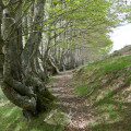 1.59 mi
+741 ft
-748 ft
1h 25
Moderate
Departure from Etsaut (Pyrénées-Atlantiques)
1.59 mi
+741 ft
-748 ft
1h 25
Moderate
Departure from Etsaut (Pyrénées-Atlantiques)
An easy short circular loop above Etsaut, through a landscape of pastures visited by bears some time ago. The local authority has marked out two loops allowing visitors to explore the areas visited by the bears (scratches, etc.); this loop is limited to the upper section to ensure it is accessible to all.
Towards the Licoué hut
 4.60 mi
+1,644 ft
-1,621 ft
3h 35
Moderate
Departure from Etsaut (Pyrénées-Atlantiques)
4.60 mi
+1,644 ft
-1,621 ft
3h 35
Moderate
Departure from Etsaut (Pyrénées-Atlantiques)
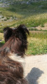
In the Aspe Valley, many people come to walk and admire the Chemin de la Mâture. Some of them continue on the GR®10, others make a loop by returning via the Col d'Arras. But who ventures further?That's what we offer you with this simple and very pretty route.
Towards the Pédaing hut (revised version)
 5.45 mi
+2,700 ft
-2,700 ft
4h 50
Difficult
Departure from Cette-Eygun (Pyrénées-Atlantiques)
5.45 mi
+2,700 ft
-2,700 ft
4h 50
Difficult
Departure from Cette-Eygun (Pyrénées-Atlantiques)
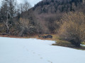
A gradual climb before joining the "classic" Narbèze path, passing through the pretty Pédaing valley, at the cost of a difficult moment!
Please note: following the GPX track is very useful for this route (as are walking sticks).
Towards the Narbèze hut
 7.71 mi
+3,438 ft
-3,438 ft
6h 30
Difficult
Departure from Cette-Eygun (Pyrénées-Atlantiques)
7.71 mi
+3,438 ft
-3,438 ft
6h 30
Difficult
Departure from Cette-Eygun (Pyrénées-Atlantiques)
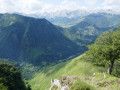
There is a fairly steep climb from Cette to the summer pastures above the village. The effort is well worth it, as the location and the view of the flocks of sheep on the grassy slopes are magnificent.To avoid the effect of going back the same way, we suggest two alternative routes to make the return journey more enjoyable.
Pic de Narbissat, starting from Cette
 3.79 mi
+1,923 ft
-1,923 ft
3h 25
Moderate
Departure from Cette-Eygun (Pyrénées-Atlantiques)
3.79 mi
+1,923 ft
-1,923 ft
3h 25
Moderate
Departure from Cette-Eygun (Pyrénées-Atlantiques)
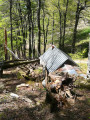
A route taking in a beautiful viewpoint over the centre of the Aspe Valley and the Bedous Valley, along a signposted path. The Pic de Narbissat is a prime spot for geological observation, situated where the Iberian tectonic plate slides beneath the Eurasian plate. It also offers a good vantage point over the surrounding mountains.
This route is particularly recommended in spring and summer (May to October), when ferns can obstruct the path and reduce visibility off the main tracks. In winter, a different circular route is possible (see the ‘Pic de Narbissat via Les Muralhetas’ walk).
Pic de Narbissat via Les Muralhetas – Winter route
 4.36 mi
+2,011 ft
-2,001 ft
3h 45
Moderate
Departure from Cette-Eygun (Pyrénées-Atlantiques)
4.36 mi
+2,011 ft
-2,001 ft
3h 45
Moderate
Departure from Cette-Eygun (Pyrénées-Atlantiques)
A circular walk offering a unique viewpoint over the centre of the Aspe Valley and the Bedous valley, with an alternative loop route along a signposted path. The Pic de Narbissat is a prime spot for geological observation, situated at the point where the Iberian tectonic plate slides beneath the Eurasian plate. It also offers a good vantage point over the surrounding mountains.
This circular route is only recommended in winter ( November to April), when the ferns no longer obstruct the path or visibility.