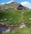
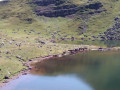
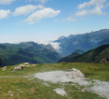
The refuge and Lac d’Arlet as seen from Lhers

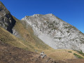
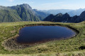
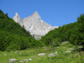
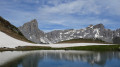
The Refuge d’Arlet is accessible from several locations. This hike, which is a little long and involves a significant elevation gain, is one of the most beautiful, alongside the Aubise route. The lake, dominated by the Pic d’Aillary and the Pic d’Arlet, is absolutely stunning. The herds grazing all around add a bucolic touch to the landscape. In 20 minutes, you can climb up to the Col d’Arlet.

Details

3195314
Creation:
Last update:
Last review:
  • Walking
    Activity: Walking
  • ↔
    Distance: 11.47 mi
  • ◔
    Average duration: 8h 15 
  • ▲
    Difficulty: Difficult

  • ⚐
    Back to start: Yes
  • ↗
    Ascent: + 3,445 ft
  • ↘
    Descent: - 3,425 ft

  • ▲
    Highest point: 6,555 ft
  • ▼
    Lowest point: 3,776 ft

Photos

Description of the walk

In Oloron-Sainte-Marie, take the D134 towards the Col du Somport. The road bypasses Bedous and Accous. Then turn off to the right towards Lescun. Shortly afterwards, turn left onto the D339 towards Lhers. Pass a lodge on the left and continue along this road to Aumet. Car park on the right (1,140 m).

(S) Follow the road due south for 1.6 km to the Pourcibo hut.

(1) Continue along this road. There are several shortcuts you can take to avoid the hairpin bends that follow.
It’s best to pace yourself as the walk is quite long. You’ll arrive at the Cabane Det Caillau.

(2) Take a path that climbs to the right (signposted). It starts off through grassy terrain but soon becomes well-marked. It follows a circular route to the left before continuing to wind its way southwards up the mountain to a junction marked by a sign.

(3) Ignore the path on the left, which heads towards the huts and the Col de Souperret, and take the one on the right, towards the Col de Saoubathoù. The path continues southwards with a steady climb and reaches a flat section.

(4) A short rest. The path continues and, after several hairpin bends, reaches the junction with the path coming from the right and from the Col de Pau

(5) Turn left. The path follows a contour line more or less straight to the Col de Saoubathou (1949 m).

(6) Continue along the path (signpost) which follows a gentle contour line for about 1 km.

(7) Begin a descent of about 1 km to the Lapassa Hut and the junction for the Hotassy Hut and the Col de Lagréou.

(8) Keep to the right. The well-marked path will first begin a gentle climb, followed by a steeper ascent with a series of hairpin bends up to the refuge.

(9) Take full advantage of this idyllic spot, then return along the same route to (S/E).

Waypoints

  1. S/E : mi 0 - alt. 3,776 ft - Aumet car park
  2. 1 : mi 1.09 - alt. 4,416 ft - Pourcibo Hut
  3. 2 : mi 1.71 - alt. 4,757 ft - Det Caillau Hut
  4. 3 : mi 2.3 - alt. 5,295 ft - Crossroads, signpost
  5. 4 : mi 2.98 - alt. 5,955 ft - Flat section
  6. 5 : mi 3.46 - alt. 6,358 ft - Col de Pau junction
  7. 6 : mi 3.57 - alt. 6,394 ft - Col de Saoubathoù
  8. 7 : mi 4.18 - alt. 6,411 ft - Start of the descent
  9. 8 : mi 4.87 - alt. 6,083 ft - Cabane de Lapassa
  10. 9 : mi 5.73 - alt. 6,555 ft - Arlet Mountain Hut - Lac d'Arlet
  11. S/E : mi 11.47 - alt. 3,776 ft - Aumet car park

Notes

You can get something to eat at the refuge; the welcome there is very warm. It’s best to book the day before, though. The food is good, generous and inexpensive.

Reviews and comments

4.7 / 5
Based on 3 reviews

Reliability of the description
5 / 5
Ease of following the route
4.3 / 5
Route interest
4.7 / 5
Sigrid 82
Sigrid 82
• Edited:

Overall rating : 4.7 / 5

Date of your route : Oct 23, 2023
Reliability of the description : ★★★★★ Very good
Ease of following the route : ★★★★☆ Good
Route interest : ★★★★★ Very good
Very busy route : Yes

Some truly beautiful scenery, and once you reach the lake, you can carry on to the Pic d’Aillary – it’ll only take you another half an hour or so to get there.

Machine-translated

Marie FERRY
Marie FERRY

Overall rating : 4.7 / 5

Date of your route : Aug 14, 2023
Reliability of the description : ★★★★★ Very good
Ease of following the route : ★★★★☆ Good
Route interest : ★★★★★ Very good
Very busy route : Yes

An easy walk to follow, although very, very poorly signposted.
Just a few signs here and there.
The app helps and puts your mind at ease.
Above the refuge is the Pic d’Aillarry.
A breathtaking panorama.

Machine-translated

helena patrice
helena patrice

Hello
I’m thinking of going on this walk this weekend; it seems to be allowed with a dog, even though part of it is in the Pyrenees National Park… Do you have any information, please?

Machine-translated

Lucie63
Lucie63

Overall rating : 4.7 / 5

Date of your route : May 22, 2020
Reliability of the description : ★★★★★ Very good
Ease of following the route : ★★★★★ Very good
Route interest : ★★★★☆ Good
Very busy route : No

The walk is very scenic, but it’s a shame to stop at Lake Arlet. It’s definitely worth pushing on at least as far as the Col d’Arlet, just a little further on, where the view is fantastic; or even as far as the Pic d’Aillary if you’ve got the energy left (follow the cairns to get there).
The final section of the route between the Col de Saoubathou and the refuge is easy but I found it very long. Allow 1 hour each way.
It took me 2 hours 45 minutes from the car park to the refuge. A further 30 minutes to the peak.

Machine-translated

Other walks in the area

For more walks, use our search engine .

The GPS track and description are the property of this route's author. Please do not copy them without permission.