Country:

 City:
City:


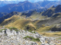
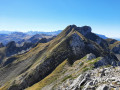
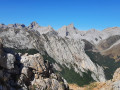
From Oloron-Sainte-Marie, head towards Lescun, then after the Toyal factory, head towards Lhers; after the six hairpin bends, follow the signs for Lescun; at the junction, go straight on towards Masousa-Ansabère, then pass the sign for Anapia-Lhurs on your right. Turn left onto a road that winds uphill; at the end, turn right towards Maison Salanoube and park at the cattle grid.
(S/E) Continue along the track until you reach a Y-junction.
(1) Carry on straight ahead along the grassy track; following a virtually flat path, you’ll reach the area above the Résurgence des Oueils, then the stream.
(2) Cross the stream – it is often dry – then follow it upstream as best you can through scree, large boulders and dead trees. You will reach an unnamed stream.
(3) Cross this too, then turn left to follow it uphill. Caution: when you reach an impressive vertical drop, go round it before reaching the park boundary.
(4) Leave the stream, the dry vertical waterfall and the difficult sections behind to follow a less steep and more enclosed tributary, reaching the foot of a cliff.
(5) Turn right towards a beech wood, leading to a hanging valley, which takes you back to the main valley below Les Tourelles.
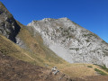
(6) Head up the valley keeping to the left; here there is more grass and less scree. Follow the tracks to the northern breach. Then climb up to the left to a small pass, which allows you to bypass the rocky peak via the Lazeque slope. Continue along the steep ridge, keeping to the left; you may need to use your hands on the grassy and rocky sections. Reach Pic Bacqué.
(7) Descend the southern ridge, initially close to the cairns and tracks, then moving away from them – there are several possible routes – until you reach the southern breach.
(8) Descend at a 90° angle to the left along the path; there is a slight climb to reach the ridge.
(9) Descend easily down the wide valley to the Cabanes d’Annès (water).
(10) Climb slightly, then descend the good but long path to the clearing at the Cabane de Couyède.
(11) Turn left and head down through the woods, cross the Ruisseau d’Annès, and follow its left bank to reach the original crossroads.
(1) Turn right and head back along the route you took on the way there to return to the car park near the Maison Salanoube (S/E).
 Visorando Member
 Difficult
 Average
 Easy
Easy